
Download
3D Flyover
Add to list
More
8.5 km
~2 hrs 1 min
195 m
Loop
“Rolling Brailes hills blend airy views, birdsong woods, and Norman echoes on a rewarding loop.”
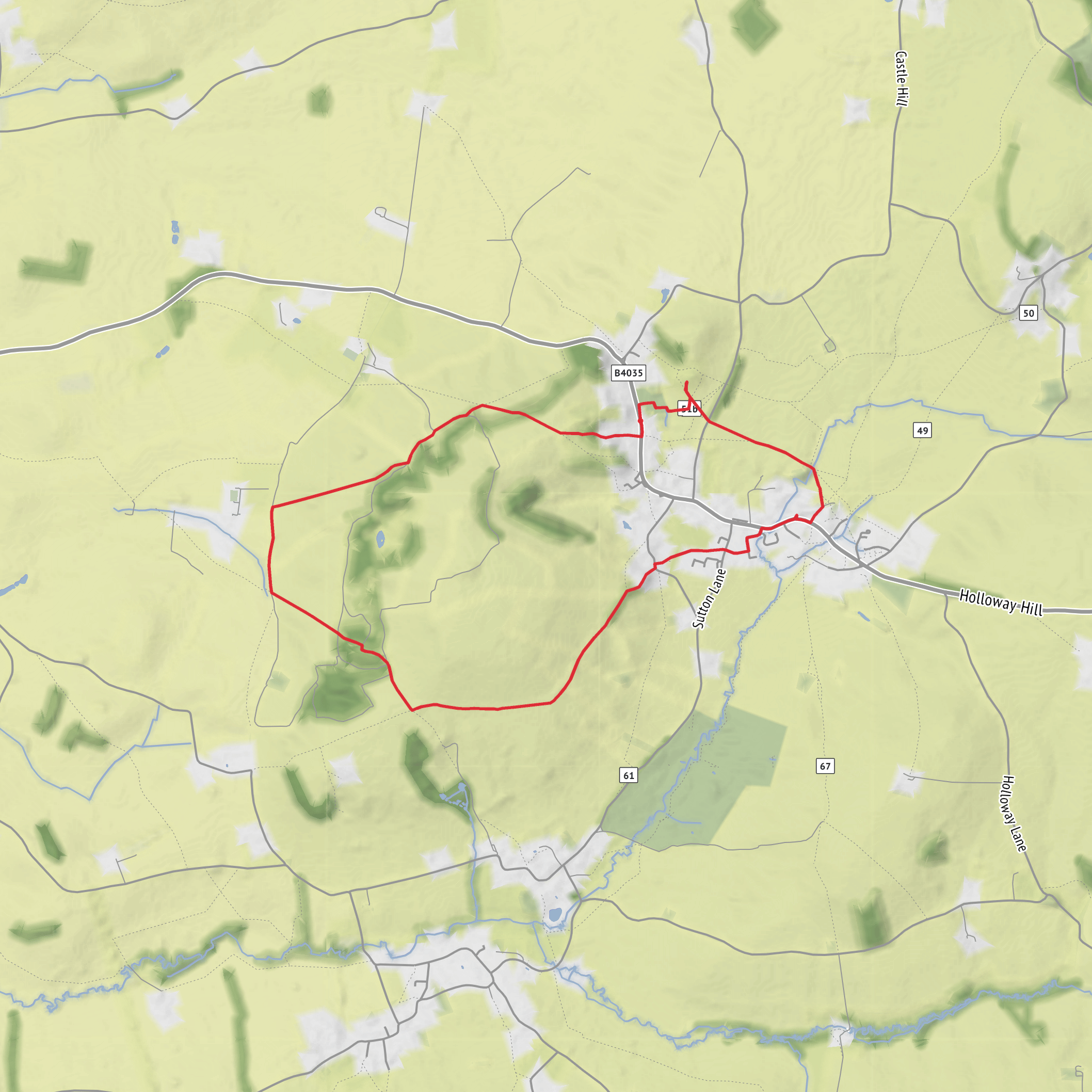
This medium-difficulty loop explores the rolling edge of the Warwickshire Cotswolds around Upper Brailes, linking open hillside, hedgerow-lined bridleways, a short woodland passage through Ashen Coppice, and the prominent medieval earthwork of Castle Hill Motte. Expect roughly 8 km to 9 km (about 5 to 5.6 miles) with around 200 m of ascent (about 620 to 660 ft), most of it coming in steady climbs rather than one long mountain-style haul. The route is best suited to walkers comfortable with uneven field paths, gates and stiles, and occasional muddy sections after rain. The usual start point for this circuit is near the south end of Upper Brailes by the junction of Chapel Lane and the B4035, Upper Brailes, Warwickshire, where a small parking area is commonly used for local walks. (walkingbritain.co.uk)
The opening section rises quickly onto the flank of Gillett’s Hill, so the walk begins with one of its more energetic stretches. Fields and pasture give way to higher ground with broader views, and the route then threads through the narrow belt of trees known as Ashen Coppice before dropping onto bridleways and farm tracks. Because the landscape is a patchwork of pasture, arable land, hedges and small woods, underfoot conditions can change a lot within a short distance: short grass and firm tracks in dry weather, but slick clay, churned gateways and wet field edges in winter or after prolonged rain. Using HiiKER for turn-by-turn route checking is especially helpful where paths cross open fields or split at gates and waymarked junctions. (walkingbritain.co.uk)
What the route feels like
Although the distance is modest, this is not a flat village stroll. The climb over Gillett’s Hill gives the route its character, and the undulating terrain means you will keep gaining and losing height as the loop works around Brailes Hill country. The gradients are generally manageable for regular walkers, but they are enough to raise the effort level into the medium range, especially if the ground is wet or if you are carrying a full daypack.
Views are one of the main rewards. Upper Brailes sits on the side of Brailes Hill, which is one of the highest points in Warwickshire, and the surrounding slopes open out across a distinctly rural landscape of ridges, combes, hedged fields and scattered farmsteads. On clearer days, the higher sections feel much bigger than the mileage suggests. (en.wikipedia.org)
Landmarks, landscape and wildlife
Ashen Coppice provides a brief change in atmosphere from open country to enclosed woodland. In spring and summer, these small copses and hedgerows can be lively with birdsong, while the field margins and pasture attract common farmland species. Walkers should keep an eye out for raptors using the rising air over the slopes, as well as typical hedgerow birds and seasonal butterflies. Livestock may be present in some fields, so calm, steady movement and good dog control are important.
Castle Hill Motte is the standout historic landmark on the loop. This scheduled monument lies on the east side of Upper Brailes and preserves the earthwork and buried remains of a motte castle. Historic England dates it to the early to mid-12th century and notes that its construction has been attributed to Robert Newburgh, Earl of Warwick. The mound stands on a natural knoll that was reshaped and raised, with a surrounding ditch and associated terraced outworks that would once have strengthened access and defence. Even if only earthworks remain, it is an evocative place to pause and picture the Norman landscape of control and local power. (historicengland.org.uk)
The wider Brailes area also has deeper archaeological interest. Local historical sources note evidence of ancient settlement patterns, including old routeways and tofts and crofts concealed within the modern field system. That means the walk passes through countryside shaped not just by farming today, but by many centuries of occupation and land use. (brailesvillage.co.uk)
Route planning and practicalities
For most walkers, allow around 2.5 to 3.5 hours depending on pace, stops and ground conditions. Waterproof footwear is a sensible choice for much of the year, and gaiters can be worthwhile in muddy months. There are likely to be several gates, stiles and field boundaries, so this is less suitable for wheels or anyone needing barrier-free access. Wind can be more noticeable on the exposed higher ground than it feels in the village, so an extra layer is worth packing even on mild days.
Navigation is usually straightforward on established rights of way, but there are enough field crossings, track junctions and waymarked turns that it pays
Surfaces
Unpaved
Unknown
Grass
Gravel
Asphalt
Paved
Comments and Reviews
User comments, reviews and discussions about the Gillett's Hill, Ashen Coppice and Castle Hill Motte Loop, England.
average rating out of 5
0 rating(s)
