Download
Preview
Add to list
More
15.1 km
~3 hrs 48 min
477 m
Loop
“Embark on a captivating 15 km loop through Staffordshire's stunning landscapes, historical sites, and diverse wildlife.”
Starting your adventure near Staffordshire, England, the Thor's Cave, Wetton Hill, and Narrowdale Hill Loop is a captivating 15 km (approximately 9.3 miles) journey with an elevation gain of around 400 meters (about 1,312 feet). This loop trail offers a medium difficulty rating, making it suitable for moderately experienced hikers.
Getting There
To reach the trailhead, you can drive to the village of Wetton, which is the nearest significant landmark. If you're using public transport, the nearest train station is in Buxton, from where you can take a local bus to Wetton. The trailhead is conveniently located near the village, making it accessible for both drivers and public transport users.
Thor's Cave
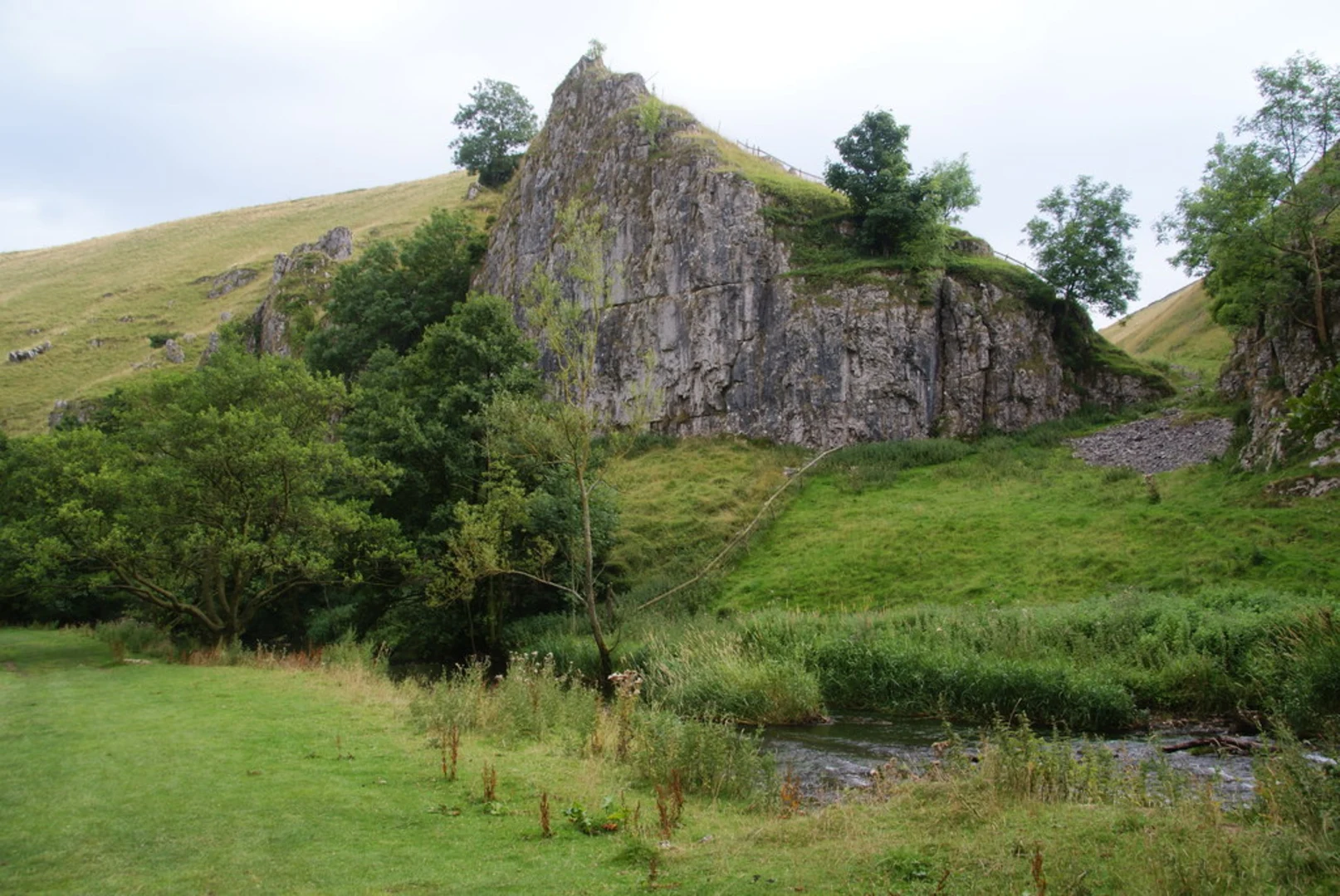
The first major landmark you'll encounter is Thor's Cave, situated approximately 2 km (1.2 miles) from the trailhead. This natural limestone cave is perched 80 meters (262 feet) above the Manifold Valley and offers stunning views of the surrounding landscape. The cave itself is steeped in history, with archaeological findings suggesting it was inhabited during the Stone Age. Be prepared for a steep climb to reach the cave entrance, but the panoramic views are well worth the effort.
Wetton Hill
Continuing on, you'll make your way to Wetton Hill, which stands at an elevation of 371 meters (1,217 feet). This section of the trail is about 5 km (3.1 miles) from Thor's Cave. The hill offers a more challenging ascent, but the grassy slopes and wildflower meadows provide a picturesque setting. Keep an eye out for local wildlife, including various bird species and small mammals.
Narrowdale Hill
Next, you'll head towards Narrowdale Hill, located roughly 4 km (2.5 miles) from Wetton Hill. This hill is slightly less challenging but equally rewarding, with an elevation of 367 meters (1,204 feet). The area is known for its rolling hills and scenic vistas, making it a perfect spot for a short rest and some photography.
Historical Significance
The region is rich in history, with evidence of ancient settlements and agricultural practices dating back centuries. The landscape is dotted with dry stone walls and old farmsteads, offering a glimpse into the area's past. The Manifold Valley, through which part of the trail runs, was once a bustling industrial area with mills and railways, remnants of which can still be seen today.
Navigation and Safety
Given the varied terrain and elevation changes, it's advisable to use a reliable navigation tool like HiiKER to stay on track. The trail is well-marked, but having a digital map can be invaluable, especially in areas where the path may be less defined.
Flora and Fauna
The trail traverses a variety of habitats, from limestone dales to open moorland. In spring and summer, the meadows are awash with wildflowers, including orchids and bluebells. The area is also home to a range of wildlife, such as red deer, foxes, and numerous bird species like skylarks and kestrels.
Final Stretch
As you loop back towards Wetton, the final 4 km (2.5 miles) of the trail offer a gentle descent, allowing you to take in the serene beauty of the countryside. The path winds through lush fields and along quiet lanes, providing a peaceful end to your hike.
This trail offers a perfect blend of natural beauty, historical intrigue, and moderate physical challenge, making it a must-visit for any hiking enthusiast.

What to expect?
Activity types
Comments and Reviews
User comments, reviews and discussions about the Thor's Cave, Wetton Hill and Narrowdale Hill Loop, England.
5.0
average rating out of 5
3 rating(s)