Download
Preview
Add to list
More
2.7 km
~42 min
95 m
Loop
“The Red Route Loop at Blithfield Reservoir offers an accessible, scenic 3 km hike rich in wildlife and history.”
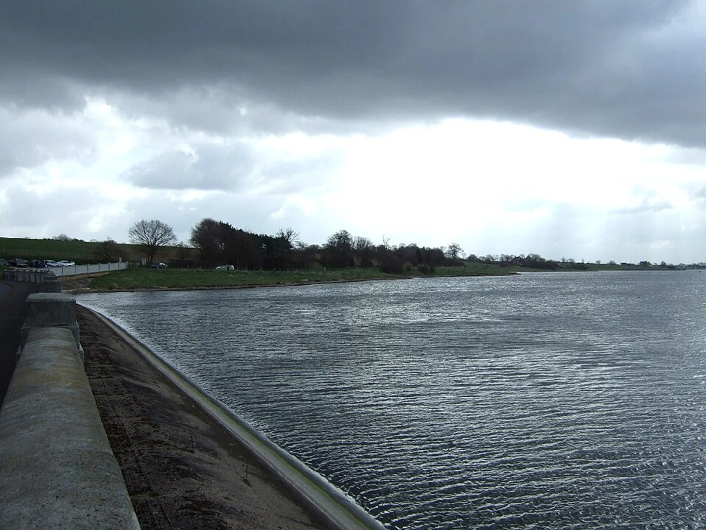
Starting near Staffordshire, England, the Red Route Loop at Blithfield Reservoir offers a delightful 3 km (approximately 1.86 miles) loop trail with no significant elevation gain, making it accessible for a wide range of hikers. The trailhead is conveniently located near the Blithfield Reservoir, a significant landmark in the area.
Getting There
For those traveling by car, the trailhead is easily accessible from the A51 road. Parking is available at the Blithfield Reservoir car park. If you prefer public transport, the nearest train station is Rugeley Trent Valley, from where you can take a local bus or taxi to the reservoir.
Trail Navigation
The trail is well-marked, but it's always a good idea to have a reliable navigation tool like HiiKER to ensure you stay on track. The loop is straightforward, with clear signage at key junctions.
What to Expect
The Red Route Loop takes you through a variety of landscapes, including open fields, wooded areas, and along the edge of the reservoir. The path is generally flat, making it suitable for families and those looking for a leisurely walk.
Landmarks and Points of Interest
- Blithfield Reservoir: The reservoir itself is a central feature of the hike. It was constructed in the mid-20th century and serves as a crucial water supply for the region. The reservoir is also a haven for birdwatchers, with species such as herons, kingfishers, and various waterfowl frequently spotted.
- Woodland Areas: As you move through the wooded sections, keep an eye out for native wildlife, including deer, foxes, and a variety of bird species. The woods are particularly beautiful in the autumn when the leaves change color.
- Historical Significance: The area around Blithfield Reservoir has a rich history. Nearby Blithfield Hall, a Grade I listed building, dates back to the 14th century and offers a glimpse into the region's past. Although the hall itself is not on the trail, it's worth a visit if you have time.
Flora and Fauna
The trail is rich in biodiversity. In the spring and summer months, wildflowers such as bluebells and primroses carpet the woodland floor. The reservoir's edge is lined with reeds and rushes, providing habitat for various aquatic creatures.
Practical Tips
- Footwear: Given the flat terrain, regular walking shoes should suffice. However, after heavy rain, some sections can become muddy, so waterproof footwear might be advisable.
- Weather: The trail is exposed in some sections, so check the weather forecast and dress accordingly. A light rain jacket can be useful.
- Facilities: There are no facilities directly on the trail, but the car park at the trailhead has restrooms and picnic areas.
Safety Considerations
While the trail is rated as medium difficulty, it's always wise to carry a basic first aid kit and plenty of water. Mobile phone reception is generally good, but having a navigation tool like HiiKER can provide additional peace of mind.
This trail offers a perfect blend of natural beauty, wildlife, and a touch of history, making it a rewarding experience for all who venture onto it.

What to expect?
Activity types
Comments and Reviews
User comments, reviews and discussions about the Red Route Loop - Blithfield Reservoir, England.
4.0
average rating out of 5
1 rating(s)