
Download
3D Flyover
Add to list
More
7.1 km
~1 hrs 41 min
162 m
Loop
“The Barlaston Loop via Millennium Topograph is a 7 km trail offering scenic views, historical landmarks, and diverse wildlife.”
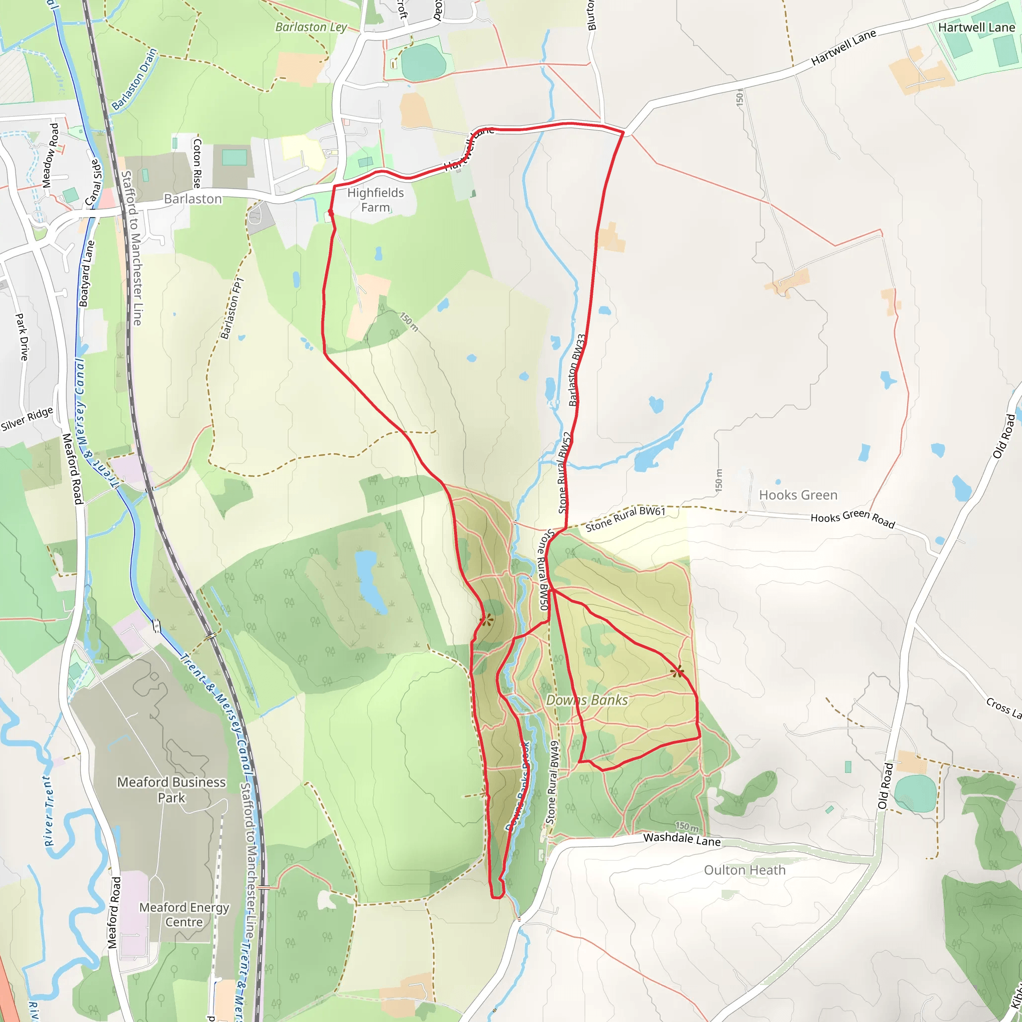
Starting near the charming village of Barlaston in Staffordshire, England, the Barlaston Loop via Millennium Topograph is a delightful 7 km (approximately 4.3 miles) loop trail with an elevation gain of around 100 meters (328 feet). This medium-difficulty trail offers a mix of scenic views, historical landmarks, and diverse wildlife, making it a rewarding experience for hikers of all levels.
Getting There
To reach the trailhead, you can drive or use public transport. If driving, set your GPS to Barlaston, Staffordshire, and look for parking near the village center. For those using public transport, the nearest train station is Barlaston Station, which is a short walk from the trailhead. Alternatively, you can take a bus to Barlaston village from nearby towns like Stoke-on-Trent or Stafford.
Trail Overview
The trail begins near the village center, where you can find the Millennium Topograph, a notable landmark that provides panoramic views of the surrounding countryside. As you start your hike, you'll be greeted by a mix of open fields and wooded areas, offering a variety of landscapes to enjoy.
Key Landmarks and Points of Interest
- Millennium Topograph (0 km / 0 miles): This is your starting point and a great place to get an overview of the area. The topograph is a stone structure that points out significant landmarks in the distance.
- Wedgwood Estate (2 km / 1.2 miles): As you continue, you'll pass near the historic Wedgwood Estate, home to the famous Wedgwood pottery. The estate is rich in history and offers a glimpse into the region's industrial past.
- Trent and Mersey Canal (4 km / 2.5 miles): Midway through the hike, you'll encounter the Trent and Mersey Canal. This canal played a crucial role in the industrial revolution, facilitating the transport of goods. The towpath along the canal is a serene spot for a break and offers opportunities to see waterfowl and other wildlife.
Flora and Fauna
The trail is abundant with native flora and fauna. In the wooded sections, you might spot oak, ash, and beech trees. The open fields are often dotted with wildflowers, especially in the spring and summer months. Wildlife enthusiasts can look out for deer, rabbits, and a variety of bird species, including woodpeckers and kingfishers near the canal.
Navigation and Safety
While the trail is well-marked, it's always a good idea to have a reliable navigation tool. The HiiKER app is highly recommended for this purpose, providing detailed maps and real-time updates. Wear sturdy hiking boots, as some sections can be muddy, especially after rain. Carry water and snacks, as there are limited facilities along the route.
Historical Significance
The area around Barlaston has a rich history, with evidence of human settlement dating back to the Roman era. The nearby Wedgwood Estate adds a layer of industrial heritage, showcasing the region's contribution to the pottery industry. The Trent and Mersey Canal further highlights the area's importance during the industrial revolution.
Final Stretch
As you loop back towards Barlaston village, you'll pass through more open fields and small wooded areas, gradually descending back to your starting point at the Millennium Topograph. This final section offers a peaceful end to your hike, with ample opportunities to reflect on the diverse landscapes and historical landmarks you've encountered.
This trail offers a perfect blend of natural beauty, historical intrigue, and moderate physical challenge, making it a must-visit for hikers exploring Staffordshire.
What to expect?
Activity types
Comments and Reviews
User comments, reviews and discussions about the Barlaston Loop via Millennium Topograph, England.
4.5
average rating out of 5
4 rating(s)
