
Download
3D Flyover
Add to list
More
2.2 km
~38 min
126 m
Loop
“Stepping stones, limestone drama, and a punchy climb make this compact Dovedale loop feel memorably bigger.”
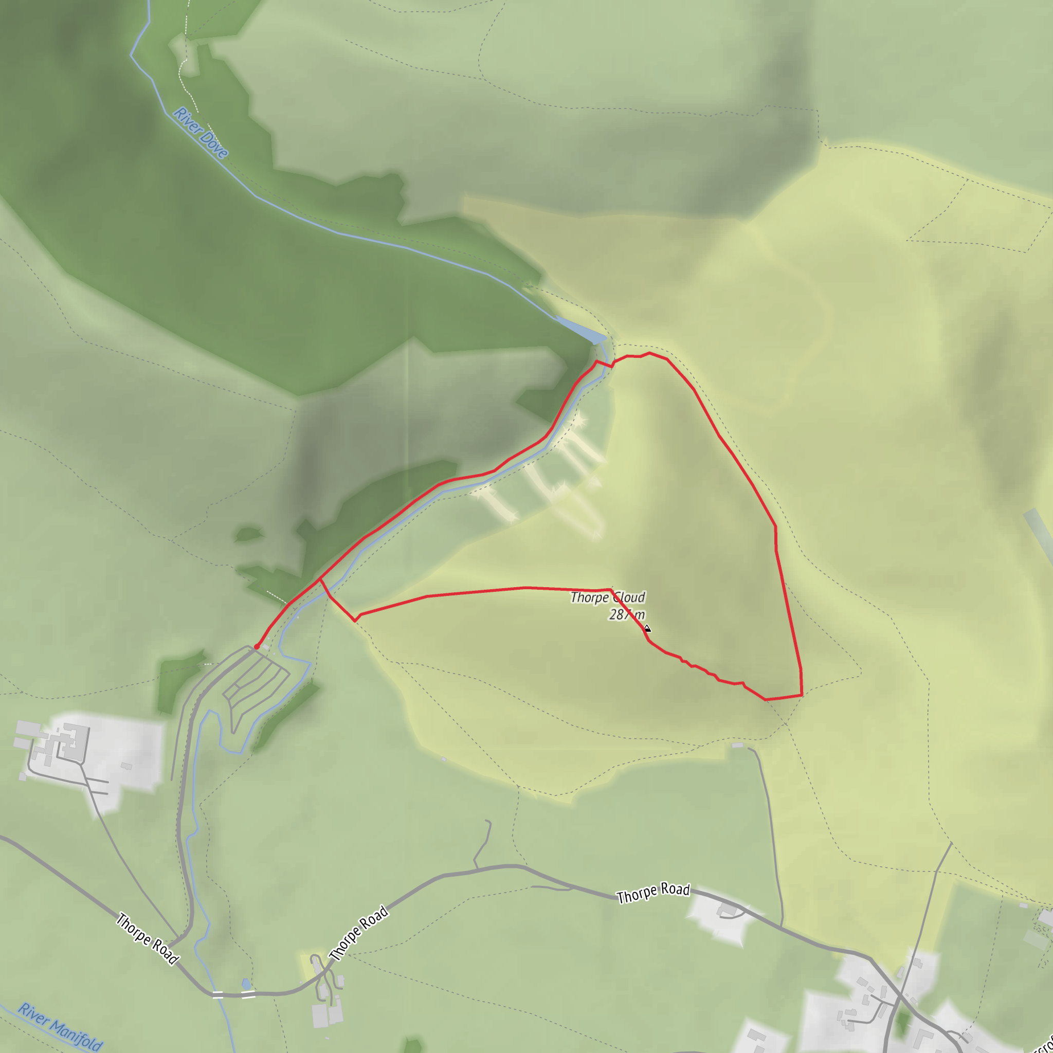
This short but varied loop packs a lot into roughly 2 km / 1.2 miles, with about 100 m / 328 ft of ascent. Although the distance is modest, the climb onto Thorpe Cloud is steep enough to justify the medium rating, especially if the ground is wet, chalky, or polished by heavy foot traffic. The route is best known for combining the famous Dovedale stepping stones with a quick but rewarding hill climb above the River Dove, giving hikers a mix of riverside walking, limestone scenery, and a sharp burst of elevation in a very compact outing. The usual start is near Dovedale Car Park, Dovedale, Ashbourne DE6 2AY, beside the River Dove and close to the Izaak Walton Hotel area. (peakdistrict.gov.uk)
The opening section is generally straightforward, following the well-used path toward the stepping stones at the foot of Thorpe Cloud. This part is often busy, particularly on weekends and holidays, because Dovedale is one of the Peak District’s best-known beauty spots. The stepping stones themselves are a landmark rather than a technical obstacle, but they can become slippery in damp weather, after flooding, or when crowded. If river levels are high, extra care is needed around the crossing and along the banks. (peakdistrict.gov.uk)
Climb to Thorpe Cloud
After the river crossing, the character of the walk changes quickly. The ascent of Thorpe Cloud is short but noticeably steeper than the rest of the loop, gaining most of the route’s 100 m / 328 ft in a concentrated climb. Expect a narrow, worn path with some loose sections and potentially muddy patches, especially after rain. For a hike of only around 2 km / 1.2 miles, this is the section that makes it feel more substantial than the mileage suggests. Hikers should allow time for careful footing on both the ascent and descent. (alltrails.com)
From the top, the main reward is the elevated view over Dovedale and the River Dove. Thorpe Cloud rises to about 287 m / 942 ft above sea level and stands prominently at the southern entrance to the dale, making it one of the most recognizable hills in the White Peak. The summit gives a clear sense of the limestone valley landscape: steep-sided slopes, pale rock, pastureland, and the winding river below. (en.wikipedia.org)
Landscape, wildlife, and what to watch for
This walk sits within a nationally important limestone landscape, and Dovedale is also a National Nature Reserve. The scenery is shaped by limestone geology, which creates dry slopes, rocky outcrops, caves, and a river corridor that supports a rich mix of plant and animal life. Depending on season, hikers may notice wildflowers on the grassier slopes, woodland birds near the river, and grazing livestock in surrounding fields. Sheep and cattle are commonly mentioned on local routes here, so dogs should be managed carefully where permitted. (nt.global.ssl.fastly.net)
The River Dove is central to the walk’s appeal. Its clear water, wooded banks, and pale limestone setting have made Dovedale a celebrated beauty spot for generations. The riverside sections can feel gentle and accessible, but the stone surfaces, roots, and damp patches still deserve attention. In colder months, frost and leaf cover can make the path more awkward than the short distance suggests. For navigation, a HiiKER route map is useful, particularly if you want to confirm the correct path up and down Thorpe Cloud rather than drifting onto nearby connecting trails.
Historical significance
Dovedale has a long cultural and historical reputation that goes well beyond its size. The valley became famous centuries ago for its scenery and for the River Dove’s association with fishing literature, especially through Izaak Walton. The wider area around Ilam and Dovedale also contains historic features including old bridges, estate landscapes, and early stone monuments such as Saxon crosses noted on nearby National Trust trails. In the 20th century, Dovedale formed part of the broader movement that helped establish the Peak District as Britain’s first National Park in 1951. (nationaltrust.org.uk)
Getting to the start
By car, the most practical access is via Dovedale Car Park, Dovedale, Ashbourne DE6 2AY, which is the standard trailhead for the stepping stones and Thorpe Cloud area. The approach road is narrow, and the car park can fill quickly in fine weather, so arriving early is wise. National Trust information also notes nearby facilities and that Ilam Park and Dovedale parking are free for National Trust members with a membership card. (nationaltrust.org.uk)
By public transport, the
What to expect?
Surfaces
Asphalt
Unknown
Gravel
Dirt
Wood
Cobblestone
Comments and Reviews
User comments, reviews and discussions about the Stepping Stones and Thorpe Cloud Loop, England.
average rating out of 5
0 rating(s)

