
Download
3D Flyover
Add to list
More
88.3 km
16 days
1397 m
Multi Day
“From Sheffield’s rivers to Huddersfield’s valleys, this rail-linked trail unfolds through history, farmland, and shifting skies.”
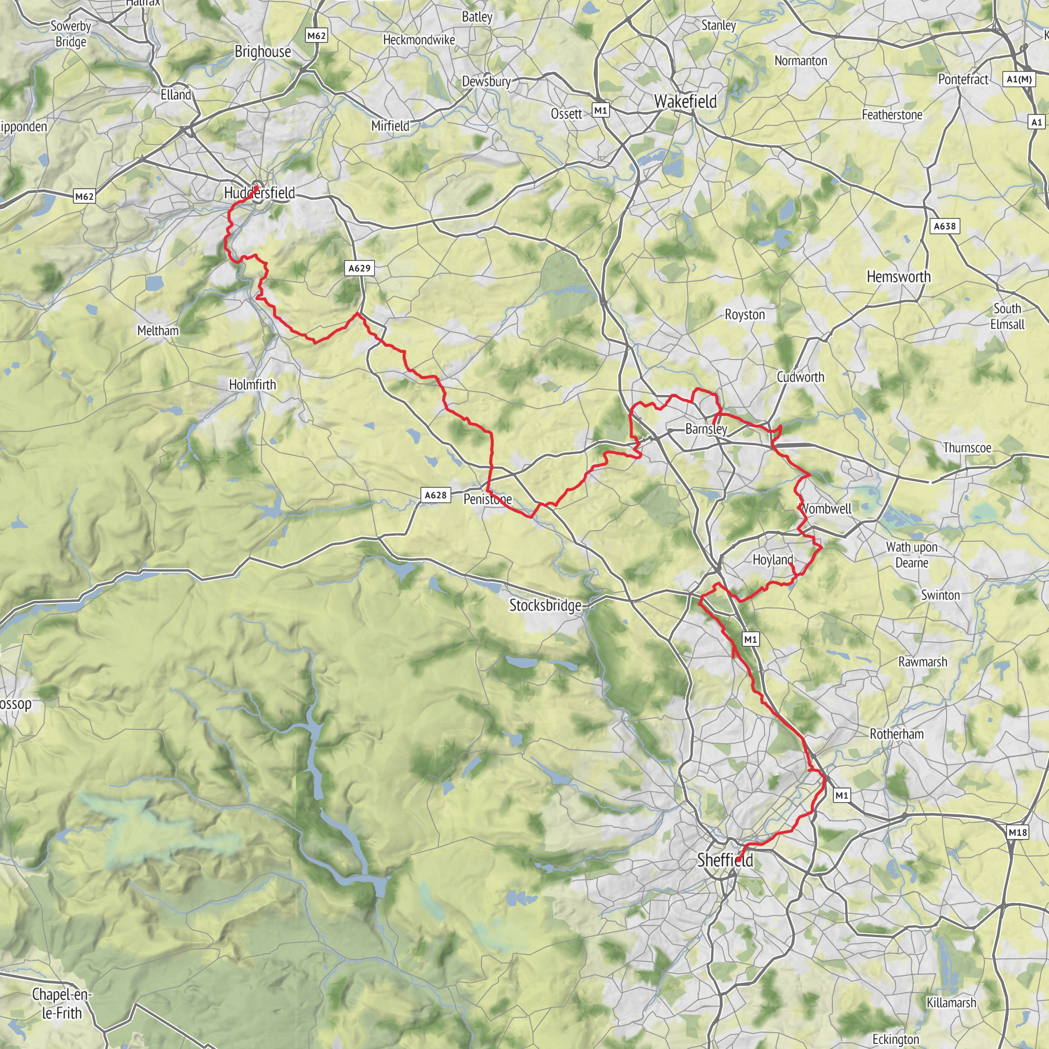
This long rail-linked walk follows the Penistone Line from Sheffield to Huddersfield, linking all 17 stations on the route and covering about 88 km / 55 miles with roughly 1,400 m / 4,593 ft of total ascent. Although often rated easy, that grading is best understood as technically straightforward rather than effortless: the route uses a mix of riverside paths, field tracks, canal towpaths, old railway alignments, bridleways, village lanes, and urban footpaths, so the challenge comes more from the overall length and repeated undulations than from any single hard climb. (penline.co.uk)
The character of the walk changes constantly. In the east, the trail begins in a more urban and industrial landscape around Sheffield, then threads out along the River Don and later the River Dearne. Farther west and north-west, it becomes more rural, with rolling farmland, wooded cloughs, reservoirs, stream valleys, and broader Pennine-edge views as it works toward the Holme Valley and finally the Colne Valley at Huddersfield. The route crosses old packhorse ways, causeys, canal-side sections, and disused railway corridors, so it feels as much like a journey through Yorkshire’s transport history as a countryside walk. (penline.co.uk)
For planning, most hikers break it into 4 to 6 days, often using the station-to-station structure to create manageable stages of roughly 8 to 16 km / 5 to 10 miles. That setup makes it especially flexible: you can shorten a day, skip ahead, or leave the trail by train if weather or energy levels change. Because the route is tied so closely to the railway, it suits both end-to-end walkers and people building a series of day hikes. The official trail is presented in 16 route leaflets between the stations, and for digital navigation the most useful approach is to load the route in HiiKER before setting out. (penline.co.uk)
What the route feels like on the ground
Expect a very mixed walking surface. Some sections are easy-going and fast underfoot on towpath, tarmac path, or firm track; others cross pasture, stiles, muddy field edges, and occasionally overgrown rights of way. After rain, lowland sections near rivers and fields can become slick, while short descents into wooded stream valleys can be greasy underfoot even though they are not mountainous. The cumulative ascent is spread across many smaller rises rather than one major climb, so the trail tends to feel gentler than the total elevation figure suggests, but it can still be tiring over consecutive days. (penline.co.uk)
Wayfinding is usually most demanding where the trail leaves obvious corridors such as rail paths or roads and cuts across farmland, housing edges, or small woods. Around places like Penistone to Denby Dale and Denby Dale to Shepley, the route uses bridleways, field boundaries, stiles, and short linking lanes, with landmarks such as Gunthwaite Dam, Gunthwaite Hall, St Nicholas’ Church, and views toward the Emley Moor Television Mast helping to confirm direction. These are the kinds of sections where having the route open in HiiKER is particularly useful. (penline.co.uk)
Landmarks, scenery, and wildlife
One of the standout features near Penistone is the Penistone Viaduct, an impressive 29-arch railway viaduct over the River Don valley. A short diversion near Watermeadows Park gives a good view of it, and it is one of the clearest reminders that this trail is deeply tied to the railway age. (penline.co.uk)
The route also passes through landscapes shaped by much older movement and settlement. At the Sheffield end, the trail’s eastern historic anchor is Wincobank Hill Fort, an Iron Age hillfort overlooking a strategic crossing of the Don. At the Huddersfield end, the western historic counterpoint is **Castle Hill
Surfaces
Unknown
Asphalt
Gravel
Dirt
Unpaved
Grass
Paved
Cobblestone
Concrete
Comments and Reviews
User comments, reviews and discussions about the Penistone Line Trail, England.
average rating out of 5
0 rating(s)



