
Download
3D Flyover
Add to list
More
8.5 km
~1 hrs 55 min
135 m
Point to Point
“From rail trail to rolling pasture, this Yorkshire station-to-station ramble feels varied and quietly atmospheric.”
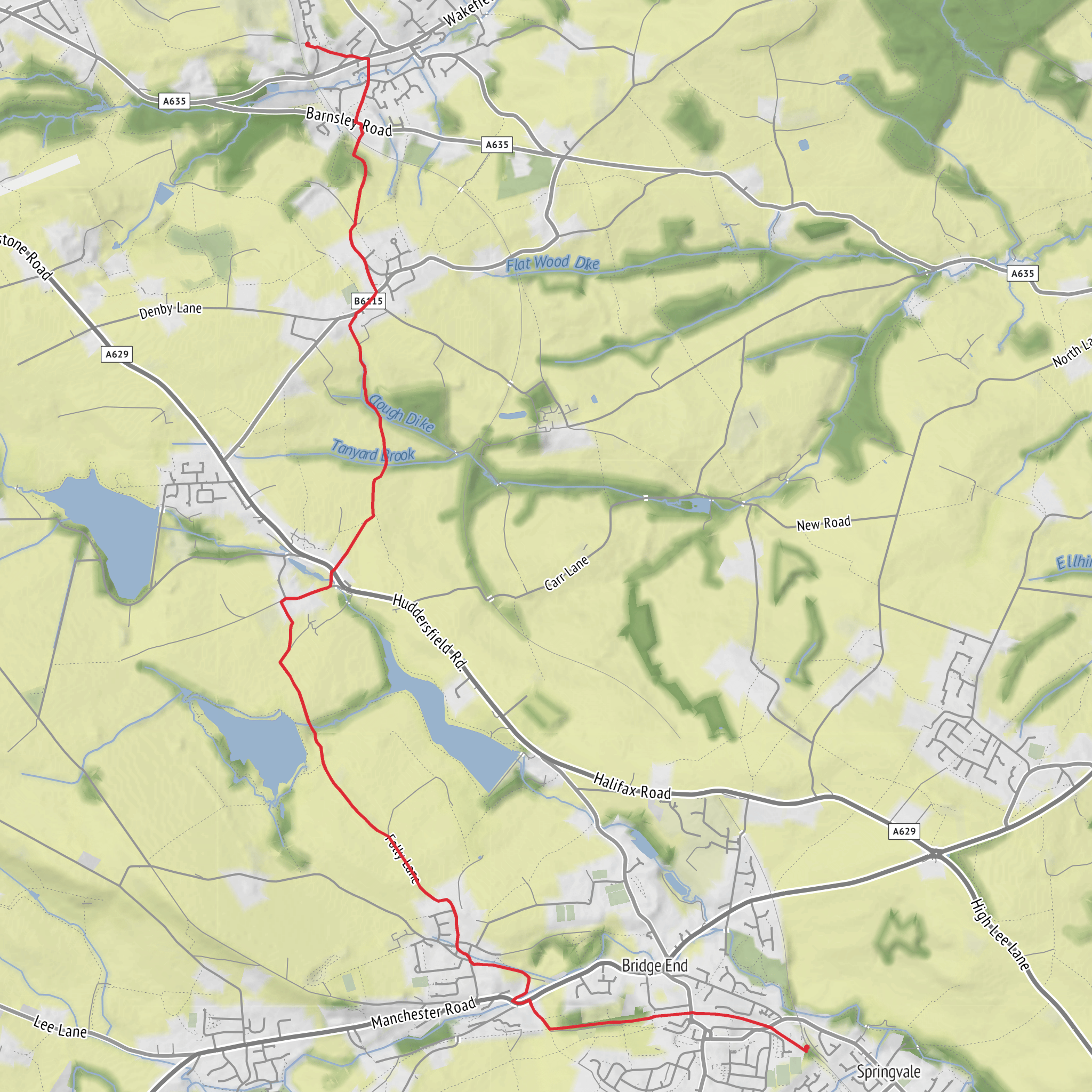
This easy point-to-point walk runs for about 8 km / 5 miles, with roughly 100 m / 330 ft of total ascent, linking Penistone railway station and Denby Dale railway station through a mix of former railway corridor, field paths, bridleways, village lanes, and open countryside. It is a very manageable outing for most walkers, but it is not completely flat throughout, and the short climbs away from the old rail trail and across farmland can feel more noticeable in wet or windy weather. The route is waymarked as the Pen-Den Trail, and it is best treated as a station-to-station walk rather than a circular unless you are arranging a return by train or bus. (denbydale-pc.gov.uk)
The usual western start is at Penistone railway station, Station Road, Penistone, Sheffield S36 6HP, and the eastern end is at Denby Dale railway station, Woodhouse Lane, Denby Dale, Huddersfield HD8 8RX. If arriving by car, both towns are the practical access points, with Penistone reached from the A629/A628 corridor and Denby Dale from the A636/A635 area; because this is a linear walk, many hikers prefer to park at one end and return by rail. Public transport is especially convenient here, as both trail ends are served by stations on the Sheffield–Huddersfield line, and Denby Dale also has a bus interchange beside the station. (denbydale-pc.gov.uk)
The opening section from Penistone is gentle and straightforward. From the old stone-built station frontage, the route joins the Trans Pennine Trail, following the broad former railway for almost 1 mile / 1.6 km. This is one of the easiest parts underfoot, with a wide track and easy navigation, and it gives the walk a relaxed start before the route breaks away into more rural terrain. Around Penistone there are useful services, shops, and cafés if you want to sort food or water before setting off. (visitpenistone.co.uk)
Terrain and route character
After leaving the rail trail, the walk becomes more varied. The route drops toward local roads near Stottercliffe Road and the A628, then continues through Ingbirchworth and out across open fields on public footpaths and bridleways. This middle portion is where the trail feels most like a traditional Yorkshire countryside walk: grassy paths, gates, stiles, farm tracks, and occasional muddy stretches after rain. Some older route notes specifically mention several awkward stiles in quick succession near the field sections, so anyone walking with limited mobility, a large group, or a dog should allow extra time. (visitpenistone.co.uk)
Navigation is generally helped by waymarkers, but this is not a route where you should switch off completely. There are points where the main bridleway continues ahead while side tracks, farm drives, or smaller paths branch away, especially on the approach to Upper Denby. Using HiiKER before setting out is a sensible way to confirm junctions, field boundaries, and the station-to-station line of travel. (denbydale-pc.gov.uk)
Road crossings are one of the main things to watch for. The route meets both the A628 Barnsley–Manchester Road and later the A636 near Denby Dale, and although these are only short roadside sections, traffic can be fast. Extra care is needed when crossing, particularly with children or in poor visibility. (visitpenistone.co.uk)
Landmarks, scenery, and atmosphere
One of the most distinctive features of the walk is the contrast between industrial transport history and quiet agricultural landscape. The early section on the Trans Pennine Trail follows the bed of the former Sheffield to Manchester railway, and later views in the wider area include the striking Penistone Viaduct, a landmark often associated with the trail in local walking material. The route then shifts into rolling pasture, wooded edges, streams, and village approaches that feel much more rural and enclosed. (denbydale-pc.gov.uk)
Near Ingbirchworth, the route passes a small recreation area by a stream with picnic benches, which can make a useful pause point roughly in the first half of the walk. Beyond that, the countryside opens and closes in turns, with hedged fields and occasional broader views over the surrounding South Yorkshire and West Yorkshire border landscape. Expect a patchwork of pasture rather than dramatic mountain scenery; the appeal here is in the changing textures of the route and the sense of walking between two historic settlements. (kirklees.gov.uk)
The finish through Upper Denby and down toward Denby Dale is especially rich in local character. Upper Denby is described in local trail literature as an ancient upland village and conservation area, with old stone houses and cottages,
Surfaces
Asphalt
Unknown
Gravel
Dirt
Grass
Ground
Concrete
Paved
Comments and Reviews
User comments, reviews and discussions about the Pen Den Trail, England.
average rating out of 5
0 rating(s)
