
Download
3D Flyover
Add to list
More
8.0 km
~1 hrs 45 min
94 m
Point to Point
“From Meadowhall’s bustle, the trail softens into a green, history-laced valley toward peaceful Chapeltown.”
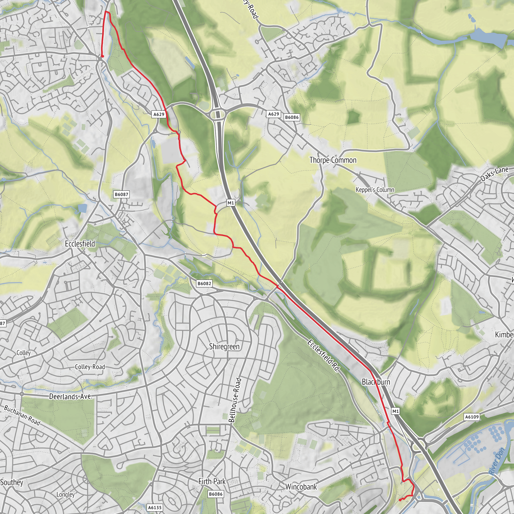
This easy point-to-point walk follows a well-used section of the Trans Pennine Trail from Meadowhall Interchange, Sheffield S9 1JQ to Chapeltown Park, Burncross Road, Chapeltown, Sheffield S35 1RX, covering about 8 km / 5 miles with roughly 100 m / 330 ft of total ascent. The gradient is generally gentle, and much of the route uses surfaced or well-compacted paths, so it suits walkers looking for a straightforward outing with urban access at one end and greener valley scenery as the route unfolds. The start is best understood as the transport hub beside Meadowhall Interchange and Meadowhall shopping centre, while the finish is near Chapeltown Park and the centre of Chapeltown. (penline.co.uk)
From the outset, expect a transition from busy transport infrastructure into a corridor shaped by former railway lines and the Blackburn Valley. The route is part of the Blackburn Valley Trail, itself incorporated into the Trans Pennine Trail, and waymarking typically follows the signed trail north toward Chapeltown. This makes navigation relatively simple, though it is still worth checking the route in HiiKER before setting out, especially around junctions where local links branch away. (southyorkshire-ca.gov.uk)
What the walk feels like
The first section leaves the bustle of Meadowhall and quickly picks up the trail alignment near the Park and Ride area. Here the landscape is strongly influenced by Sheffield’s transport and industrial geography: rail lines, major roads, retail development, and the River Don corridor all sit close together. Even so, the trail soon settles into a more relaxed rhythm as it follows the valley northward. Because this is an easy route, the challenge is less about steep climbing and more about being prepared for a mix of exposed stretches, occasional road crossings, and shared-use sections with cyclists. (sheffieldcycleroutes.org)
Underfoot, hikers should expect mostly firm paths, often suitable in ordinary walking shoes during dry weather, though rain can leave some edges muddy or gritty. The modest elevation gain is spread out rather than concentrated in one hard climb, so the route is usually manageable for beginners, families, and anyone wanting a shorter linear walk with good transport links at both ends.
Landmarks, landscape, and wildlife
A defining feature of this walk is the way it follows Blackburn Brook, the watercourse that helps mark the boundary between Sheffield and Rotherham. As the route moves away from Meadowhall, the surroundings become greener, with pockets of woodland, embankments, and open valley-side views replacing the more built-up start. The brook corridor can attract common waterside and edge-habitat birdlife, so walkers should keep an eye out for species such as wagtails, robins, blackbirds, woodpigeons, and seasonal songbirds in scrub and trees. In quieter sections, rabbits and other small mammals may also be seen along grassy margins. The route is not remote, but it still offers a useful strip of urban nature. (southyorkshire-ca.gov.uk)
One of the more notable green landmarks on this stretch is Netherwood Country Park, which the route passes as it continues along the valley. This helps break up the walk and gives the middle and later stages a more open, recreational feel. Near the Chapeltown end, the approach becomes calmer and more suburban again, with Chapeltown Park providing a natural finishing point and a convenient place to pause before heading for shops, buses, or the railway station. (southyorkshire-ca.gov.uk)
Historical significance of the area
This walk is especially interesting for hikers who enjoy routes shaped by industrial history. Parts of the trail use the course of former railway infrastructure, a common feature of the Trans Pennine Trail network. In this area, old transport corridors that once served heavy industry and rail movement have been repurposed into recreational routes, creating a direct link between South Yorkshire’s industrial past and its present-day green travel network. (en.wikipedia.org)
The Meadowhall area itself sits in a landscape long associated with steelmaking, rail transport, and large-scale redevelopment. What is now a major retail and transport interchange grew in a corridor historically tied to manufacturing and freight movement. Walking north from there toward Chapeltown gives a sense of how the region has evolved: industrial land, transport engineering, river and brook valleys, and reclaimed green space all appear in close succession. Chapeltown, by contrast, feels more like a settled suburban destination, with parkland and local amenities marking the end of the route. (en.wikipedia.org)
Planning, access, and practicalities
Public transport is one of the strongest advantages of this hike. Meadowhall Interchange is exceptionally well connected by train, bus, and Supertram, making it an easy place to start without a
Surfaces
Unknown
Asphalt
Unpaved
Grass
Gravel
Paved
Comments and Reviews
User comments, reviews and discussions about the Meadowhall Interchange to Chapeltown via Trans Pennine Trail, England.
average rating out of 5
0 rating(s)
