
Download
3D Flyover
Add to list
More
6.4 km
~1 hrs 36 min
201 m
Loop
“The Curland Loop is a scenic 6 km trail in Somerset, blending nature, wildlife, and historical landmarks.”
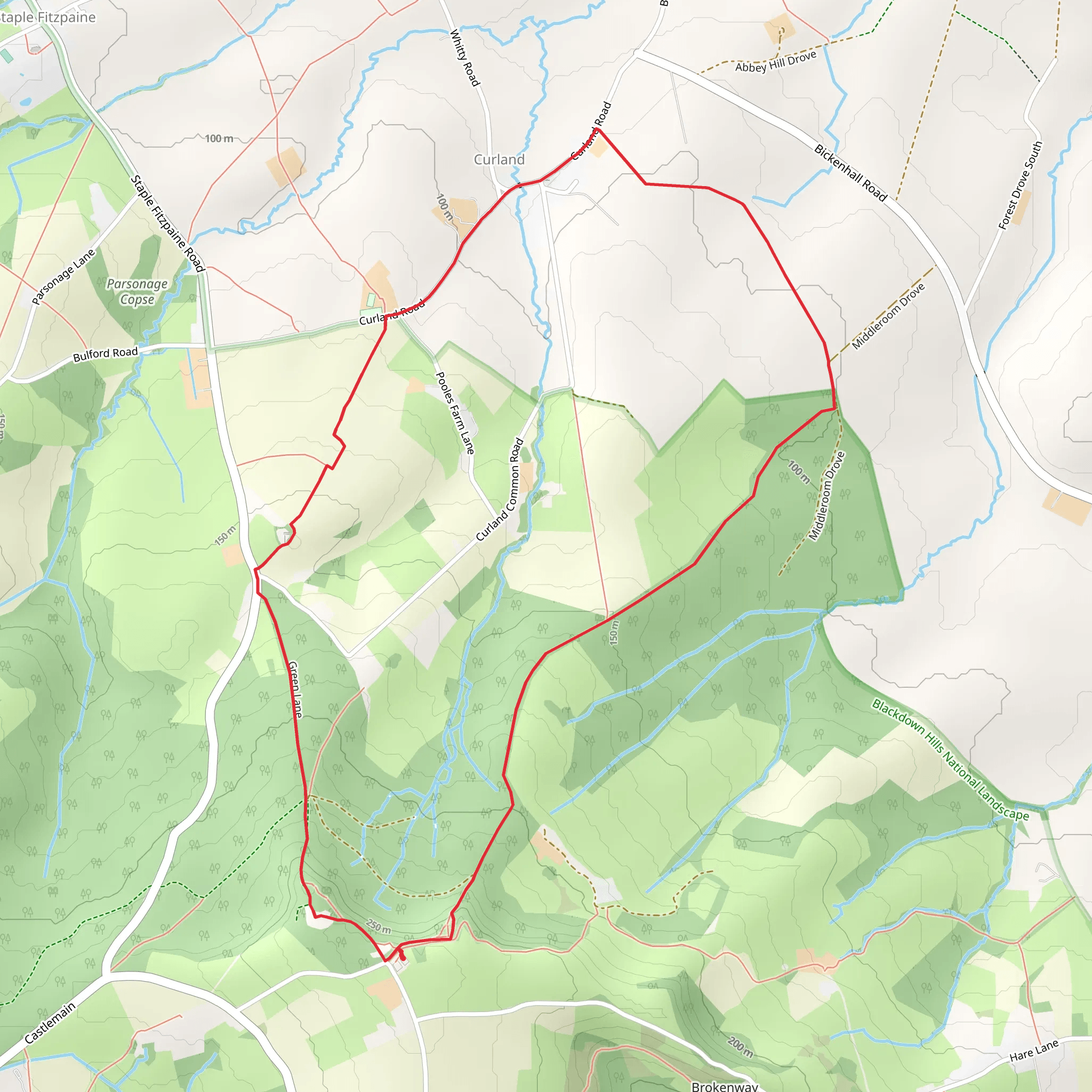
Starting near the picturesque village of Curland in Somerset, England, the Curland Loop is a delightful 6 km (approximately 3.7 miles) trail that offers a moderate challenge with an elevation gain of around 200 meters (656 feet). This loop trail is perfect for those looking to immerse themselves in the serene English countryside, with a mix of woodland paths, open fields, and charming rural landscapes.
Getting There
To reach the trailhead, you can drive or use public transport. If driving, set your GPS to Curland, Somerset, and look for parking options near the village center. For those using public transport, the nearest major town is Taunton. From Taunton, you can take a local bus service towards Curland, with the closest bus stop being in the village itself. From there, it's a short walk to the trailhead.
Trail Navigation
For navigation, it's highly recommended to use HiiKER, which provides detailed maps and real-time updates to ensure you stay on track. The trail is well-marked, but having a reliable navigation tool can enhance your hiking experience.
The Hike
The trail begins in the heart of Curland village, where you'll immediately be greeted by the quaint charm of traditional English cottages. As you set off, the path gently ascends through a mix of open fields and hedgerows, offering stunning views of the surrounding countryside. After about 1 km (0.6 miles), you'll enter a dense woodland area, where the trail becomes more shaded and the air cooler.
Woodland and Wildlife
This section of the trail is particularly rich in wildlife. Keep an eye out for deer, foxes, and a variety of bird species. The woodland is primarily composed of oak, ash, and beech trees, creating a lush canopy overhead. The undergrowth is thick with ferns and wildflowers, especially in the spring and summer months.
Historical Significance
As you continue, you'll come across several historical landmarks. Around the 3 km (1.9 miles) mark, you'll find the remnants of an old stone bridge, a relic from the 18th century that once served as a crucial crossing point for local farmers. Further along, at approximately 4 km (2.5 miles), you'll pass by an ancient oak tree, believed to be over 500 years old. This tree has stood as a silent witness to the changing landscape and is a popular spot for a brief rest and some photos.
Open Fields and Panoramic Views
Emerging from the woodland, the trail opens up into expansive fields. This section offers panoramic views of the Blackdown Hills to the south and the Quantock Hills to the north. The elevation gain is more noticeable here, but the effort is well worth it for the breathtaking vistas.
Final Stretch
The final 2 km (1.2 miles) of the trail gradually descend back towards Curland village. This part of the hike is relatively easy, allowing you to enjoy the scenery without too much exertion. You'll pass through more farmland, where you might see grazing sheep and cattle, adding to the rural charm of the hike.
Practical Tips
- Wear sturdy hiking boots, as the trail can be muddy, especially after rain.
- Bring water and snacks, as there are no facilities along the trail.
- Check the weather forecast before heading out, as conditions can change rapidly.
The Curland Loop offers a perfect blend of natural beauty, wildlife, and historical intrigue, making it a rewarding hike for those looking to explore the Somerset countryside.
What to expect?
Activity types
Comments and Reviews
User comments, reviews and discussions about the Curland Loop, England.
4.17
average rating out of 5
6 rating(s)
