
Download
3D Flyover
Add to list
More
13.6 km
~2 hrs 51 min
77 m
Loop
“A tranquil borderland loop of canals, hedgerows and Big Mere beneath wide, wind-brushed skies.”
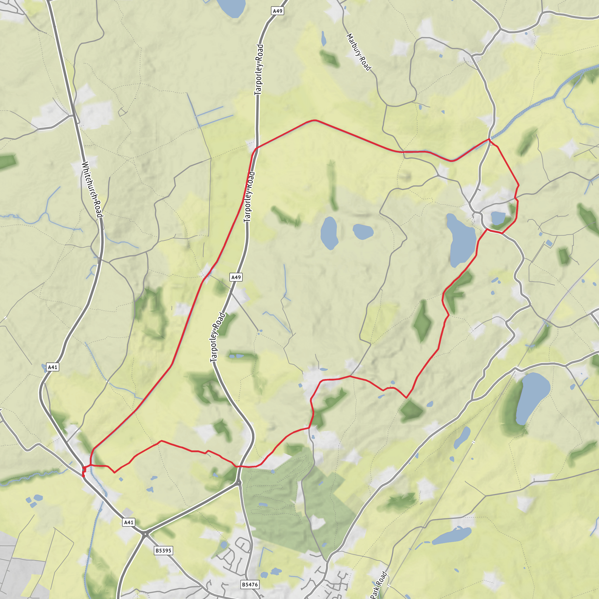
This easy loop of about 14 km / 8.7 miles with roughly 100 m / 328 ft of ascent is a gentle countryside walk through the Shropshire–Cheshire border landscape, combining canal towpath, quiet lanes, field-edge paths and the distinctive mere country around Marbury. The route is best understood as a low-level ramble rather than a hill walk: gradients are generally mild, but the variety comes from changing scenery—waterways, open farmland, hedgerows, broad skies, and the large glacial lake of Big Mere near Marbury. The nearest practical start area is around Jackson’s Bridge on the Llangollen Canal near Whitchurch/Marbury, with the route also passing Steer Bridge on the canal west of Marbury and looping around Big Mere near St Michael and All Angels Church, Marbury. Big Mere lies by Marbury village, about 3 miles / 4.8 km northeast of Whitchurch, and Steer Bridge is one of the numbered canal bridges on the Llangollen Canal in this same stretch. (mapcarta.com)
The walking is suitable for most hikers looking for a relaxed half-day outing. Underfoot, expect a mix of compact towpath, farm tracks, grassy paths and short road sections. After rain, the field paths can become muddy and slick, especially near gates, low spots and lake-edge ground, so waterproof footwear is a sensible choice even though the route is rated easy. Because the landscape is open and only gently undulating, wind and exposure can feel more noticeable than the elevation figures suggest. Navigation is usually straightforward, but the junctions between canal, lanes and rights of way can still be easy to miss, so having the route loaded in HiiKER is useful.
What the route feels like
From the canal side near Jackson’s Bridge, the opening section is typically calm and level, with the Llangollen Canal setting the tone for the day. This canal is known for its rural character and for the sequence of bridges and lift bridges that punctuate the towpath. The stretch around Whitchurch and Marbury is especially peaceful, with long straight reaches, hedgerow-lined banks and occasional views out across pasture. Steer Bridge marks one of the notable crossing points on this section of canal, and it helps anchor the western side of the loop. (explore.opencanalmap.uk)
Leaving the canal, the route turns into classic border-country farmland. The terrain rolls gently rather than climbing sharply, which is where most of the roughly 100 m / 328 ft of ascent is gained—small rises, embankments, and gradual transitions between canal level, village lanes and the mere-side landscape. This middle part of the walk often feels more open, with broad views over fields and scattered trees rather than enclosed woodland.
The approach to Big Mere is one of the highlights. This is a substantial natural lake formed in a glacial hollow, part of the wider Meres and Mosses landscape that makes this area ecologically and visually distinctive. Around Marbury, the mere sits beside the village and below St Michael and All Angels Church, which stands on slightly higher ground overlooking the water. That pairing of church, lake and pasture gives this section a particularly strong sense of place. (en.wikipedia.org)
Landmarks, nature and wildlife
The canal itself is a major landmark. The Llangollen Canal was built in stages by the Ellesmere Canal Company and later became part of the Shropshire Union system. Around Whitchurch, it is especially associated with lift bridges and with the historic Whitchurch Arm, which once connected the main line more directly into the town. The canal corridor now provides both heritage interest and a valuable wildlife strip through agricultural land. (waterways.org.uk)
Steer Bridge is one of the identifiable bridge points on the canal
Surfaces
Unknown
Grass
Asphalt
Ground
Gravel
Dirt
Unpaved
Concrete
Comments and Reviews
User comments, reviews and discussions about the Jackson's Bridge, Llangollen Canal, Steer Bridge and Big Mere Loop, England.
average rating out of 5
0 rating(s)


