
Download
3D Flyover
Add to list
More
35.8 km
~2 days
437 m
Loop
“Embark on the Upper Hambleton and Rutland Water Loop for a scenic 36 km adventure through history and nature.”
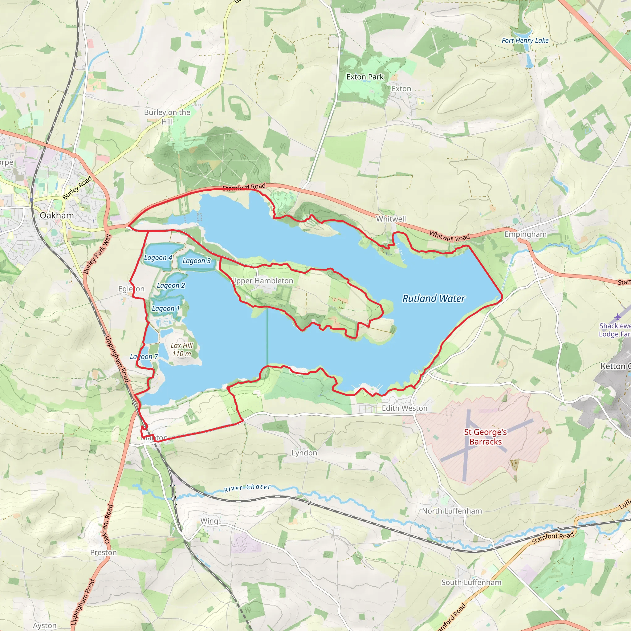
Starting near the charming village of Hambleton in Rutland, England, the Upper Hambleton and Rutland Water Loop is a captivating 36 km (22.4 miles) trail with an elevation gain of approximately 400 meters (1,312 feet). This loop trail offers a medium difficulty rating, making it suitable for moderately experienced hikers.
Getting There
To reach the trailhead, you can drive to Hambleton, which is easily accessible via the A606 from Oakham. If you prefer public transport, Oakham Railway Station is the nearest major station, and from there, you can take a local bus or taxi to Hambleton.
Trail Overview
The trail begins near Hambleton and quickly immerses you in the serene beauty of the Rutland countryside. As you set off, you'll traverse a mix of woodland paths, open fields, and lakeside trails, offering a diverse hiking experience.
Key Landmarks and Sections
Hambleton Peninsula
Approximately 5 km (3.1 miles) into the hike, you'll reach the Hambleton Peninsula. This area is known for its stunning views of Rutland Water, one of the largest artificial lakes in Europe. The peninsula itself is rich in history, with remnants of medieval settlements that once thrived here.
Rutland Water Nature Reserve
Around the 10 km (6.2 miles) mark, you'll enter the Rutland Water Nature Reserve. This section is a haven for birdwatchers, with over 25,000 waterfowl visiting annually. Keep an eye out for ospreys, which have been successfully reintroduced to the area. The reserve also features several bird hides, perfect for a quiet moment of observation.
Normanton Church
At approximately 18 km (11.2 miles), you'll come across the iconic Normanton Church. This partially submerged church is a striking landmark and a popular photo spot. Originally built in the 14th century, it was saved from flooding during the creation of Rutland Water and now stands as a museum.
Terrain and Navigation
The trail features a variety of terrains, from well-maintained gravel paths to more rugged, uneven sections. While the elevation gain is moderate, some parts of the trail can be steep and challenging. It's advisable to use a reliable navigation tool like HiiKER to stay on track, especially in the more remote sections.
Flora and Fauna
The trail is abundant with diverse flora and fauna. In spring and summer, the fields are awash with wildflowers, including bluebells and poppies. The woodlands are home to deer, foxes, and a variety of bird species. The lakeside sections offer opportunities to spot aquatic life, such as otters and various fish species.
Historical Significance
The region around Rutland Water is steeped in history. The creation of the reservoir in the 1970s led to the flooding of several villages, and remnants of these can still be seen. The area also has a rich agricultural history, with many of the fields and hedgerows dating back to medieval times.
Practical Information
Given the length and moderate difficulty of the trail, it's essential to come prepared. Wear sturdy hiking boots, bring plenty of water, and pack a lunch or snacks. There are several picnic spots along the way, particularly around the nature reserve and Normanton Church. Public restrooms are available at the visitor centers around Rutland Water.
Whether you're a seasoned hiker or looking for a challenging day out, the Upper Hambleton and Rutland Water Loop offers a rewarding experience with its blend of natural beauty, historical landmarks, and diverse wildlife.
AI Planner
Days planned around your pace, with somewhere to stay each night.
What to expect?
Activity types
Comments and Reviews
User comments, reviews and discussions about the Upper Hambleton and Rutland Water Loop, England.
4.62
average rating out of 5
13 rating(s)



