
Download
3D Flyover
Add to list
More
6.4 km
~1 hrs 31 min
152 m
Point to Point
“The Slapewath to Saltburn Viaduct Walk offers lush landscapes, historical landmarks, and moderate hiking challenges.”
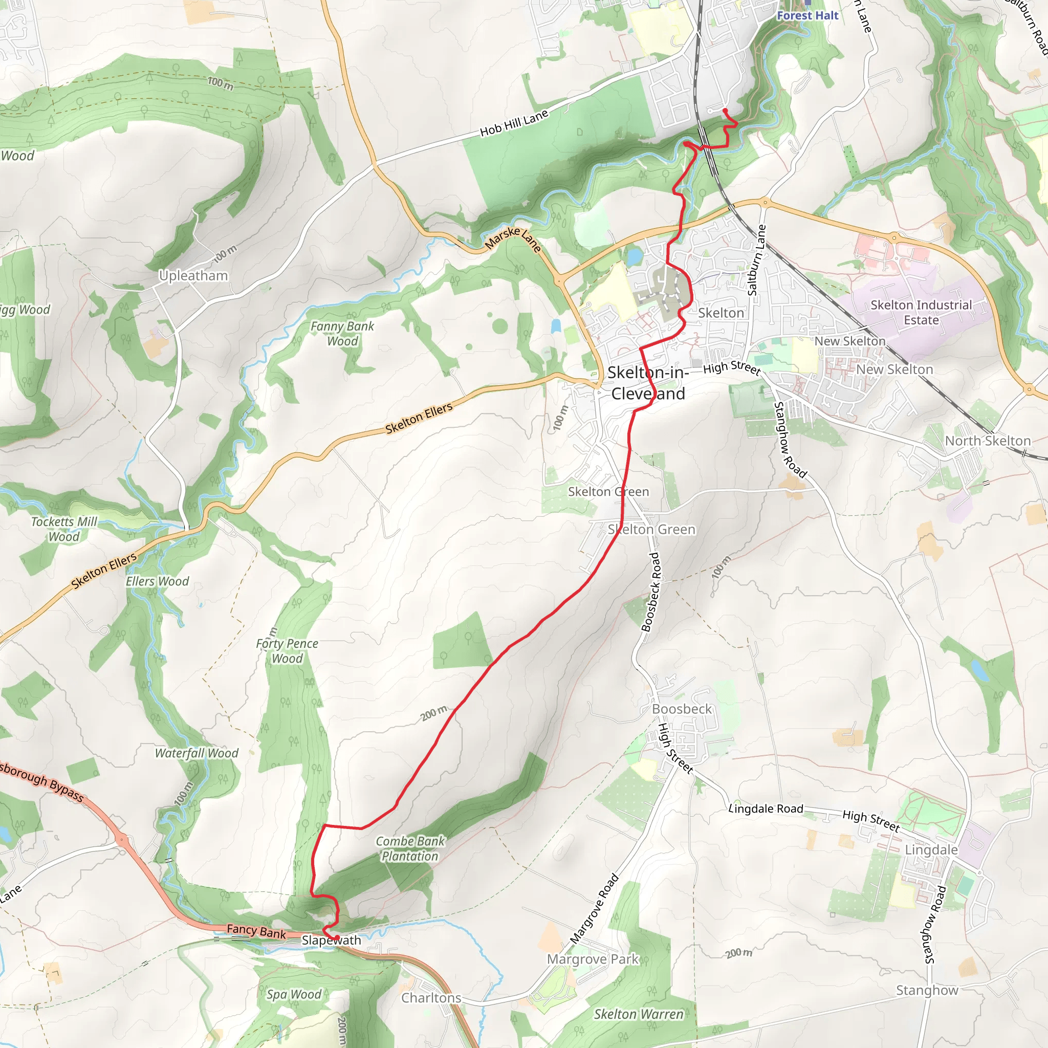
Starting near Redcar and Cleveland, England, the Slapewath to Saltburn Viaduct Walk spans approximately 6 km (3.7 miles) with an elevation gain of around 100 meters (328 feet). This point-to-point trail offers a medium difficulty rating, making it suitable for moderately experienced hikers.
Getting There
To reach the trailhead, you can drive or use public transport. If driving, head towards Slapewath, which is easily accessible from the A171. For those using public transport, the nearest significant landmark is Guisborough, which has bus services connecting to Slapewath. From Guisborough, you can take a local bus or taxi to the starting point.
Trail Overview
The trail begins in the quaint village of Slapewath, nestled in the North York Moors National Park. As you set off, you'll find yourself surrounded by lush greenery and the serene sounds of nature. The initial part of the trail is relatively flat, making it a gentle start.
Key Landmarks and Nature
Around 1.5 km (0.9 miles) into the hike, you'll encounter the first significant landmark: the ancient woodland of Guisborough Forest. This area is rich in biodiversity, home to various bird species, including woodpeckers and owls. Keep an eye out for deer, which are often seen grazing in the early mornings or late afternoons.
Continuing for another 2 km (1.2 miles), you'll reach the charming village of Upleatham. This village is known for its historical significance, particularly the Church of St. Andrew, one of the smallest churches in England. It's worth taking a short detour to explore this quaint structure and its surrounding graveyard.
Elevation Gain and Scenic Views
As you leave Upleatham, the trail begins to ascend gradually. The next 1.5 km (0.9 miles) will take you through rolling hills and open fields, offering panoramic views of the surrounding countryside. The elevation gain here is around 50 meters (164 feet), providing a moderate challenge without being too strenuous.
Historical Significance
Approaching the final stretch of the trail, you'll come across the Saltburn Viaduct, an impressive structure with a rich history. Built in the 19th century, this viaduct was a crucial part of the railway network that connected the industrial towns of the North East. The viaduct stands as a testament to the engineering prowess of the Victorian era and offers a stunning backdrop for photos.
Final Stretch
The last 1 km (0.6 miles) of the trail descends gently towards Saltburn-by-the-Sea. This coastal town is known for its Victorian pier and cliff tramway, the oldest water-balanced funicular still in operation in Britain. As you finish your hike, take some time to explore Saltburn's beautiful beach and perhaps enjoy a well-deserved meal at one of the local cafes.
Navigation
For navigation, it's highly recommended to use HiiKER, which provides detailed maps and real-time updates to ensure you stay on track. This tool is particularly useful for identifying any potential detours or points of interest along the way.
This trail offers a perfect blend of natural beauty, historical landmarks, and moderate physical challenge, making it a rewarding experience for any hiker.
What to expect?
Activity types
Comments and Reviews
User comments, reviews and discussions about the Slapewath to Saltburn Viaduct Walk, England.
4.4
average rating out of 5
5 rating(s)


