Download
3D Flyover
Add to list
More
17.5 km
~4 hrs 13 min
435 m
Loop
“A windswept Swaledale loop weaving limestone scars, lonely moors and Tan Hill’s storied high country.”
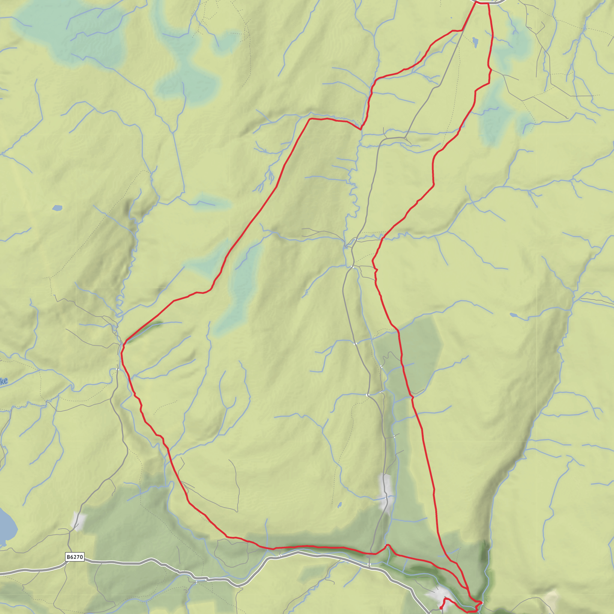
This medium-grade loop explores one of the most remote-feeling corners of upper Swaledale, linking limestone scar, open moor, old mining country and the famous high ground around Tan Hill. At roughly 17 km / 10.5 miles with about 400 m / 1,300 ft of ascent, it is a day walk that feels bigger than the numbers suggest because of the exposed terrain, long stretches between landmarks and the likelihood of wind, wet ground and rapidly changing weather on the moors. The route is best suited to walkers who are comfortable with uneven paths, rough pasture, moorland tracks and occasional boggy sections. Nearby access points and route descriptions strongly suggest the walk starts around Keld, North Yorkshire, most practically near Park Lodge Farm / Rukin’s Campsite, Keld, DL11 6LN, or the village itself, with the loop heading out toward Cotterby Scar, Thomas Gill Rigg and Tan Hill before returning. (masarnenramblers.com)
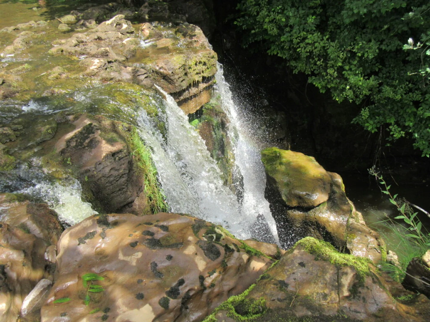
From the start near Keld, the opening section is usually the gentlest underfoot, giving you time to settle in before the higher, emptier ground. Keld sits in upper Swaledale within the Yorkshire Dales National Park, and the first few kilometres / miles often combine lanes, field paths and stony tracks. If your version of the loop begins by crossing or skirting the River Swale side of the valley, expect classic dale scenery: stone barns, drystone walls, grazing land and fast-moving watercourses. Cotterby Scar is one of the early standout features, a limestone escarpment above the Swale that adds a more rugged edge to the pastoral valley setting. Older route descriptions also note nearby waterfalls in this part of the walk, including East Gill Force and views toward Wain Wath Force depending on the exact line taken. (masarnenramblers.com)
Climbing onto the moor
As the route leaves the valley influence and works upward by Barney Brow and toward Thomas Gill Rigg, the character changes noticeably. The ground becomes broader, quieter and more exposed, with fewer obvious waymarks from the landscape itself. This is where the walk starts to earn its medium rating. The climbing is not usually technical, but it can be sustained in places, and the combination of peat, grass, rough tracks and moorland crossings can slow progress more than expected. Around Thomas Gill Rigg, you are moving through high Pennine country where gills cut sharply into the plateau and where visibility can deteriorate quickly in mist. A navigation aid such as HiiKER is especially useful here, not because the route is extreme, but because junctions, faint trods and broad moorland can become confusing in poor weather. (masarnenramblers.com)
Thomas Gill itself is one of the more dramatic natural features on the loop. Historical walking accounts describe the gill narrowing into a ravine, with the beck cutting deeply through the moorland. In wet weather, the streams and becks around this section can become more serious obstacles than they appear on a map, so after heavy rain it is worth allowing extra time and taking care on descents to bridges or crossing points. The approach to Stonesdale Beck and the climb back toward Tan Hill can also feel committing because there is little shelter and the terrain is open on all sides. (visorando.com)
Tan Hill and the high country
Tan Hill is the best-known landmark on the loop and gives the walk much of its sense of place. The Tan Hill Inn, Reeth, Richmond, Swaledale, North Yorkshire Dales, DL11 6ED, is widely noted as Britain’s highest public house at about 528 m / 1,732 ft above sea level. Reaching this point often feels like arriving at a true upland outpost rather than a simple roadside stop. The surrounding moorland is expansive, with long views in clear weather and a strong Pennine atmosphere even on relatively modest summits. (tanhillinn.com)
This area also carries real industrial history. Tan Hill was associated with coal mining, and nearby route descriptions mention old mine workings, shafts and even the remains of a horse gin on short walks from the inn. Older accounts of the wider route network note that some of the paths and tracks across this high ground were once used as packhorse or “jagger” routes, including routes by which coal was carried from the Tan Hill mines. That history helps explain why some tracks seem to strike such purposeful lines across otherwise lonely moorland.
Surfaces
Unknown
Ground
Unpaved
Paved
Dirt
Asphalt
Comments and Reviews
User comments, reviews and discussions about the Silver Hill, Cotterby Scar, Barney Brow, Thomas Gill Rigg and Tan Hill Loop, England.
average rating out of 5
0 rating(s)
