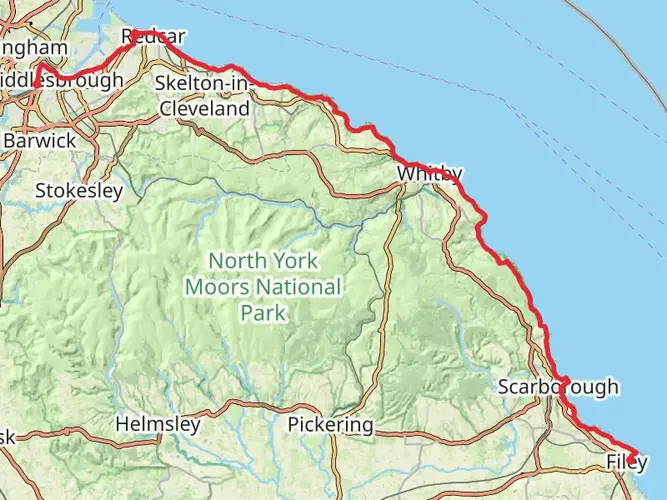
Runswick Bay - Port Mulgrave - Staithes - Skinningrove and Saltburn by the Sea
Download
Preview
Add to list
More
18.9 km
~4 hrs 26 min
404 m
Multi-Day
The Runswick Bay - Port Mulgrave - Staithes - Skinningrove and Saltburn by the Sea is a 18.9 km trail that starts in Scarborough, North Yorkshire, England. Based on our data, the hike is graded as Medium. For information on how we grade trails, please read measuring the difficulty of a hiking trail on hiiker. Also, check our latest community posts for trail updates. This hike can be completed in approx 4 hrs 27 mins. Caution is advised on trail times as this depends on multiple variables. For more info read about how we calculate hike time.

What to expect?
Activity types
Frequently asked questions
How long does the Runswick Bay - Port Mulgrave - Staithes - Skinningrove and Saltburn by the Sea hike take?
Runswick Bay - Port Mulgrave - Staithes - Skinningrove and Saltburn by the Sea is 18.85 km long with 404 m of climbing, so most hikers should allow roughly 5 to 7 hours of walking time. The route is rated medium and includes repeated coastal climbs and descents between Runswick Bay, Port Mulgrave, Staithes, Skinningrove, and Saltburn-by-the-Sea.
Is the Runswick Bay - Port Mulgrave - Staithes - Skinningrove and Saltburn by the Sea hike hard?
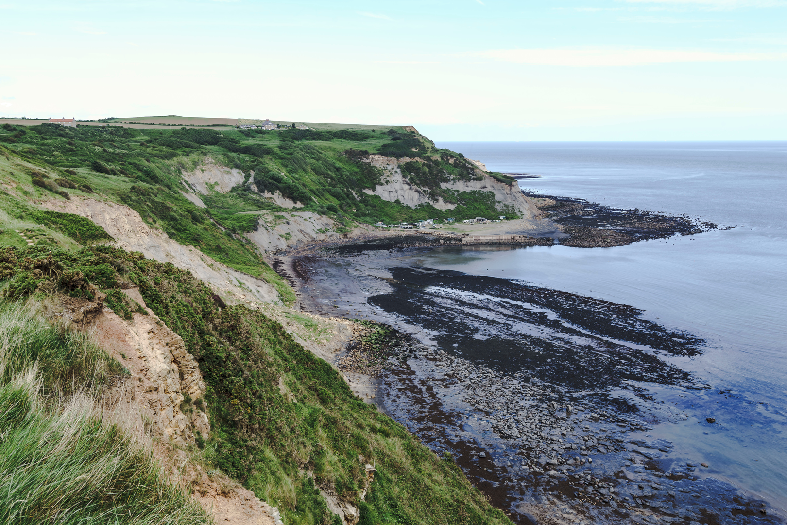
Runswick Bay - Port Mulgrave - Staithes - Skinningrove and Saltburn by the Sea is best described as a medium coastal hike rather than an easy stroll. The challenge comes from its 18.85 km length and 404 m of elevation gain, plus steep cliff-path sections and village descents around places like Staithes, Skinningrove, and the approach to Saltburn-by-the-Sea.
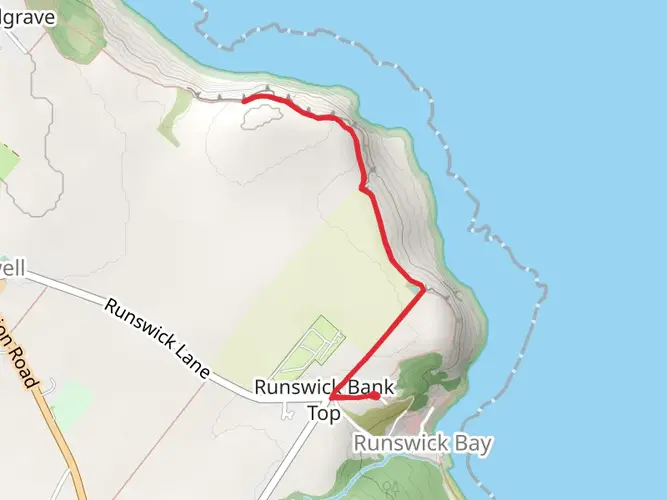
Where do you start and finish the Runswick Bay - Port Mulgrave - Staithes - Skinningrove and Saltburn by the Sea hike?
The hike runs between Runswick Bay and Saltburn-by-the-Sea on the North Yorkshire coast, passing Port Mulgrave, Staithes, and Skinningrove on the way. It follows the Cleveland Way coastal section, so it works well as a point-to-point walk rather than a loop.
Is there parking for the Runswick Bay - Port Mulgrave - Staithes - Skinningrove and Saltburn by the Sea hike?
Parking is available at both ends, which makes this route practical as a linear day hike. Runswick Bay has an Upper Car Park on the clifftop, while Staithes has Bank Top Car Park near the village, and Saltburn-by-the-Sea has town parking close to the seafront and Cleveland Way access points.
Can you use public transport for the Runswick Bay - Port Mulgrave - Staithes - Skinningrove and Saltburn by the Sea hike?
Yes. Saltburn-by-the-Sea has a railway station, which makes the northern end especially convenient, and there are regular coast-road bus links serving villages on this stretch including Staithes and Runswick Bay. That makes it realistic to walk one way and return by public transport instead of arranging two cars.
What landmarks are on the Runswick Bay - Port Mulgrave - Staithes - Skinningrove and Saltburn by the Sea hike?
This route links several of the best-known places on the Cleveland Way coast: Runswick Bay, the old ironstone port at Port Mulgrave, the harbor village of Staithes, Skinningrove, and Saltburn-by-the-Sea. Along the way the path passes dramatic cliff scenery, former mining remains near Port Mulgrave, and the high coastal ground around Boulby, noted as the highest cliffs on England’s east coast.
Is the Runswick Bay - Port Mulgrave - Staithes - Skinningrove and Saltburn by the Sea hike good for a multi-day walk?
Yes. Although 18.85 km is manageable in a single long day for many hikers, the route is also well suited to being split as part of a longer Cleveland Way trip. Staithes is a natural break point on this coast, and the sequence of villages gives useful access to services between Runswick Bay and Saltburn-by-the-Sea.
Comments and Reviews
User comments, reviews and discussions about the Runswick Bay - Port Mulgrave - Staithes - Skinningrove and Saltburn by the Sea, England.
5.0
average rating out of 5
1 rating(s)