Download
3D Flyover
Add to list
More
9.5 km
~2 hrs 17 min
234 m
Loop
“Explore the enchanting Osmotherley Loop: 10 km of diverse landscapes, historical intrigue, and breathtaking views.”
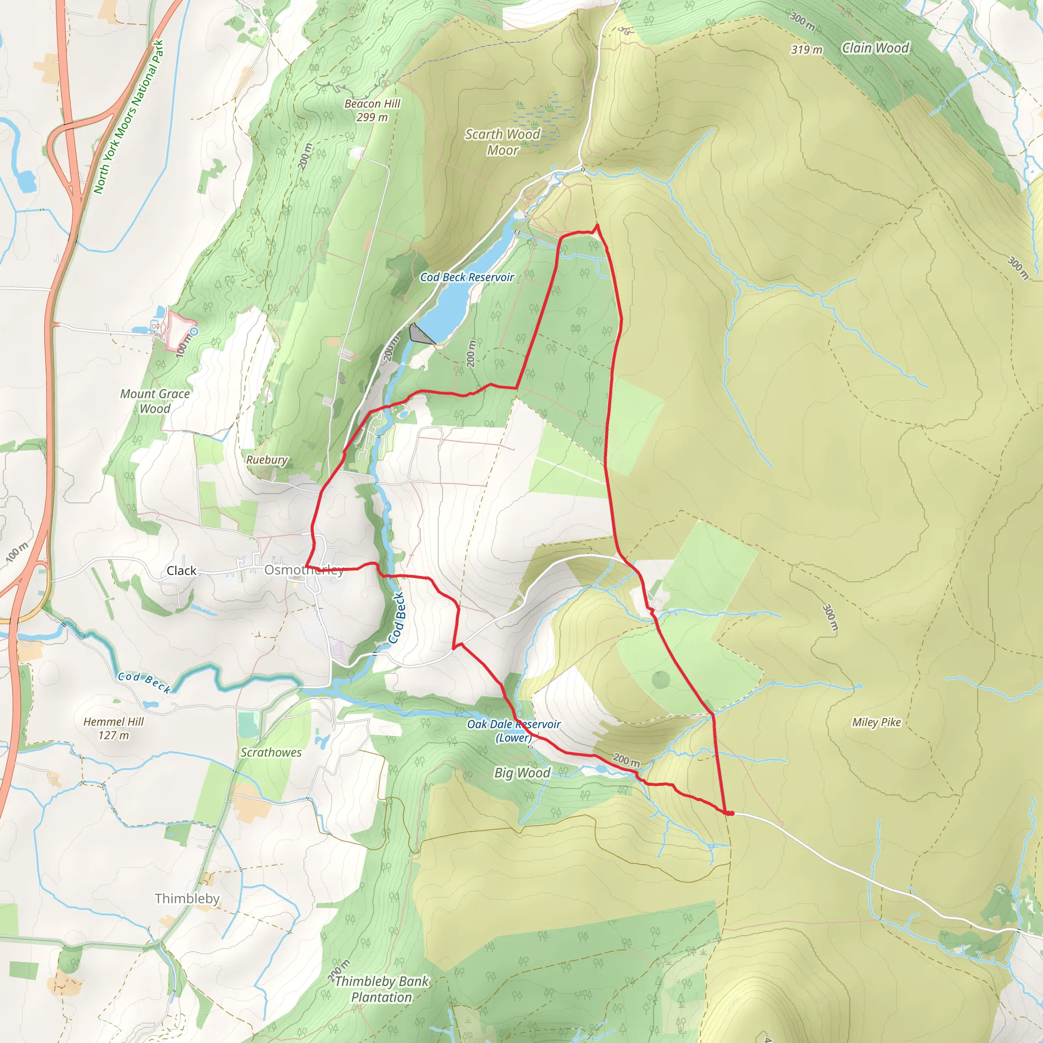
Starting near the picturesque village of Osmotherley in North Yorkshire, England, this loop trail spans approximately 10 km (6.2 miles) with an elevation gain of around 200 meters (656 feet). The trailhead is conveniently located near the village, making it accessible for both locals and visitors.
Getting There
To reach the trailhead, you can drive or use public transport. If driving, head towards Osmotherley, which is easily accessible from the A19. There is a car park near the village center where you can leave your vehicle. For those using public transport, the nearest train station is Northallerton. From Northallerton, you can take a bus or taxi to Osmotherley, which is about 11 miles (18 km) away.
Trail Overview
The Osmotherley Loop is a medium-difficulty trail, suitable for hikers with a moderate level of fitness. The loop offers a variety of landscapes, including woodlands, open moorlands, and charming village scenes.
Key Sections and Landmarks
Osmotherley Village
Starting from the village, you'll immediately notice the quaint charm of Osmotherley, with its stone cottages and historic buildings. The village itself is worth exploring, with several pubs and shops that offer local delicacies and crafts.
Cod Beck Reservoir
About 2 km (1.2 miles) into the hike, you'll reach Cod Beck Reservoir. This serene body of water is a popular spot for picnics and offers beautiful reflections of the surrounding trees. The path around the reservoir is relatively flat, making it a pleasant section of the hike.
Climbing to the Moorlands
After leaving the reservoir, the trail begins to ascend towards the moorlands. This section involves a steady climb, gaining approximately 100 meters (328 feet) over the next 3 km (1.9 miles). The effort is rewarded with expansive views of the North York Moors National Park. Keep an eye out for local wildlife, including grouse and deer.
Historical Sites
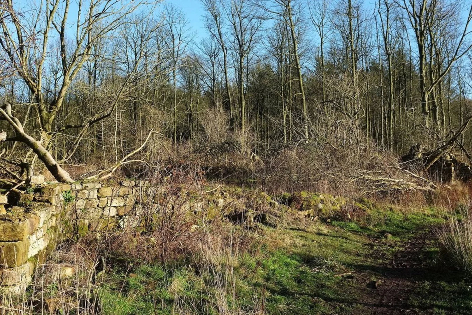
As you traverse the moorlands, you'll come across remnants of ancient settlements and old stone walls. These historical markers are a testament to the area's rich past, dating back to the Iron Age. The moorlands were once home to small farming communities, and you can still see the outlines of their fields and homes.
Scarth Wood Moor
Around the 7 km (4.3 miles) mark, you'll enter Scarth Wood Moor. This area is known for its diverse flora, including heather and bilberry. The moor is particularly stunning in late summer when the heather is in full bloom, painting the landscape in shades of purple.
Navigation
For navigation, it's highly recommended to use the HiiKER app, which provides detailed maps and real-time updates. The trail is well-marked, but having a reliable navigation tool ensures you stay on track and can explore any interesting detours with confidence.
Final Stretch
The final 3 km (1.9 miles) of the loop take you back down towards Osmotherley. This descent offers more beautiful views and a chance to spot various bird species. As you approach the village, the path becomes more sheltered, passing through wooded areas that provide a cool respite on warmer days.
Practical Tips
- Wear sturdy hiking boots, as the terrain can be uneven, especially on the moorlands.
- Bring water and snacks, as there are limited facilities once you leave the village.
- Check the weather forecast before you go; the moorlands can be exposed and windy.
- If hiking in late summer, be prepared for midges, especially near the reservoir.
This loop trail offers a perfect blend of natural beauty, historical intrigue, and moderate physical challenge, making it a rewarding experience for any hiker.
What to expect?
Activity types
Comments and Reviews
User comments, reviews and discussions about the Osmotherley Loop, England.
4.4
average rating out of 5
5 rating(s)
