Download
3D Flyover
Add to list
More
19.8 km
~5 hrs 8 min
708 m
Loop
“Explore Yorkshire's enchanting 20 km loop, blending lush meadows, historical ruins, and panoramic moorland views.”
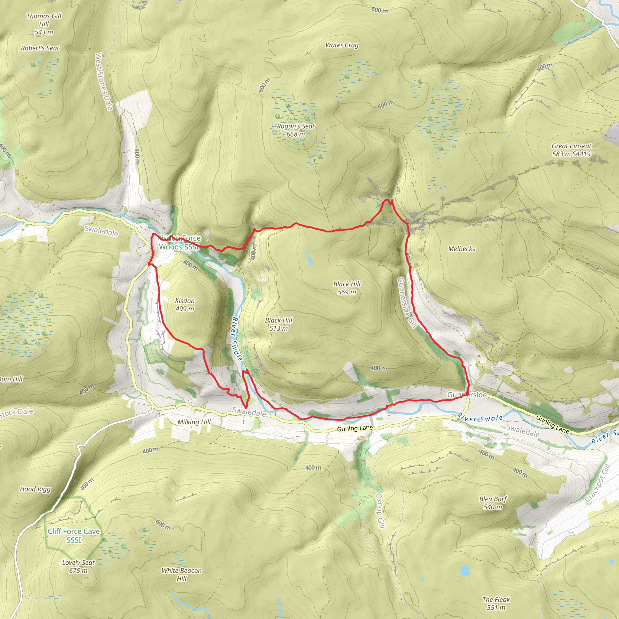
Starting near North Yorkshire, England, this 20 km (approximately 12.4 miles) loop trail offers a fascinating blend of natural beauty and historical intrigue. With an elevation gain of around 700 meters (approximately 2,297 feet), the trail is rated as medium difficulty, making it suitable for moderately experienced hikers.
Getting There
To reach the trailhead, you can drive or use public transport. If driving, head towards the village of Keld, which is the nearest significant landmark. There is limited parking available near the village, so arriving early is advisable. For those using public transport, the nearest major town is Richmond, from where you can take a bus to Keld. Check local bus schedules for the most accurate information.
Trail Overview
The trail begins near Keld and quickly immerses you in the rugged beauty of the Yorkshire Dales. The first section of the hike takes you through lush meadows and along the banks of the River Swale. As you progress, you'll encounter a series of waterfalls, including the picturesque East Gill Force, located about 2 km (1.2 miles) from the start.
Historical Landmarks
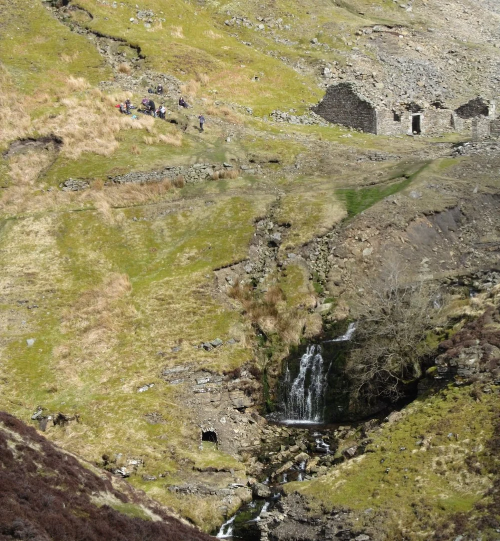
Around the 5 km (3.1 miles) mark, you'll reach the Blakethwaite Smelt Mill. This historical site dates back to the 19th century and was once a bustling hub for lead smelting. The ruins of the mill and its associated buildings offer a glimpse into the industrial past of the region. Interpretive signs provide detailed information about the smelting process and the lives of the workers who toiled here.
Continuing on, the trail ascends towards Swinner Gill Lead Mine, another significant historical site. Located approximately 10 km (6.2 miles) into the hike, this area was extensively mined for lead during the 18th and 19th centuries. The remnants of the mine, including old shafts and spoil heaps, are scattered across the landscape. Exercise caution when exploring these areas, as some of the old structures can be unstable.
Natural Beauty
As you make your way through Swinner Gill, the trail offers stunning views of the surrounding moorlands and valleys. The area is rich in wildlife, and you may spot red grouse, curlews, and even the occasional peregrine falcon. The flora is equally diverse, with heather, bilberry, and various wildflowers adding splashes of color to the landscape.
Navigation and Safety
Given the trail's remote location and historical sites, it's crucial to have reliable navigation tools. The HiiKER app is highly recommended for this purpose, as it provides detailed maps and real-time tracking to ensure you stay on course. The weather in the Yorkshire Dales can be unpredictable, so come prepared with appropriate clothing and gear. Waterproof boots and a good quality rain jacket are essential.
Final Stretch
The final leg of the hike descends back towards Keld, offering panoramic views of the valley below. This section is less strenuous, allowing you to enjoy the scenery at a more leisurely pace. As you approach the village, you'll pass through more meadows and along the river, bringing your journey full circle.
This trail offers a unique combination of natural beauty and historical significance, making it a rewarding experience for those willing to explore its many facets.
What to expect?
Activity types
Comments and Reviews
User comments, reviews and discussions about the Blakethwaite Smelt Mill and Swinner Gill Lead Mine via Herriot Way, England.
4.25
average rating out of 5
4 rating(s)
