Download
Preview
Add to list
More
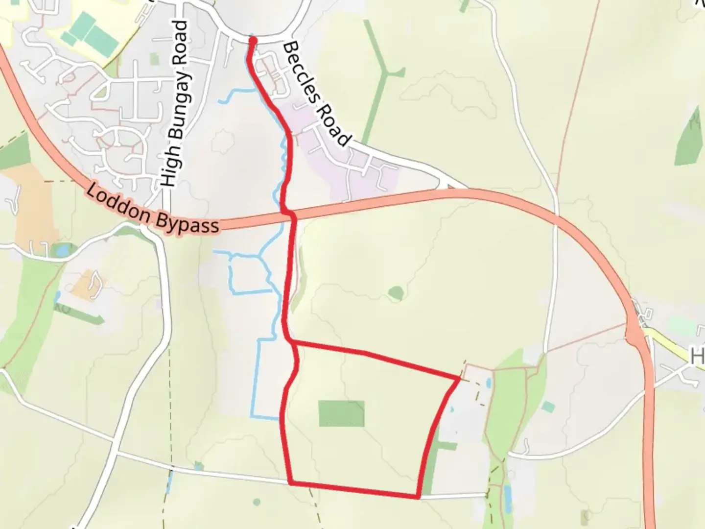
4.1 km
~51 min
33 m
Loop
“The Loddon Walk offers a serene 4 km loop through Norfolk's lush countryside, rich in wildlife and history.”
Starting near the picturesque village of Norfolk, England, the Loddon Walk is a delightful 4 km (approximately 2.5 miles) loop trail that offers a serene escape into nature. With an elevation gain of around 0 meters, this trail is relatively flat, making it accessible for hikers of varying skill levels, though it is rated as Medium difficulty due to some uneven terrain and potentially muddy sections.
Getting There
To reach the trailhead, you can drive or use public transport. If driving, set your GPS to the village of Loddon, Norfolk. There is a small parking area near the start of the trail. For those using public transport, the nearest bus stop is in Loddon village, which is serviced by local buses from Norwich. From the bus stop, it's a short walk to the trailhead.
Trail Navigation
For navigation, it's highly recommended to use the HiiKER app, which provides detailed maps and real-time GPS tracking to ensure you stay on course.
Trail Highlights
As you embark on the Loddon Walk, you'll immediately be greeted by the lush greenery of the Norfolk countryside. The trail meanders through a mix of open fields and dense woodlands, offering a variety of landscapes to enjoy.
Wildlife and Nature
Keep an eye out for local wildlife, including deer, rabbits, and a variety of bird species. The area is particularly known for its vibrant birdlife, so bringing a pair of binoculars could enhance your experience. In the spring and summer months, the trail is adorned with wildflowers, adding a splash of color to your hike.
Historical Significance
The region around Loddon is steeped in history. As you walk, you'll pass by several historical landmarks, including remnants of old farm buildings and ancient hedgerows that have been part of the landscape for centuries. The village of Loddon itself has a rich history dating back to the medieval period, and you might want to take some time to explore its charming streets and historic church before or after your hike.
Points of Interest
- Loddon Mill: Approximately 1 km (0.6 miles) into the hike, you'll come across the site of the old Loddon Mill. While the mill is no longer operational, the site offers a glimpse into the area's industrial past.
- River Chet: Around the halfway mark, the trail runs parallel to the River Chet for a short distance. This is a perfect spot to take a break and enjoy the tranquil waters.
- Woodland Section: The final stretch of the trail takes you through a beautiful woodland area, where the canopy of trees provides a cool, shaded environment, especially welcome on warmer days.
Trail Conditions
The trail is well-marked but can become muddy after rain, so waterproof hiking boots are recommended. There are a few stiles and gates to navigate, but no significant obstacles.
Facilities
There are no facilities directly on the trail, so be sure to bring enough water and snacks for the hike. The village of Loddon has several pubs and cafes where you can enjoy a meal or a drink after your walk.
Safety Tips
While the trail is generally safe, it's always a good idea to let someone know your plans and expected return time. Mobile reception can be patchy in some areas, so downloading the trail map on HiiKER before you set out is advisable.

Activity types
Comments and Reviews
User comments, reviews and discussions about the Loddon Walk, England.
average rating out of 5
0 rating(s)