
Download
3D Flyover
Add to list
More
20.5 km
~4 hrs 5 min
0 m
Point to Point
“A tranquil Thames wander through meadows and ancient history, with muddy floodplain stretches adding quiet challenge.”
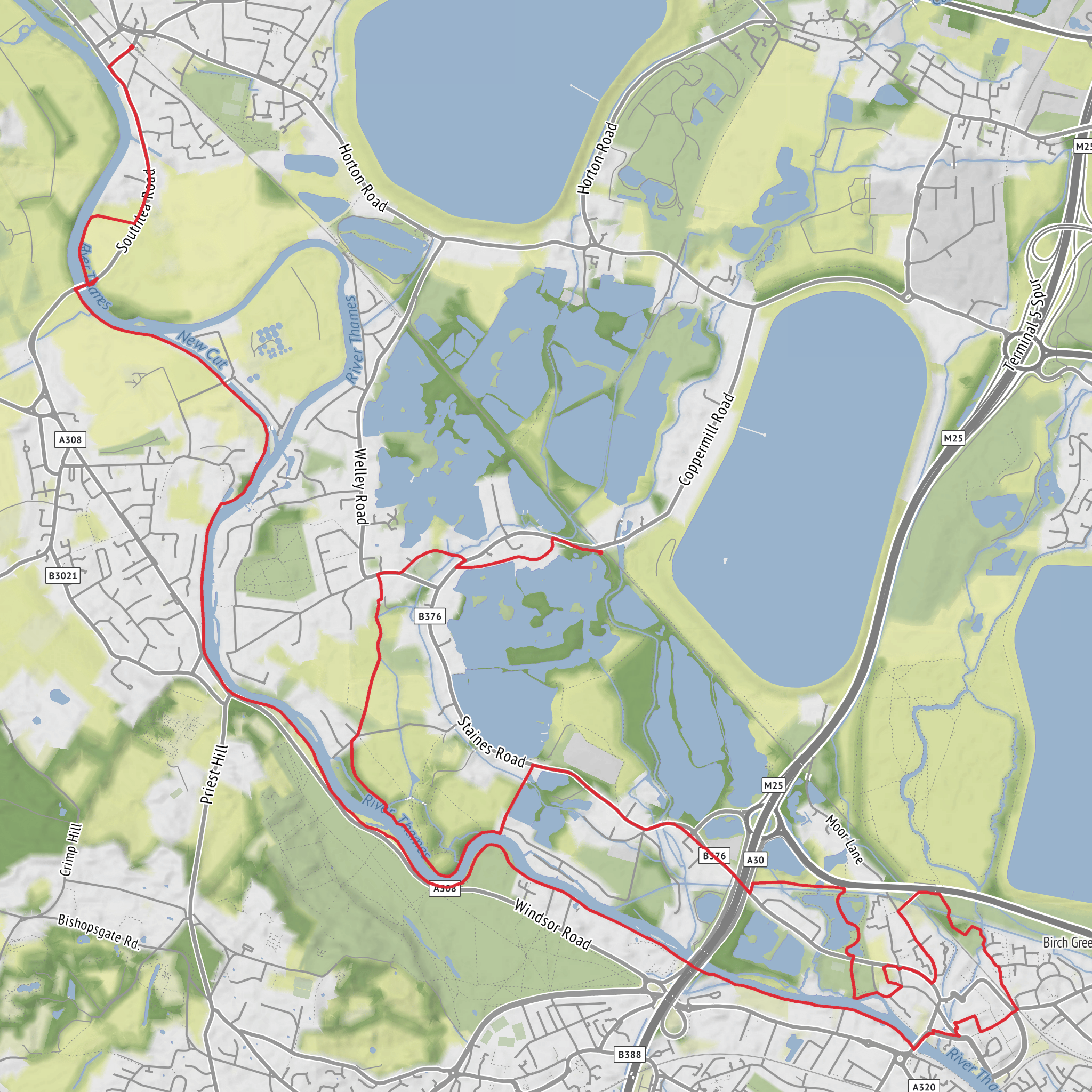
This is a long, mostly level riverside and meadow walk of about 20 km / 12.4 miles with virtually no climbing, so the challenge comes less from elevation and more from time on feet, exposed sections, and the possibility of muddy or waterlogged ground in the Thames floodplain. The route links Wraysbury with Datchet while passing through a landscape shaped by the River Thames, old water meadows, historic islands, and one of the most important constitutional landscapes in England. The nearest practical start point is Wraysbury railway station, and for navigation it is best to load the route in HiiKER before setting out. (visorando.com)
For the start, the clearest landmark is Wraysbury railway station, Station Road, Wraysbury, Berkshire. If arriving by train, Wraysbury is on the South Western Railway network, and Datchet station at the far end of the walk is at High Street, Datchet, Berkshire, SL3 9ED, making this a convenient one-way outing by rail. If coming by car, a useful nearby destination for the historic middle section is Ankerwycke, Magna Carta Lane, Wraysbury, Staines, TW19 5AG, though access is along a small lane also used by residents and emergency vehicles, so parking and approach need care. (nationalrail.co.uk)
The opening kilometres are gentle and low-lying, with the route moving out from Wraysbury through a flat Thames-side environment of village edges, pasture, and floodplain. Because the total ascent is only around 0 m / 0 ft, this is suitable for walkers looking for an easier grade physically, but it should not be underestimated in wet weather. After rain, paths can become soft, puddled, or slick, especially near meadows, riverside stretches, and access tracks. Waterproof footwear is often more useful here than trekking poles. (nationaltrust.org.uk)
Through Ankerwycke and the historic floodplain
One of the most memorable early-to-middle sections is around Ankerwycke, where the landscape becomes more atmospheric, with woodland, open meadow, and layers of medieval history. The National Trust identifies this area as home to the remains of a Benedictine priory and the Ankerwycke Yew, an ancient tree believed to be around 2,000 to 2,500 years old, making it the oldest tree in the National Trust’s care. This part of the walk is especially rewarding if you enjoy places where the scenery feels quiet but historically dense. (nationaltrust.org.uk)
Expect a calm, pastoral character here rather than dramatic viewpoints. The terrain stays easy underfoot when dry, and the lack of ascent means you can keep a steady pace. Around the halfway point, many walkers will want to pause for a short break, particularly near the meadows and wooded margins where birdlife is often more noticeable. The floodplain setting supports typical Thames-side species such as waterfowl, swans, geese, ducks, and smaller songbirds in hedgerows and woodland edges; depending on season and water levels, you may also notice riparian vegetation, willow, and damp-ground flora. The broader Wraysbury area is also associated with lakes and wetland habitats created in part by former gravel extraction, now valuable for wildlife. (visorando.com)
Holm Island, Magna Carta Island, and the Thames-side section
As the route continues, the river becomes the defining feature. This is the section where the walk’s historical interest deepens, especially near Magna Carta Island, which lies on the Thames near Bell Weir Lock. The island is closely tied to traditions surrounding the events of 1215, when King John and the barons met at Runnymede and the Magna Carta was sealed. Modern historical interpretation usually places the sealing within the wider Runnymede landscape, while Magna Carta Island remains strongly associated with that story and is one of the most evocative landmarks on this stretch of river. (nationaltrust.org.uk)
The route also refers to Holm Island, another Thames island landmark in the wider river setting, reinforcing the sense that this walk follows a corridor of channels, aits, locks, and old crossing points rather than a simple bank-side footpath. Around Bell
Surfaces
Unknown
Asphalt
Grass
Dirt
Concrete
Wood
Comments and Reviews
User comments, reviews and discussions about the Wraysbury to Datchet via Holm Island and Magna Carta Island, England.
average rating out of 5
0 rating(s)
