
Download
3D Flyover
Add to list
More
12.2 km
~2 hrs 35 min
85 m
Loop
“A breezy estuary loop blending muddy woodland, wide sea-wall horizons, and rich birdlife.”
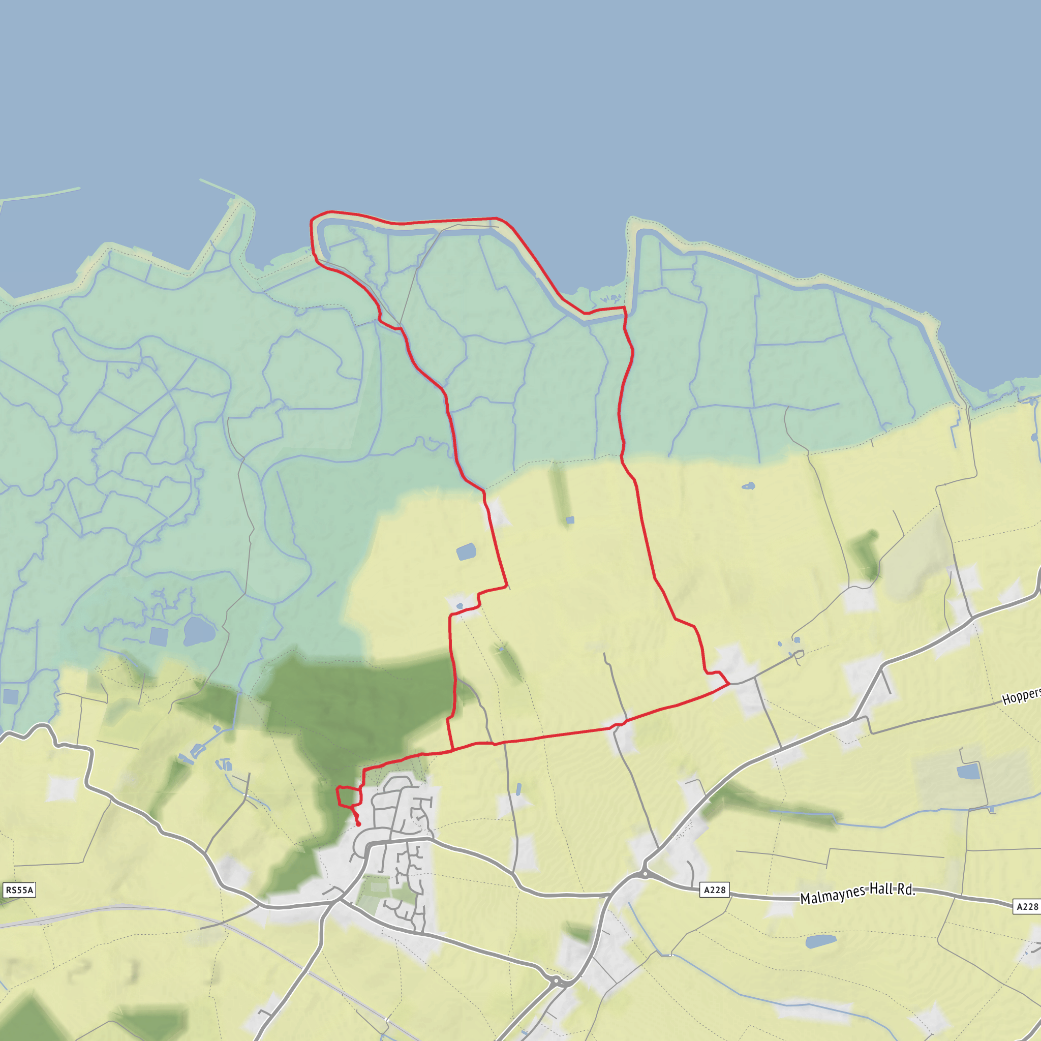
This easy loop of about 12 km / 7.5 miles explores the quiet northern edge of the Hoo Peninsula, combining open farmland, low wooded ground, sea-wall walking, and broad estuary views. With only around 100 m / 330 ft of elevation gain, it is more of a long, gently undulating ramble than a strenuous hike, but the exposed coastal sections and potentially muddy inland paths can make it feel more demanding in poor weather. The route is commonly started from High Halstow Recreation Ground, High Halstow, Rochester, Kent, and passes through or beside RSPB Northward Hill, one of the most important wildlife sites in North Kent. (medway.gov.uk)
The opening stretch usually leaves the village quickly and heads into a mix of field-edge paths and woodland tracks. This first section is useful for settling into the walk: gradients are mild, surfaces are generally straightforward in dry conditions, and the landscape opens gradually rather than all at once. In wetter months, expect sticky mud through the wooded and agricultural sections, especially around Northward Hill, where the RSPB specifically notes that trails can become muddy in winter. (group.rspb.org.uk)
Terrain and route character
For most hikers, the route breaks naturally into three parts. The first 3 to 4 km / 2 to 2.5 miles are inland, with paths through farmland and reserve-edge habitat. Around the 4 km / 2.5 mile point, the route reaches Egypt Bay, where the scenery changes from enclosed countryside to open shoreline. From there, the walk follows the coast toward St Mary’s Bay, reached at roughly 8 km / 5 miles, before turning inland again for the return to High Halstow. (hiiker.app)
The coastal section is typically the most memorable part of the loop. The path runs along or near the sea wall, with wide views across the Thames Estuary and a strong sense of space. This stretch is mostly flat, but it is exposed to wind, and underfoot conditions can vary between firm track, grassy margins, and uneven coastal path. After rain, some sections can be slick; after dry spells, they are usually much easier going. Because the route is not mountainous, the main physical considerations are distance, weather exposure, and footing rather than steep climbing. Using HiiKER before setting out is a good way to check the route line and judge where the inland-to-coast transitions occur.
Landmarks, wildlife, and seasonal highlights
Northward Hill is the standout natural feature of the walk. The reserve sits on a ridge above the Thames marshes and is known for woodland, wetlands, hayfields, and a cherry orchard, with especially strong birdlife throughout the year. The RSPB highlights Grey Herons and Little Egrets, as well as Nightingales, Water Voles, wintering ducks, and birds of prey including Short-eared Owls in the colder months. Spring is especially rewarding, with bluebells in the woods and singing warblers in the undergrowth; summer brings butterflies, dragonflies, and marshland raptors. (rspb.org.uk)
Egypt Bay and St Mary’s Bay add a different character. These are quiet estuarine shorelines rather than classic sandy resort beaches, and they feel remote despite being relatively close to Medway settlements. The sea wall between them is itself a notable feature, and the coast here has long been shaped by drainage, embankment, and marsh management. HiiKER’s route mapping is particularly helpful on this kind of landscape, where paths can appear deceptively simple on the ground but junctions across fields and marsh-edge tracks are easy to misread in flat light.
There is also historical interest along the coast. The area around Egypt Bay includes remnants of World War II defenses, reflecting the strategic importance of the Thames Estuary approaches during the war. More broadly, Northward Hill’s wetlands were heavily altered by drainage in the 1940s, and the RSPB later restored much of the habitat after acquiring the land in the 1990s, which explains the mix of engineered marshland and recovering wildlife habitat seen today. (hiiker.app)
What to prepare for
Although
Surfaces
Unknown
Dirt
Grass
Concrete
Comments and Reviews
User comments, reviews and discussions about the Northward Hill, Egypt Bay and St Mary's Bay Loop, England.
average rating out of 5
0 rating(s)
