
Download
3D Flyover
Add to list
More
16.2 km
~3 hrs 29 min
152 m
Loop
“A mellow limestone loop threads quiet villages, hedged farmland, and wooded edges with ever-changing rural charm.”
This easy loop of around 16 km / 10 miles in the limestone countryside between Swinstead and Creeton is a gentle rural outing rather than a strenuous hill walk, with roughly 200 m / 656 ft of total ascent spread across rolling ground rather than any one major climb. The route is best thought of as a broad circuit through quiet farmland, estate tracks, small woods, and attractive South Kesteven villages, where the interest comes from changing views, historic buildings, and the character of the landscape as much as from dramatic terrain. Local walking information for this area describes the wider Edenham–Swinstead–Creeton circuit as easy, generally well signposted, and liable to become muddy after heavy rain, which is a useful guide for what to expect here too. (edenham.parish.lincolnshire.gov.uk)
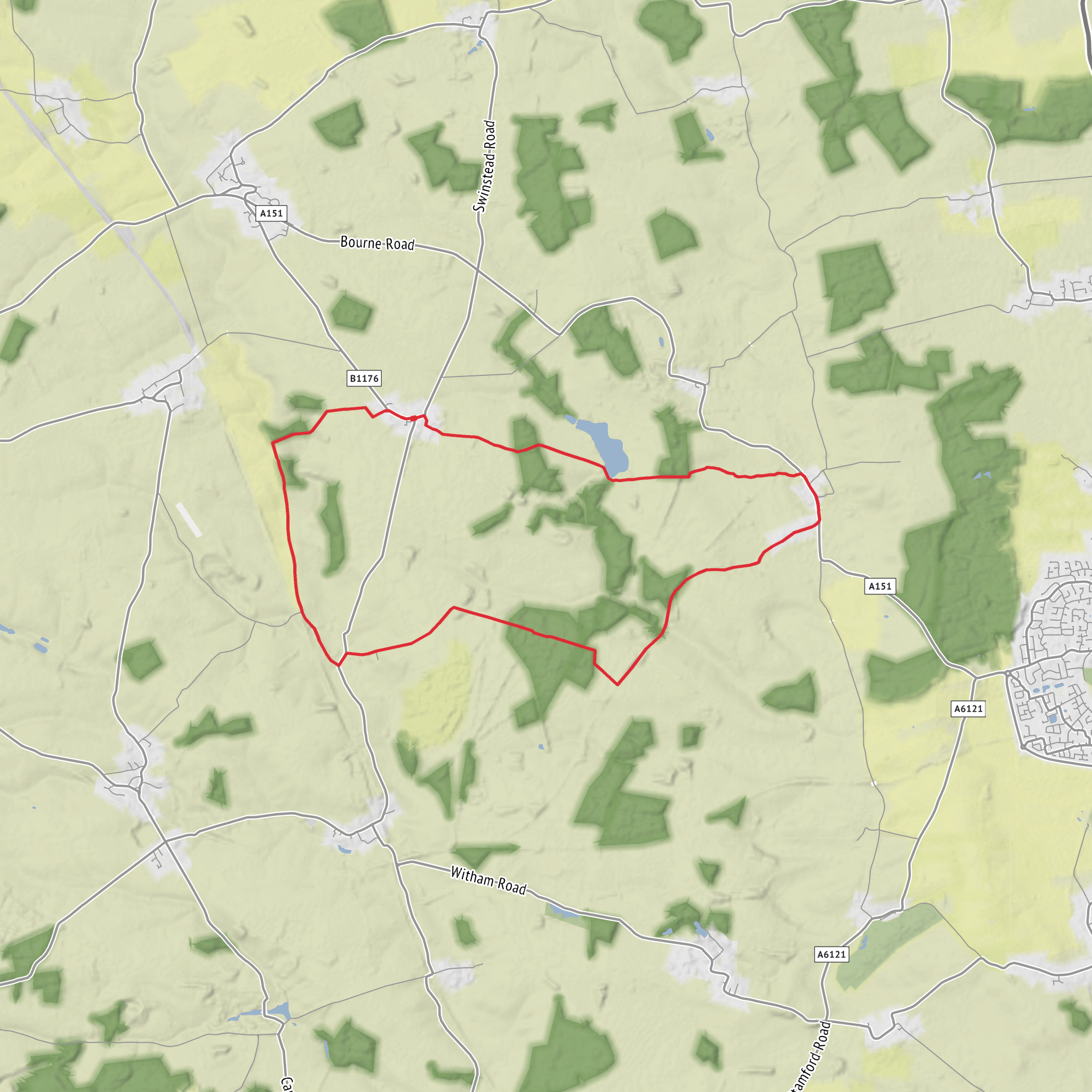
The route shown sits just east of Swinstead and west of Creeton, in the countryside near Grimsthorpe in Lincolnshire. A practical place to begin is Swinstead village, near the junction of High Street and Creeton Road by the historic village cross, which is a known landmark in the village. Another useful nearby landmark is St Mary’s Church, Swinstead, and for those approaching from the east there is also a large lay-by on the B1176/Little Bytham Road just south of Creeton, which local walking material identifies as a good parking option for walks in this area. (heritage-explorer.lincolnshire.gov.uk)
By car, Swinstead is reached most easily from the A151 or A6121 via the local road network around Corby Glen, Little Bytham, and Bourne. Parking is usually informal rather than a dedicated trailhead car park, so roadside consideration is important in the villages. If starting near Creeton, the lay-by south of the village is one of the more straightforward options mentioned in local walk notes. (toft-lound-manthorpe.parish.lincolnshire.gov.uk)
Public transport is possible but limited. The nearest rail access is typically Little Bytham station area for the eastern side of the walk, though onward road walking or a taxi is likely to be needed. Bus coverage in these villages can be sparse and changeable, so it is sensible to check current local services before setting out. For on-the-ground route following, HiiKER is the best tool to use alongside an OS map.
What the walk feels like
Expect a mixture of field-edge paths, farm tracks, minor lanes, and short stretches near woodland. The terrain is mostly undulating rather than steep, with broad open views over arable land and pockets of shelter where the route brushes plantations and estate woodland. On a dry day, this is a straightforward easy-grade walk; after rain, the clay-and-limestone mix can make gateways, field margins, and tractor tracks slick and sticky. Sturdy waterproof footwear is a better choice than lightweight road shoes, especially in autumn and winter. The route length of 16 km / 10 miles means most walkers will want to allow about 4 to 5 hours at a relaxed pace, longer if stopping often for photographs, birdwatching, or village exploration.
The western side near Swinstead tends to feel more open and agricultural, while the central and eastern sections have more visual variety, with belts of trees, estate land, and a stronger sense of the old Lincolnshire parkland landscape. The elevation gain is modest overall, but the repeated rises and dips mean it is not completely flat. None of the climbs are especially demanding, yet they are enough to create changing viewpoints across the valley and surrounding farmland.
Landmarks, landscape, and route character
Swinstead itself has historic interest before the walk even properly begins. The village cross at High Street and Creeton Road is a listed historic feature and reflects the long continuity of settlement here. The village was also once associated with Swinstead House, of which only fragments survive, including a summer house and former service buildings later used as a school. (heritage-explorer.lincolnshire.gov.uk)
As the loop heads out into the countryside, the landscape is shaped by the Lincolnshire limestone belt and the quiet folds of the Swinstead Valley. This is not mountain scenery, but it has a subtle beauty: hedged lanes, broad fields, shallow valleys, and occasional wooded edges. The nearby West Glen / Swinstead Valley is notable for its limestone geology and seasonal water behaviour, with streams that can disappear through porous ground in places. That geology helps explain both the dry-valley feel of parts of the route and the rich grassland habitats found locally. (ratedtrips.com)
Creeton is the smaller and quieter of the two villages and has a distinctly tucked-away feel. The Church of St Peter, Creeton is one of the main built landmarks in the area and gives the village much of its identity. Around Creeton, the route is likely to feel especially peaceful, with long stretches where the main sounds are wind in hedges, farm activity, and birdsong. (en.wikipedia.org)
The broader district is also tied to the Grimsthorpe estate landscape. Local
Surfaces
Unknown
Dirt
Asphalt
Gravel
Unpaved
Comments and Reviews
User comments, reviews and discussions about the Swinstead and Creeton Loop, England.
average rating out of 5
0 rating(s)
