Download
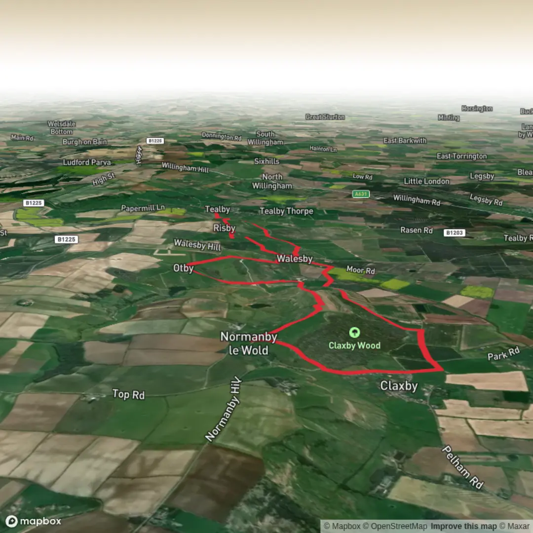
3D Flyover
Add to list
More
15.6 km
~3 hrs 34 min
275 m
Loop
“Rolling Wolds lanes, woodland edges and broad skies make this a quietly rewarding, rise-and-view circuit.”
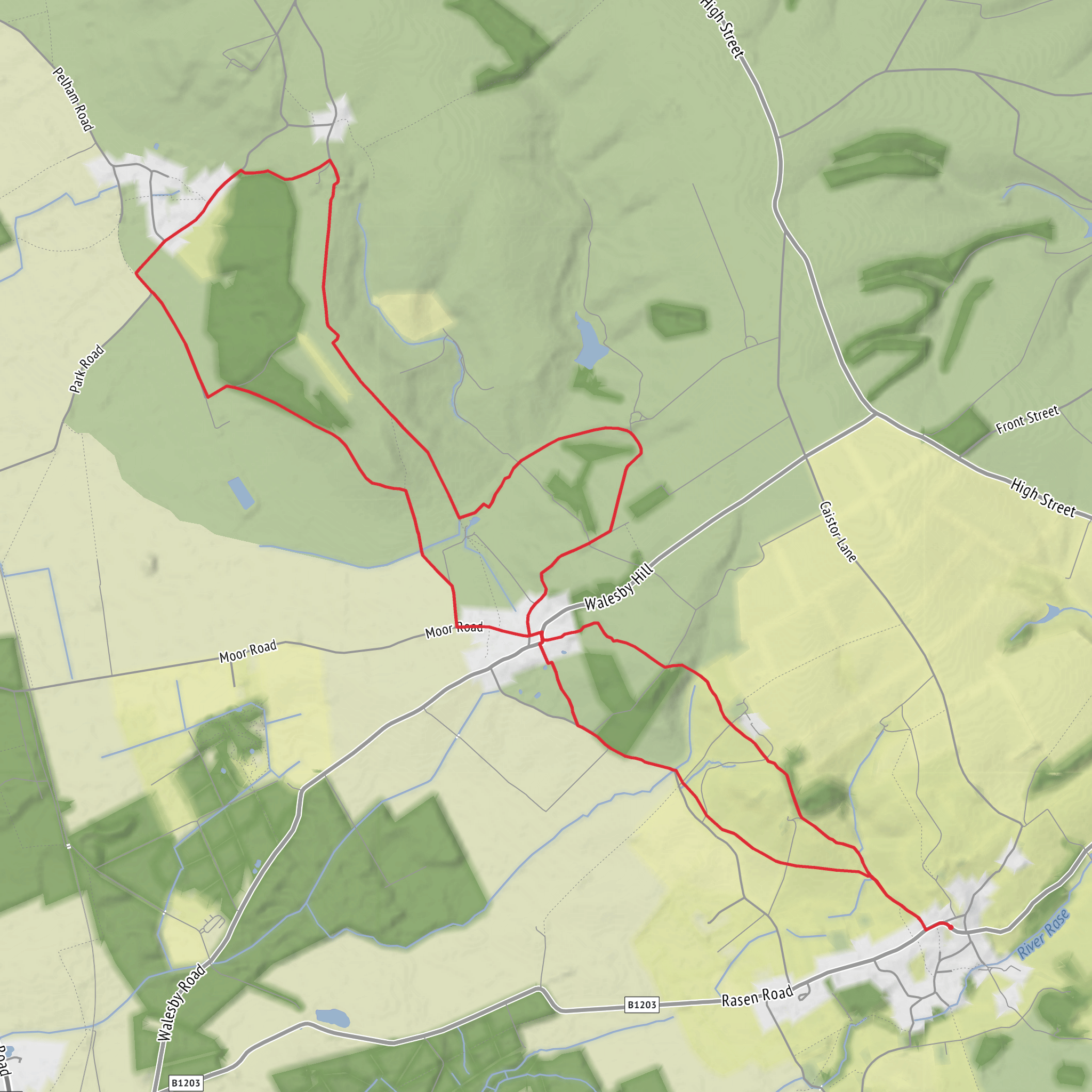
This roughly 16 km / 10 mile loop through the Lincolnshire Wolds is a gentle but varied countryside walk with around 300 m / 985 ft of climbing, best suited to walkers who are comfortable with a few steady rises rather than anything steep or technical. The route links attractive Wolds villages, woodland edges, open farmland and long ridge views, so although the overall difficulty is often rated easy, it feels more like an easy-to-moderate day out if the ground is wet, windy, or deeply rutted after farm traffic. The area sits within the Lincolnshire Wolds National Landscape, a protected landscape known for rolling chalk hills, quiet lanes and broad skies. (visitlincolnshire.com)
The most practical trailhead for a walk of this type is near Tealby Memorial Hall, Beck Hill, Tealby, Market Rasen LN8 3XS, which is a known walking start point in the village and gives straightforward access to rights of way and Viking Way sections in the area. Another commonly used access point for longer loops nearby is Willingham Woods car park, Legsby Road, Market Rasen LN8 3RQ, which has parking and facilities, though that start tends to suit bigger circuits. If your planned GPX begins “near” an unnamed point, Tealby village and its Memorial Hall are the nearest clear landmark and most useful address to work from. (visitlincolnshire.com)
By car, Tealby is reached most easily from Market Rasen via local roads into the Wolds. Parking is usually simplest at or near the Memorial Hall in Tealby where walking information also commonly starts, while some nearby routes use considerate roadside parking in villages such as Claxby. If starting from Market Rasen instead, John Street car park, Market Rasen LN8 3HH, is used for longer Claxby Wood walks that connect into the same landscape. (visitlincolnshire.com)
Public transport is possible but requires more planning. Market Rasen is the main nearby rail access point, and local walking information notes links onward by public transport or demand-responsive bus services into the Wolds. From Market Rasen, walkers typically use local bus connections where available or a flexible CallConnect-style rural service toward villages such as Tealby. Because rural timetables can be limited, it is worth checking the day’s connections carefully and loading the route in HiiKER before setting out. (visitlincolnshire.com)
What the route feels like
Expect a classic Wolds mix of village lanes, field-edge paths, farm tracks and woodland margins. The walking is rarely mountainous, but the land rolls constantly, so the 300 m / 985 ft of ascent tends to arrive in a series of smaller climbs rather than one major haul. In dry weather the paths are usually straightforward; after rain, chalky and clay-rich sections can become slick, and gateways may turn muddy. Sturdy waterproof footwear is a better choice than lightweight road shoes, especially in cooler months. The route is open enough in places that wind can be a bigger factor than gradient. (visitlincolnshire.com)
The first part of a loop here often settles walkers into the landscape gradually: village edges, hedgelines, then wider views as the route climbs onto higher ground. Around Claxby Wood and the surrounding slopes, the scenery alternates between enclosed green corridors and open panoramas across the Wolds. This is not a heavily urbanised walking area, so waymarking can feel intermittent; field boundaries and junctions deserve attention, particularly where multiple farm tracks meet. Using HiiKER is especially helpful through these transitions.
Landmarks, villages and points of interest
Tealby is one of the most characterful villages on this circuit and has deep historical roots. It appears in the Domesday Book as “Tevelsby,” and records suggest it was a substantial settlement in medieval times. That long continuity shows in the village layout and its historic buildings, making it more than just a convenient start point. (visitlincolnshire.com)
A likely highlight on or near this loop is All Saints’ Church, Walesby, widely known as the Ramblers’ Church. Local walking material specifically points walkers toward it, and it is one of the best-known landmarks in this part of the Wolds. Its hilltop setting adds to the sense of arrival, and the church is closely associated with the area’s walking culture. (visitlincolnshire.com)
The route also intersects or closely follows stretches of the Viking Way, one of Lincolnshire’s best-known long-distance trails. This gives the walk a strong sense of continuity with the wider landscape, linking these villages to a much longer historic and recreational corridor running through the county. (visitlincolnshire.com)
Near Claxby, the landscape carries traces of older rural life and transport history. Claxby itself lies at the foot of the Wolds and is described locally as tranquil and rich in
Surfaces
Unknown
Gravel
Asphalt
Grass
Comments and Reviews
User comments, reviews and discussions about the Claxby Wood and Tealby Loop, England.
average rating out of 5
0 rating(s)
