
Hungarton Park, Baggrave Park, Quenby Park and Ingarsby Hall Loop
Download
3D Flyover
Add to list
More
14.1 km
~3 hrs 6 min
170 m
Loop
“A gentle ramble through rolling parkland and ghost-village echoes, with wide views and muddy surprises.”
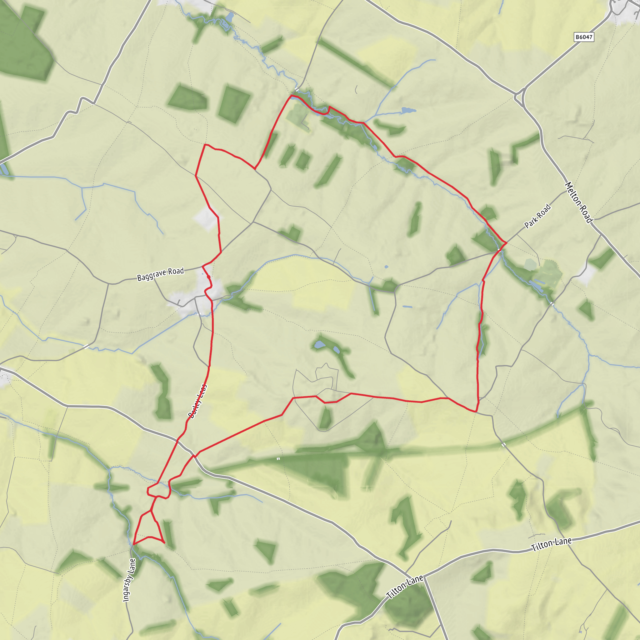
This easy-going loop of about 14 km / 8.7 miles crosses classic east Leicestershire countryside: rolling pasture, estate tracks, quiet lanes, and broad views over historic parkland. With roughly 200 metres / 656 feet of ascent spread gently across the route, it is more a walk of steady undulation than any sustained climb, so it suits walkers looking for a half-day outing with plenty of interest and relatively modest physical demands.
The route is best understood as a circuit through the old estate landscape around Hungarton, Baggrave, Quenby, and Ingarsby, a part of Leicestershire where medieval settlement patterns, later park design, and modern farmland all overlap. Expect a mixture of field paths, grassy tracks, estate roads, and short road sections. In wet weather, the clay soils here can become sticky and heavy underfoot, especially on pasture edges and around gates, so waterproof footwear is a sensible choice even on an otherwise easy day.
For the start, the nearest clear landmark is Hungarton village, near Main Street and the Village Hall on Barley Leys, Hungarton, Leicestershire LE7 9JR. Hungarton is a practical reference point for navigation and access, and the village hall is specifically identified by the parish council on Barley Leys. (hungartonparishcouncil.org.uk)
Getting there
By car, Hungarton lies about 10 miles / 16 km northeast of Leicester in rural Harborough district, and is commonly approached from the A47 via Billesdon toward Hungarton. Quenby Hall is also described as being reached from the A47 by turning toward Hungarton at Billesdon, which is a useful approach for this whole walking area. Parking in villages like this is usually limited and should be done considerately and legally on public roads only; there is no broad public visitor parking provision indicated for the estates themselves. (en.wikipedia.org)
By public transport, services in this part of east Leicestershire are limited and can change, so it is best to plan the final approach carefully before setting out. Leicestershire County Council directs walkers to its local bus journey-planning resources, and the county also operates FoxConnect, an on-demand rural transport service in parts of Harborough that may help with access where fixed-route buses are sparse. Check current options before travel and then use HiiKER to confirm the walking start point once you arrive. (leicestershire.gov.uk)
What the route feels like
The first impression is usually openness. The land around Hungarton sits on a south-facing slope below a ridgeline, and once you leave the village you move quickly into a landscape of hedged fields, mature trees, and long estate boundaries. Hungarton itself has historic character: the conservation area notes that the village was largely rebuilt in the 1760s and 1770s for Sir Shuckburgh Ashby of Quenby Hall, which helps explain the unusually coherent estate-village feel. (harborough.gov.uk)
The gradients are generally mild, but the route’s cumulative ascent comes from repeated rises and dips across rolling clayland rather than from one obvious hill. That makes pacing straightforward. Most walkers will find the terrain manageable, though stiles, livestock fields, and muddy gateways can slow progress. In summer, the route is often at its easiest underfoot; in winter and after rain, allow extra time.
Baggrave Park and the old village landscape
One of the most interesting sections is around Baggrave Hall and Baggrave Park, where the walk passes through a designed landscape layered over a much older settlement. Historic England describes Baggrave Hall standing in rolling clayland east of Leicester, with the park sloping down toward Queniborough Brook. The hall looks across the earthworks of the deserted medieval village of Baggrave, whose hollow way, banks, ditches, and house platforms still shape the ground. The village was largely depopulated before 1500, when Leicester Abbey converted the area to sheep pasture. (historicengland.org.uk)
That history matters on the ground because this is not just “pretty parkland”; it is a worked and reworked landscape where the contours often reflect former habitation. Walkers should look for subtle undulations, ridge-and-furrow patterns, old tree lines, and the way the hall is positioned to command views over the former village site. Even if the buildings themselves are not always closely accessible, the setting tells much of the story.
Wildlife here is typical of mixed lowland farmland and parkland. Mature trees and rough grass can support common songbirds, corvids, raptors overhead, and small mammals along hedgerows. Near brooks and damp ground, expect more insect life in warmer months. Because this is estate and farm country, walkers should also be alert for livestock, working vehicles, and seasonal crop operations.
Surfaces
Unknown
Grass
Asphalt
Gravel
Dirt
Comments and Reviews
User comments, reviews and discussions about the Hungarton Park, Baggrave Park, Quenby Park and Ingarsby Hall Loop, England.
average rating out of 5
0 rating(s)
