
Download
3D Flyover
Add to list
More
19.0 km
~4 hrs 6 min
180 m
Loop
“Hallaton’s looping wander blends rolling fields, muddy spinneys, and deep-rooted village history into a quietly rewarding day.”
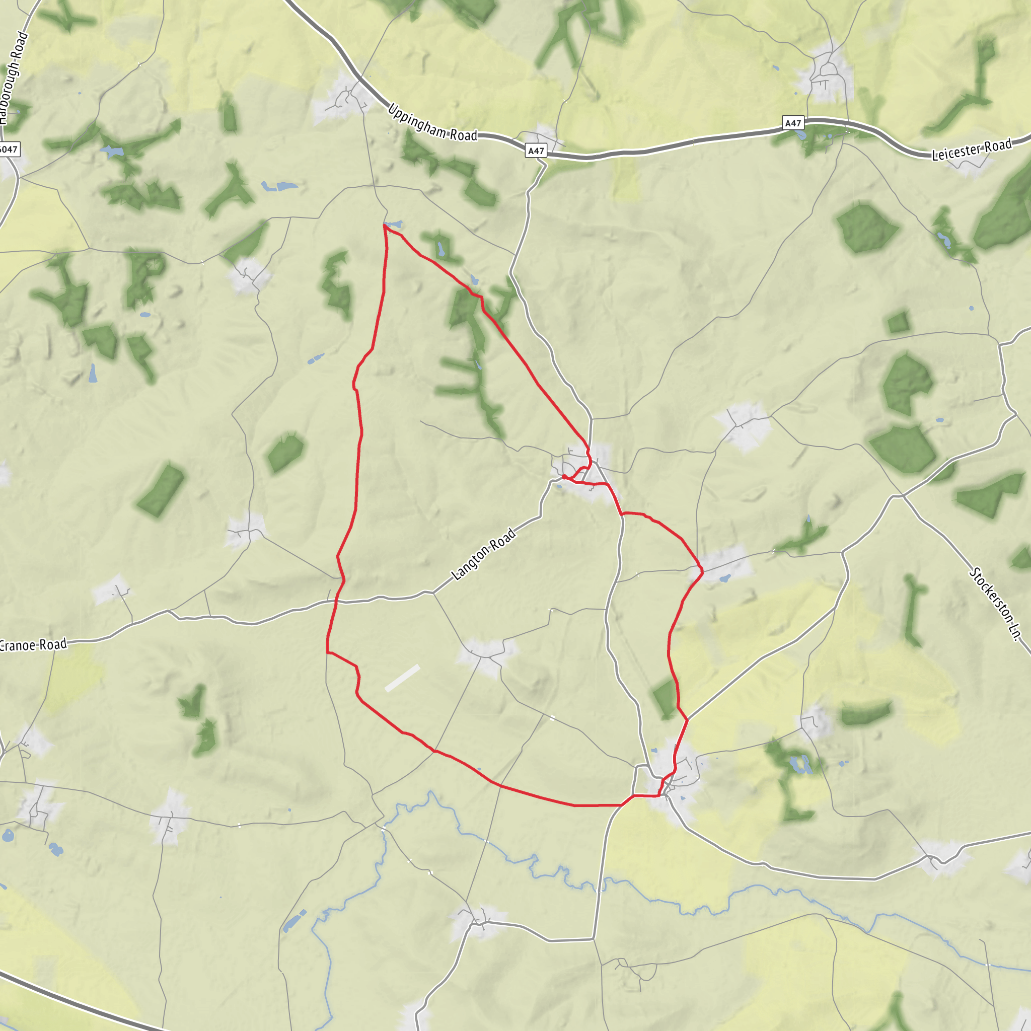
This easy-going loop of around 19 km / 11.8 miles with roughly 200 m / 656 ft of ascent explores the rolling countryside around Hallaton in east Leicestershire, linking open ridge-and-furrow farmland, small spinneys, quiet lanes, and one of the county’s most historically layered villages. Expect an undulating rather than steep day: the climbing comes in short rises and dips across the wolds, so it feels manageable for most regular walkers, but the distance still makes it a solid half-day to full-day outing. Hallaton itself lies about 16 miles southeast of Leicester and 8 miles northeast of Market Harborough. (visitharborough.com)
The walk is generally best started near Hallaton Village Green, close to the Butter Cross, St Michael and All Angels Church, and the village centre around Eastgate and Churchgate. That is the clearest significant landmark for the trailhead area, and it is a practical place to orient yourself before setting off. Hallaton’s village green and surrounding lanes are also where several local walking routes begin. (visitharborough.com)
By car, Hallaton is usually approached from Market Harborough, Uppingham, or Leicester via rural A- and B-roads, with final access on village roads into Hallaton. Parking is typically informal village parking rather than a large dedicated trail car park, so arrive considerately and avoid blocking residents, farm access, or narrow lanes. The area around the village green and the pubs is the obvious arrival point, but spaces can be limited on busy days. Hallaton has no current village-wide parking restrictions noted in local planning material, though that should not be taken as a guarantee of available space. (harborough.gov.uk)
Public transport is more limited and needs checking carefully before travel. Hallaton is served by rural bus links, but services can be infrequent, so it is wise to plan around the latest timetable and allow for a long walk day if connections are sparse. For rail access, the nearest practical hub is usually Market Harborough, followed by a bus or taxi onward; Hallaton’s own railway station is historical and no longer serves the village. For navigation on the day, using HiiKER is the simplest way to confirm the exact line of the loop and any field-boundary turns. (rome2rio.com)
What the route feels like
The character of the route is classic High Leicestershire: broad views, gently folded land, hedged fields, pasture, and pockets of woodland rather than dramatic peaks or exposed moorland. Underfoot, you can expect a mix of village lanes, farm tracks, grassy field paths, and sections that may become soft or muddy after rain, especially around gateways, pasture edges, and wooded stretches. Local walking notes specifically mention that some of these tracks can be difficult when the ground is soft and muddy, which is worth bearing in mind even on an otherwise easy-rated route. (choosehowyoumove.co.uk)
Because the total ascent is only around 200 m / 656 ft, the route is more about steady movement than hard climbing. The main challenge is distance and route-finding through farmland. In dry weather, lightweight walking shoes may be enough for experienced walkers, but waterproof boots are the safer choice in wetter months. Gaiters can be useful in winter or after prolonged rain. There may also be livestock in pasture fields, so dogs should be managed carefully and walkers should be comfortable passing through working farmland. This is not a technical hike, but it does reward attention at stiles, field corners, and junctions where paths can be less obvious on the ground. (choosehowyoumove.co.uk)
Landmarks, landscape, and wildlife
One of the most appealing aspects of this loop is the way it combines Hallaton’s historic core with the surrounding spinneys and open agricultural landscape. Around the village you may pass or see the medieval Butter Cross on the green, the Grade I listed Church of St Michael and All Angels, old ironstone and limestone buildings, cobbled pavements, and traditional village features that reflect Hallaton’s long development over centuries. The village has more than 60 Grade II listed properties as well as its scheduled monument, the Hallaton Motte and Bailey Castle. (visitharborough.com)
As the route leaves the village, the countryside opens into a patchwork of fields and small woods. Goady Road Spinney is noted locally for its mature trees and planting that includes wild cherry
AI Planner
Days planned around your pace, with somewhere to stay each night.
Surfaces
Unknown
Dirt
Asphalt
Gravel
Comments and Reviews
User comments, reviews and discussions about the Hallaton Spinneys Loop, England.
average rating out of 5
0 rating(s)

