Download
Preview
Add to list
More
3.0 km
~47 min
113 m
Loop
“Explore Anglezarke Reservoir's 3 km loop for scenic views, historical ruins, and moderate hiking challenges.”
Starting near Lancashire, England, this 3 km (approximately 1.86 miles) loop trail around Anglezarke Reservoir offers a delightful mix of natural beauty and historical intrigue. With an elevation gain of around 100 meters (328 feet), the trail is rated as medium difficulty, making it suitable for moderately experienced hikers.
Getting There
To reach the trailhead, you can drive or use public transport. If driving, set your GPS to Anglezarke Reservoir Car Park, located near the village of Rivington. For those using public transport, the nearest significant landmark is Chorley Railway Station. From there, you can take a local bus or taxi to the reservoir.
Trail Overview
The loop begins at the car park and immediately immerses you in the serene landscape of the West Pennine Moors. The trail is well-marked, but it's advisable to use HiiKER for navigation to ensure you stay on track.
Key Landmarks and Points of Interest
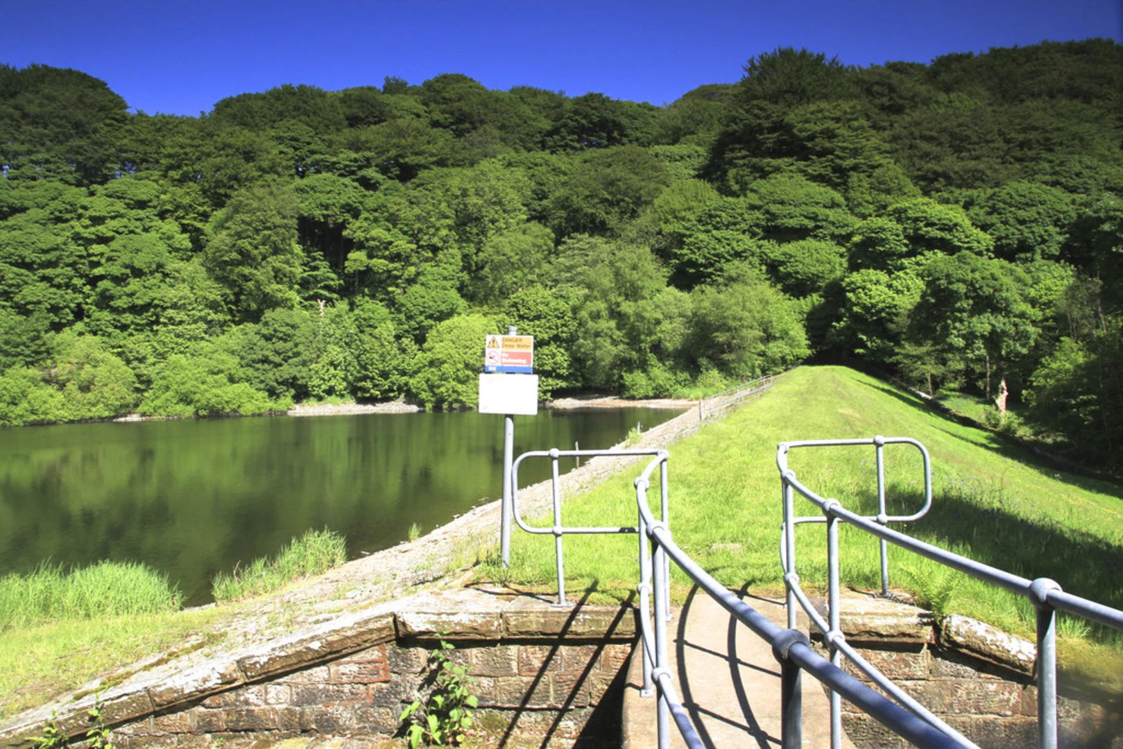
- Anglezarke Reservoir: As you start the loop, you'll walk along the edge of Anglezarke Reservoir. This body of water is not only picturesque but also historically significant, having been constructed in the mid-19th century to supply water to the rapidly industrializing towns of Lancashire.
- Stronstrey Bank: About 1 km (0.62 miles) into the hike, you'll encounter Stronstrey Bank. This area offers a slight elevation gain and provides panoramic views of the reservoir and surrounding moorland.
- Wildlife and Flora: Keep an eye out for local wildlife, including various bird species such as herons and kingfishers. The trail is also rich in flora, with seasonal wildflowers adding bursts of color to the landscape.
- Historical Ruins: Approximately 2 km (1.24 miles) into the hike, you'll come across the ruins of old farmsteads. These remnants offer a glimpse into the area's agricultural past and are perfect for a short rest and some exploration.
Trail Conditions and Safety
The trail is generally well-maintained but can become muddy and slippery after rain, so appropriate footwear is essential. The elevation gain is moderate but steady, so be prepared for some uphill sections. Always carry a map or use HiiKER to navigate, especially in foggy conditions, which can occur in this region.
Final Stretch
As you complete the loop, you'll descend back towards the reservoir, offering a different perspective of the water and surrounding hills. The final stretch is relatively flat, making for a relaxing end to your hike.
This trail offers a balanced mix of natural beauty, historical landmarks, and moderate physical challenge, making it a rewarding experience for those who venture out to explore it.

What to expect?
Activity types
Comments and Reviews
User comments, reviews and discussions about the Loop beside Anglezarke Reservoir, England.
4.5
average rating out of 5
2 rating(s)