Download
3D Flyover
Add to list
More
129.3 km
~5 days
1932 m
Multi-Day
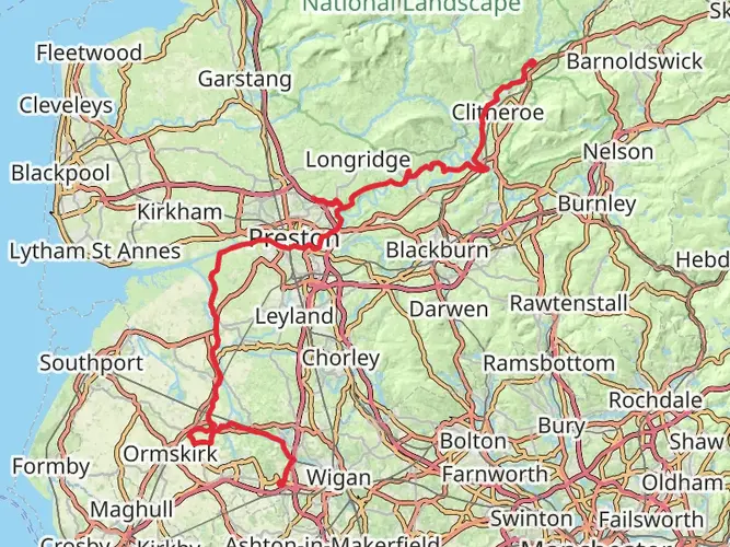
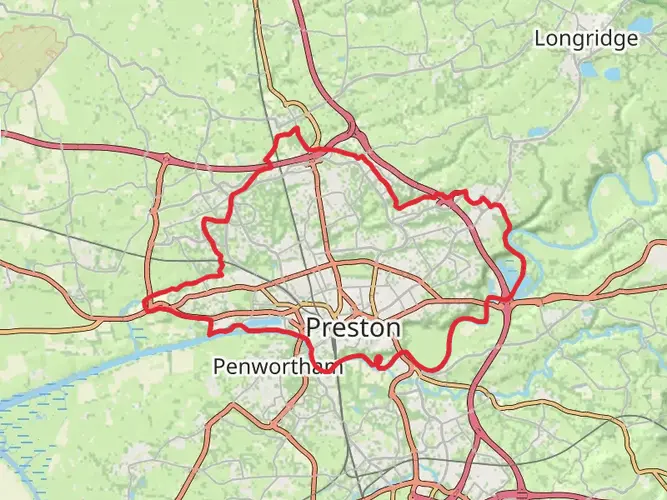
The Lancashire's Southern Loop Walk is a 129.3 km trail that starts in Preston, Lancashire, England. Based on our data, the hike is graded as Easy. For information on how we grade trails, please read measuring the difficulty of a hiking trail on hiiker. Also, check our latest community posts for trail updates. This hike can be completed in approx 5 days. Caution is advised on trail times as this depends on multiple variables. For more info read about how we calculate hike time.

What to expect?
Activity types
Frequently asked questions
How long does Lancashire's Southern Loop Walk take to complete?
Lancashire's Southern Loop Walk is 129.35 km, or about 80.4 miles, with 1,932 m of total ascent. Most hikers would treat it as a multi-day route and allow around 5 to 7 days, depending on pace, weather, and how long is spent on the hillier sections around Rivington and the West Pennine Moors.
Where does Lancashire's Southern Loop Walk start and finish?
Lancashire's Southern Loop Walk is a circular route that starts and finishes in Preston. The full loop returns to the city after crossing southern Lancashire, with stage information showing the final section ending back in Preston after passing through Much Hoole and the lowland farmland south of the Ribble.
Is Lancashire's Southern Loop Walk difficult?
Lancashire's Southern Loop Walk is rated easy overall, which fits its moderate total climb spread across a long distance. The route gains 1,932 m over 129.35 km, so most days are not especially steep, although the higher ground near Rivington and Winter Hill is more demanding than the flatter canal-side and plain sections.
What is the hardest part of Lancashire's Southern Loop Walk?
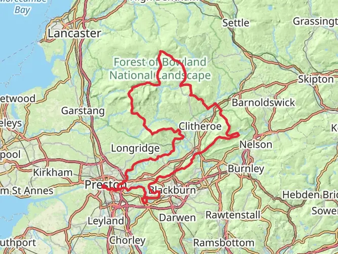
The toughest stretch on Lancashire's Southern Loop Walk is generally the section through the West Pennine Moors around Rivington and White Coppice. The Southern Loop's highest point is Winter Hill at 456 m, and the hill stages around Chorley, Rivington, and White Coppice carry the biggest climbing compared with the flatter stages nearer Much Hoole, Croston, and Preston.
Can Lancashire's Southern Loop Walk be split into stages?
Yes. Lancashire's Southern Loop Walk is commonly broken into 7 stages on HiiKER, ranging from 15.5 km to 23.2 km. Those stages begin in Preston and pass through places including Brindle, Rivington, Wigan, and Much Hoole before finishing back in Preston, which makes the route manageable as a week-long walk.
What landmarks and landscapes does Lancashire's Southern Loop Walk pass through?
Lancashire's Southern Loop Walk combines lowland Lancashire with more elevated moorland scenery. The route is known for sections along the Leeds and Liverpool Canal, industrial-heritage landscapes around Wigan, and the upland scenery of Rivington and the West Pennine Moors, with Winter Hill as the highest point on the Southern Loop.
Is Lancashire's Southern Loop Walk good for a first long-distance hike?
Lancashire's Southern Loop Walk is a strong option for a first long-distance walk because it is graded easy despite covering 129.35 km. The route mixes flatter canal and plain sections with a few hillier days, and the circular format back to Preston makes logistics simpler than a point-to-point trail.
Comments and Reviews
User comments, reviews and discussions about the Lancashire's Southern Loop Walk, England.
4.5
average rating out of 5
2 rating(s)