
Download
3D Flyover
Add to list
More
10.8 km
~2 hrs 41 min
317 m
Loop
“Explore diverse landscapes and rich history on the captivating 11 km Grizedale Head Loop trail.”
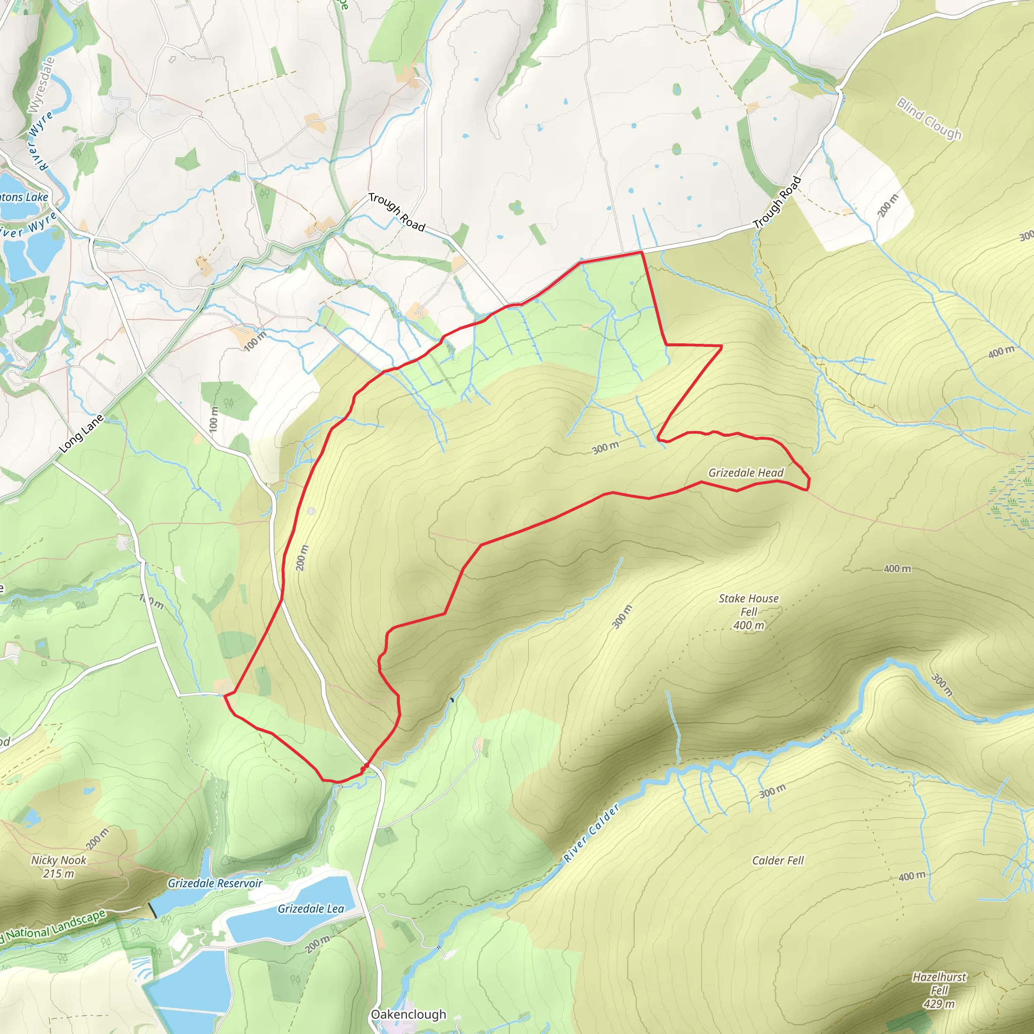
Starting near Lancashire, England, the Grizedale Head Loop is a captivating 11 km (approximately 6.8 miles) trail with an elevation gain of around 300 meters (984 feet). This loop trail is rated as medium difficulty, making it suitable for moderately experienced hikers.
Getting There
To reach the trailhead, you can drive or use public transport. If driving, set your GPS to the nearest known address: Grizedale Visitor Centre, Hawkshead, Ambleside LA22 0QJ, England. There is ample parking available at the visitor center. For those using public transport, the nearest train station is Windermere. From Windermere, you can take a bus to Hawkshead and then a short taxi ride to the Grizedale Visitor Centre.
Trail Overview
The trail begins at the Grizedale Visitor Centre, where you can find restrooms, a café, and an information center. The loop takes you through a variety of landscapes, including dense woodlands, open meadows, and scenic viewpoints.
Key Sections and Landmarks
Woodland Path (0-3 km / 0-1.9 miles): The initial section of the trail winds through Grizedale Forest, a mixed woodland known for its towering conifers and native broadleaf trees. Keep an eye out for red squirrels and a variety of bird species, including woodpeckers and owls. The path here is well-marked and relatively flat, making for a gentle start.
Elevation Gain (3-5 km / 1.9-3.1 miles): As you progress, the trail begins to ascend. This section offers a moderate climb, gaining approximately 150 meters (492 feet) in elevation. The path can be rocky and uneven, so sturdy hiking boots are recommended. Along the way, you'll pass by several small streams and waterfalls, which are perfect spots for a short break.
Grizedale Tarn (5-7 km / 3.1-4.3 miles): At around the halfway point, you'll reach Grizedale Tarn, a serene mountain lake surrounded by lush greenery. This is an ideal spot for a picnic or a moment of reflection. The tarn is also a habitat for various amphibians and aquatic plants.
Scenic Viewpoints (7-9 km / 4.3-5.6 miles): Continuing on, the trail offers several panoramic viewpoints. One notable spot is Carron Crag, the highest point in Grizedale Forest, standing at 314 meters (1,030 feet). From here, you can enjoy sweeping views of the surrounding fells and valleys. Be sure to have your camera ready.
Descent and Return (9-11 km / 5.6-6.8 miles): The final section of the loop descends back towards the Grizedale Visitor Centre. The path here is a mix of gravel and dirt, and it can be slippery when wet. As you make your way down, you'll pass through more woodland areas, where you might spot deer and other wildlife.
Historical Significance
Grizedale Forest has a rich history, dating back to the Bronze Age. The area was extensively logged during World War I and II to supply timber for the war effort. Today, it is managed by Forestry England and is a popular destination for outdoor enthusiasts. The forest is also home to several art installations and sculptures, part of the Grizedale Sculpture Trail, which adds a unique cultural element to your hike.
Navigation
For navigation, it is highly recommended to use the HiiKER app, which provides detailed maps and real-time GPS tracking to ensure you stay on the right path. The trail is well-marked, but having a reliable navigation tool can enhance your hiking experience and provide peace of mind.
Prepare adequately with water, snacks, and appropriate clothing, and you'll be set for an enjoyable hike on the Grizedale Head Loop.
What to expect?
Activity types
Comments and Reviews
User comments, reviews and discussions about the Grizedale Head Loop, England.
4.5
average rating out of 5
4 rating(s)


