Download
3D Flyover
Add to list
More
14.9 km
~3 hrs 37 min
385 m
Point-to-Point
“Explore Lancashire's charm with a 15 km trail through nature, history, and moderate challenges from Adlington to Chorley.”
Starting near the charming village of Adlington in Lancashire, England, this 15 km (approximately 9.3 miles) point-to-point trail offers a delightful mix of natural beauty, historical landmarks, and moderate physical challenge. With an elevation gain of around 300 meters (approximately 984 feet), this hike is rated as medium difficulty, making it suitable for moderately experienced hikers.
Getting There
To reach the trailhead, you can either drive or use public transport. If driving, you can park near Adlington Railway Station, which is conveniently located close to the starting point. For those using public transport, Adlington Railway Station is well-connected, with regular services from Manchester and Preston. From the station, it's a short walk to the beginning of the trail.
Trail Overview
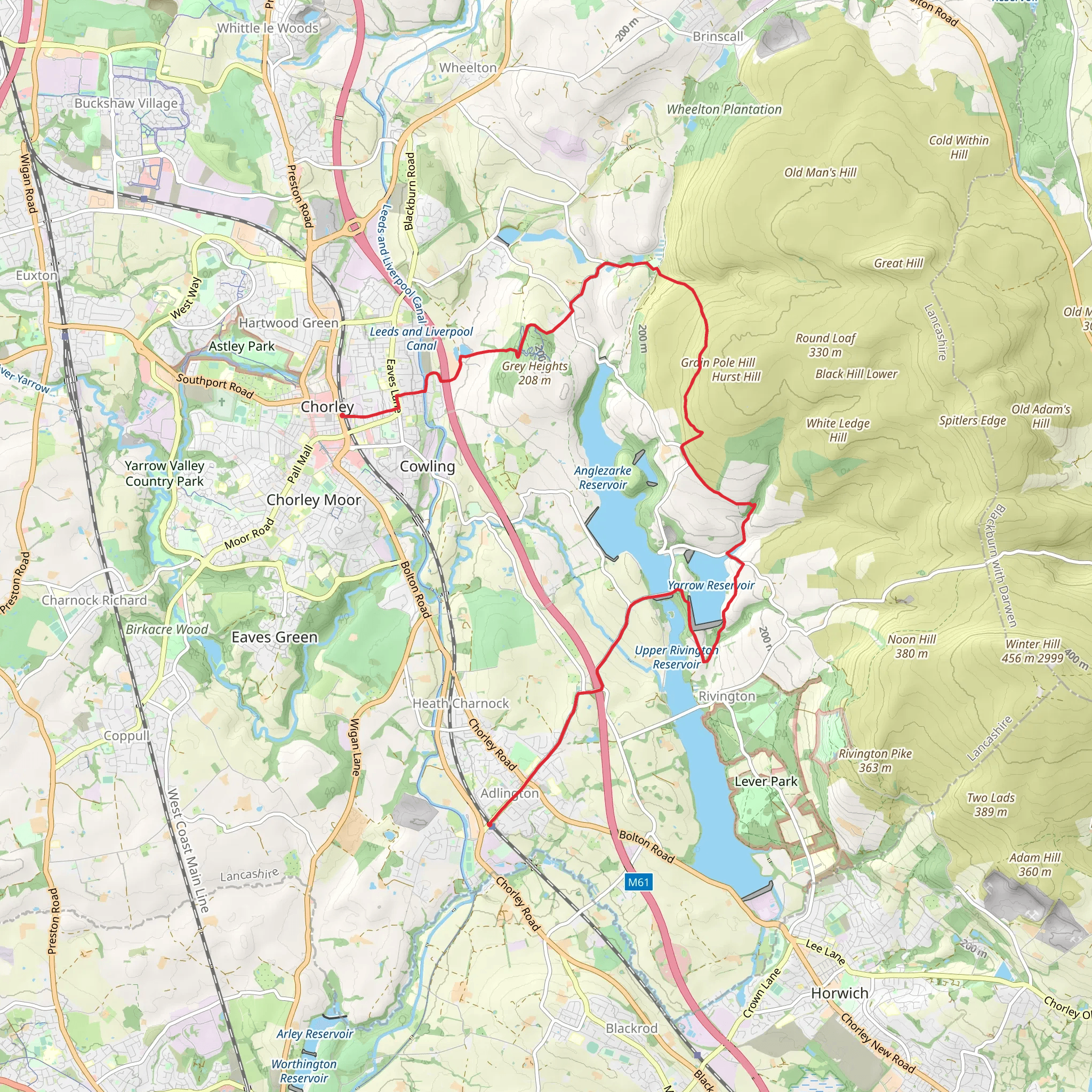
The trail begins near Adlington and meanders through a variety of landscapes, including woodlands, open fields, and along the banks of the Yarrow Reservoir. The initial section of the trail is relatively flat, allowing you to ease into the hike. As you progress, the terrain becomes more undulating, offering a moderate challenge with several short but steep ascents and descents.
Yarrow Reservoir
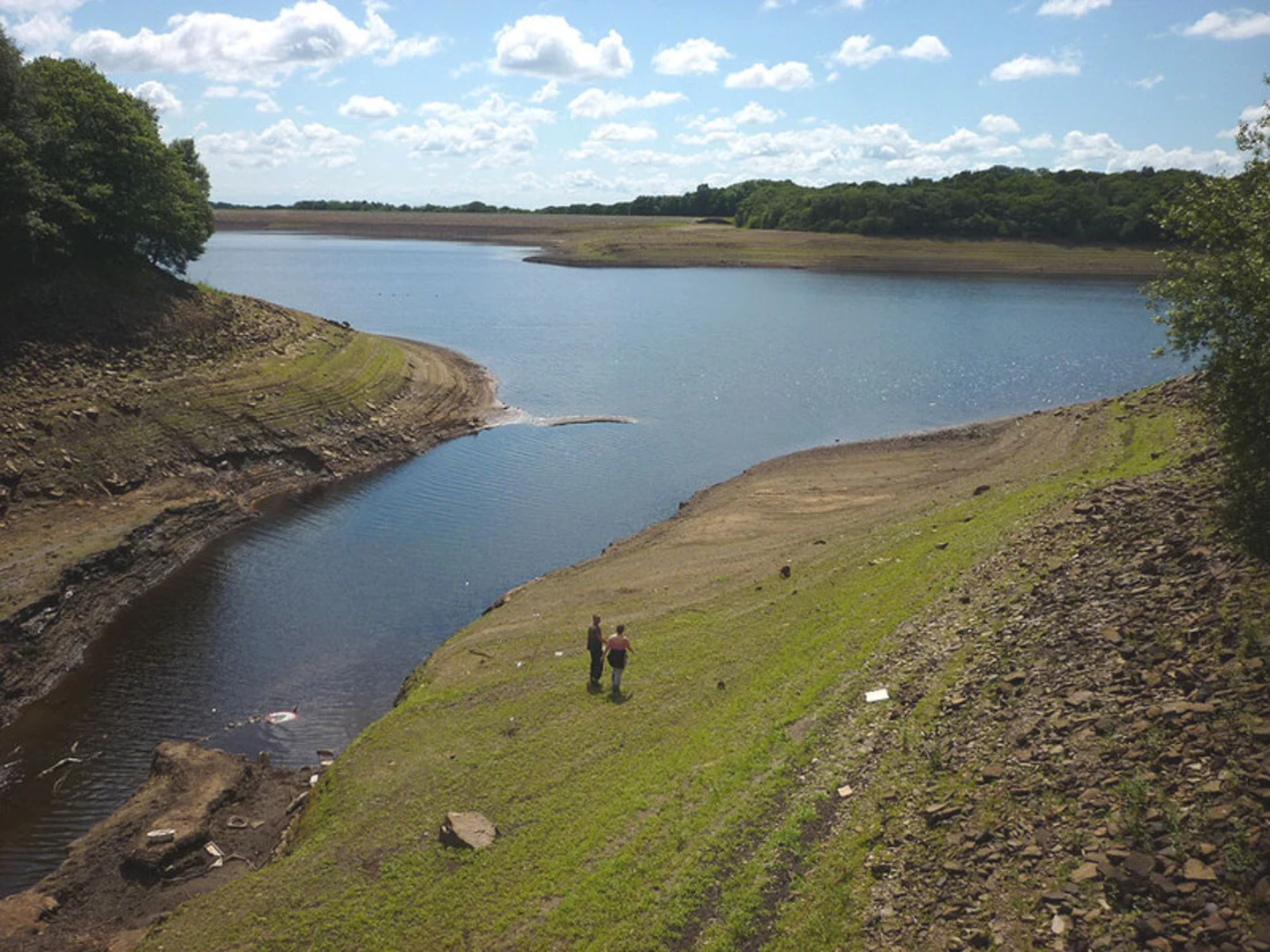
One of the highlights of this hike is the Yarrow Reservoir, located approximately 5 km (3.1 miles) from the starting point. The reservoir is a serene spot, perfect for a short break. Here, you can enjoy the tranquil waters and perhaps spot some local wildlife, including various species of waterfowl. The area around the reservoir is also rich in flora, with a variety of wildflowers blooming in the spring and summer months.
Historical Significance
As you continue, you'll pass through areas steeped in history. The region around Adlington and Chorley has a rich industrial heritage, particularly related to the textile industry. Keep an eye out for old mill buildings and remnants of the area's industrial past. Approximately 10 km (6.2 miles) into the hike, you'll come across the remains of an old mill, a poignant reminder of the region's historical significance.
Navigation and Safety
Given the varied terrain and the potential for changing weather conditions, it's advisable to use a reliable navigation tool like HiiKER to stay on track. The trail is generally well-marked, but having a digital map can be invaluable, especially in more remote sections.
Wildlife and Nature
The trail offers ample opportunities to observe local wildlife. In addition to waterfowl around the reservoir, you might spot deer, rabbits, and a variety of bird species in the woodlands and open fields. The area is also known for its diverse plant life, making it a great hike for nature enthusiasts.
Final Stretch to Chorley
The final section of the trail leads you towards Chorley, with a gradual descent that offers beautiful views of the surrounding countryside. As you approach Chorley, the landscape becomes more urban, but the transition is gradual, allowing you to enjoy the natural beauty right up until the end of the hike.
Practical Information
The trail ends near Chorley Railway Station, making it easy to return to your starting point or continue your journey. Chorley is well-served by public transport, with regular train services to major cities like Manchester and Preston. If you parked your car in Adlington, you can easily take a train back to Adlington Railway Station.
This hike offers a perfect blend of natural beauty, historical interest, and moderate physical challenge, making it a rewarding experience for those looking to explore the Lancashire countryside.
What to expect?
Activity types
Comments and Reviews
User comments, reviews and discussions about the Adlington to Chorley Walk via Yarrow Reservoir, England.
5.0
average rating out of 5
3 rating(s)
