
Download
3D Flyover
Add to list
More
23.9 km
~5 hrs 36 min
493 m
Loop
“"Explore Kent's lush landscapes and historic landmarks on the enchanting 24 km Tunbridge Wells Loop."”
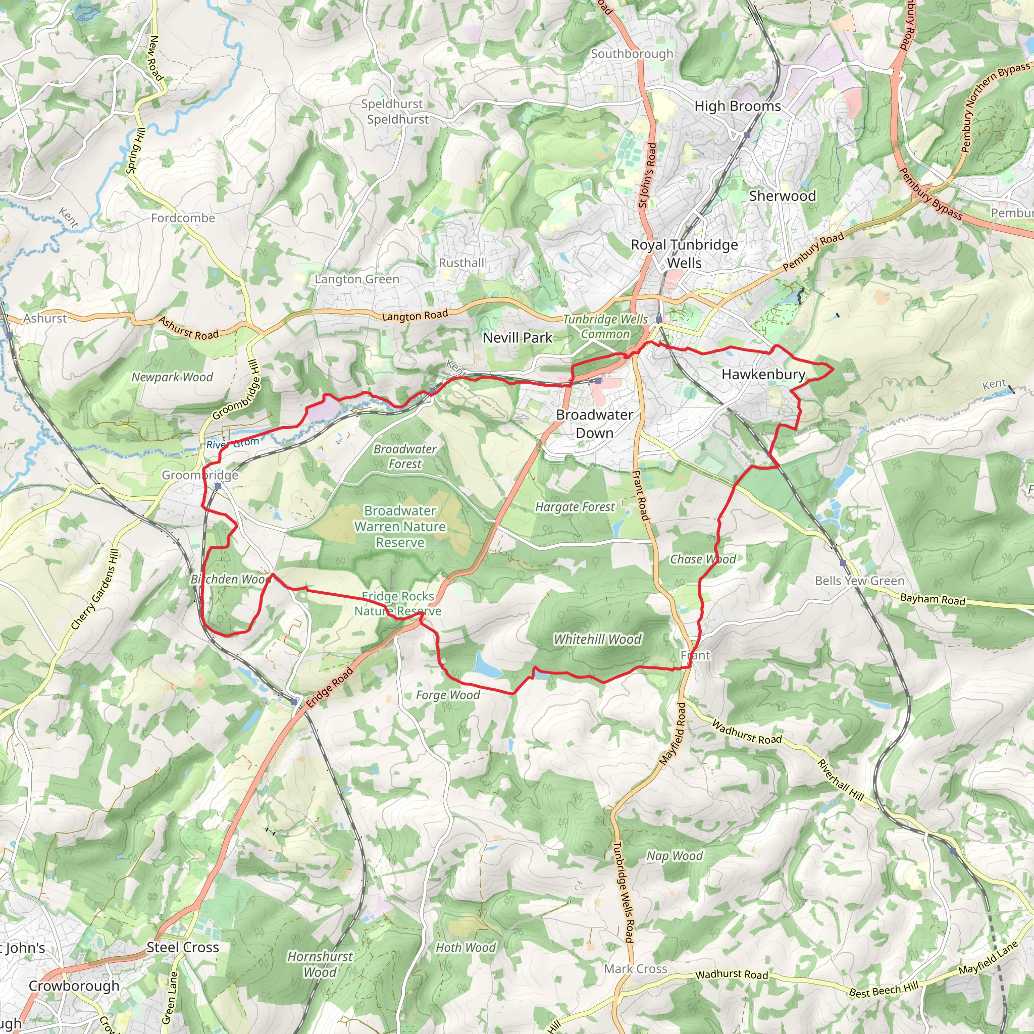
Starting near Kent, England, the Tunbridge Wells, Groombridge and Frant Loop is a captivating 24 km (approximately 15 miles) trail with an elevation gain of around 400 meters (about 1,312 feet). This loop trail is rated as medium difficulty, making it suitable for moderately experienced hikers.
Getting There
To reach the trailhead, you can either drive or use public transport. If driving, you can park near the Pantiles in Royal Tunbridge Wells, a historic area known for its Georgian architecture and charming colonnaded walkway. For those using public transport, Royal Tunbridge Wells railway station is well-connected, with regular services from London and other major cities. From the station, it's a short walk to the trailhead.
Trail Overview
The trail begins in the picturesque town of Royal Tunbridge Wells, known for its historic spa and elegant architecture. As you set off, you'll quickly find yourself immersed in the lush Kent countryside. The first section of the trail takes you through dense woodlands and open fields, offering a mix of shaded and sunny paths.
Key Landmarks and Sections
High Rocks
Approximately 5 km (3 miles) into the hike, you'll encounter High Rocks, a series of impressive sandstone formations. This area is not only a natural wonder but also a site of historical significance, having been a popular tourist attraction since the 17th century. The rocks are a great spot for a short break and some exploration.
Groombridge Place
Continuing on, around the 10 km (6 miles) mark, you'll reach Groombridge Place, a moated manor house with stunning gardens. The house dates back to the 17th century and is steeped in history. The surrounding gardens are a delight, featuring a variety of plants and wildlife. If you have time, consider taking a detour to explore the grounds.
Frant Village
At roughly 15 km (9 miles), you'll arrive in the quaint village of Frant. This charming village is home to several historic buildings, including the St. Alban's Church, which dates back to the 11th century. Frant is an ideal place to stop for lunch, with a couple of traditional English pubs offering hearty meals and refreshments.
Wildlife and Nature
The trail is rich in biodiversity. As you hike, keep an eye out for local wildlife such as deer, foxes, and a variety of bird species. The woodlands are home to ancient oak and beech trees, while the open fields are often dotted with wildflowers, especially in the spring and summer months.
Navigation
Given the trail's length and the variety of terrains, it's advisable to use a reliable navigation tool like HiiKER to ensure you stay on track. The app provides detailed maps and real-time updates, which can be particularly useful in the more remote sections of the trail.
Final Stretch
The last section of the trail brings you back towards Royal Tunbridge Wells. As you approach the town, you'll pass through more woodlands and open fields, gradually descending back to your starting point. The final few kilometers offer a gentle cool-down, allowing you to reflect on the diverse landscapes and historical sites you've encountered along the way.
This loop trail offers a perfect blend of natural beauty, historical landmarks, and moderate physical challenge, making it a rewarding experience for any hiker.
What to expect?
Activity types
Comments and Reviews
User comments, reviews and discussions about the Tunbridge Wells, Groombridge and Frant Loop, England.
4.8
average rating out of 5
5 rating(s)



