Download
3D Preview
Add to list
More
16.7 km
~3 hrs 55 min
344 m
Point-to-Point
“Explore natural beauty, historic landmarks, and charming villages on this scenic 17 km Kent trail.”
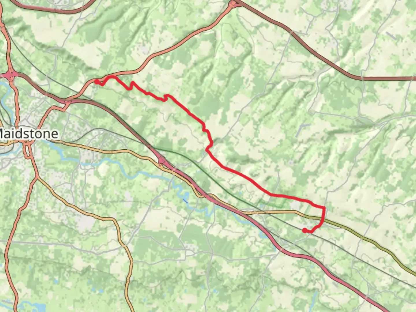
Starting near the picturesque village of Detling in Kent, England, this 17 km (approximately 10.5 miles) point-to-point trail offers a moderate challenge with an elevation gain of around 300 meters (984 feet). The trailhead is conveniently accessible by public transport or car. If you're driving, you can park near the Detling Village Hall. For those using public transport, the nearest train station is Bearsted, from where you can take a bus or taxi to Detling.
Initial Ascent and Woodland Paths
The trail begins with a gentle ascent through the North Downs, a range of chalk hills that offer stunning views over the Kent countryside. Early on, you'll pass through dense woodlands, where the path can be narrow and uneven. Keep an eye out for ancient yew trees and a variety of bird species, including woodpeckers and nuthatches. The initial climb will take you up about 100 meters (328 feet) in elevation over the first 3 km (1.9 miles).
Historical Landmarks
Around the 5 km (3.1 miles) mark, you'll come across the White Horse Wood Country Park. This area is steeped in history, featuring the remains of Thurnham Castle, a Norman fortification dating back to the 12th century. The castle ruins are a great spot for a short break and some exploration. The park itself offers panoramic views of the surrounding countryside, making it a perfect place for photography enthusiasts.
Open Fields and Farmlands
As you continue, the trail opens up into expansive fields and farmlands. This section is relatively flat and offers a respite from the earlier climbs. You'll pass through several small villages, including Hollingbourne, where you can find local pubs and shops to restock your supplies or enjoy a meal. This part of the trail covers approximately 6 km (3.7 miles) and is ideal for those who enjoy walking through open landscapes.
Wildlife and Natural Beauty
The latter part of the trail takes you through the Kent Downs Area of Outstanding Natural Beauty. This section is characterized by rolling hills, chalk grasslands, and diverse wildlife. Look out for butterflies, particularly the rare Adonis Blue, and various wildflowers that bloom in the spring and summer months. The elevation gain here is more gradual, adding another 100 meters (328 feet) over the next 4 km (2.5 miles).
Final Stretch to Lenham
The final stretch of the trail leads you into the historic village of Lenham. This part of the walk is relatively easy, with a gentle descent into the village. Lenham is known for its medieval market square and the 14th-century St. Mary's Church. The village also offers several amenities, including cafes, pubs, and shops, making it a great place to relax and unwind after your hike.
Navigation and Safety
For navigation, it's highly recommended to use the HiiKER app, which provides detailed maps and real-time updates. The trail is well-marked, but having a reliable navigation tool can help you stay on track, especially in the more remote sections. Always carry sufficient water, snacks, and a basic first aid kit. Weather in this region can be unpredictable, so pack layers and waterproof gear.
This trail offers a blend of natural beauty, historical landmarks, and charming villages, making it a rewarding experience for hikers of all levels.

What to expect?
Activity types
Comments and Reviews
User comments, reviews and discussions about the Detling to Lenham Walk, England.
4.0
average rating out of 5
1 rating(s)