
Download
3D Flyover
Add to list
More
5.7 km
~1 hrs 20 min
118 m
Loop
“A windswept chalk-down loop with grand sea views, wildflowers, history, and a bracing climb.”
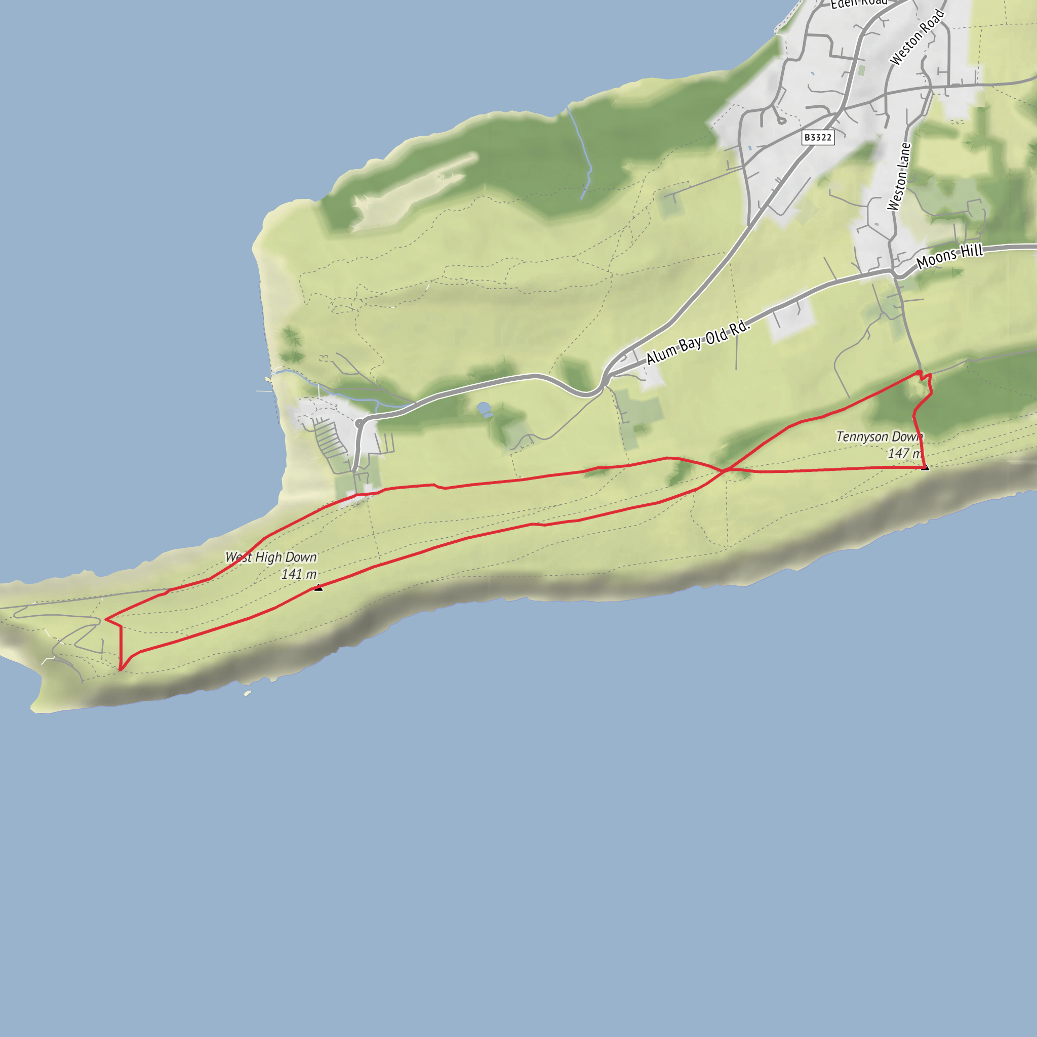
This medium-rated loop on the western Isle of Wight packs a lot into roughly 6 km / 3.7 miles, with about 100 m / 330 ft of ascent. The route explores open chalk downland above the sea, climbs to one of the island’s best-known viewpoints, and circles across West High Down with wide views toward The Needles, Alum Bay, Freshwater Bay, and the Solent. The usual starting point is High Down Chalk Pit car park, Alum Bay Old Road, Totland Bay, Isle of Wight PO39 0HY, a National Trust car park near the High Down area. National Trust route information for Tennyson Down also uses High Down Chalk Pit car park as the trailhead. (nationaltrust.org.uk)
From the start, expect a fairly quick climb onto the downs. Although the overall elevation gain is modest, the first uphill section can feel steeper than the numbers suggest, especially in wind or after rain when chalk and short turf can become slippery. Once on the ridge, the walking becomes more flowing, with broad grassy paths and exposed clifftop sections. The terrain is generally straightforward for regular walkers, but the exposure, uneven chalk ground, and occasional steep edges are why the route fits a medium difficulty rather than an easy stroll. (nationaltrust.org.uk)
What the route feels like
The high point of the walk is Tennyson Monument, the large granite memorial to Alfred, Lord Tennyson, who lived nearby at Farringford and was closely associated with this part of the island. The monument stands on Tennyson Down at about 147 m / 482 ft above sea level, and it is visible from a long way off, making it both a landmark and a useful orientation point on the loop. From here, the panorama is one of the main rewards: chalk cliffs dropping to the sea, the western tip of the Isle of Wight, and long coastal views in clear weather. (visitisleofwight.co.uk)
Beyond the monument, the route typically continues westward along the clifftop and downland toward West High Down, where the landscape feels more open and wilder. This section is especially scenic, with rolling chalk grassland and strong sea views. Looking west, walkers can often pick out The Needles, while inland views stretch across the West Wight. National Trust information for the area highlights the monument, the clifftop paths, a 19th-century fort, and even the remains of a Cold War rocket test site as notable features of the wider headland walk. (nationaltrust.org.uk)
Landmarks, wildlife, and what to look out for
This is a classic chalk downland landscape, and that matters for both scenery and wildlife. Chalk grassland is one of southern England’s richest habitats, often supporting seasonal wildflowers, butterflies, and specialist plants. West High Down is particularly noted for rare flora, including early gentians and several orchid species. Birdlife can also be rewarding on the exposed headland, especially seabirds and migrating species moving along the coast. (theguardian.com)
Because the route crosses open downland and cliff-edge country, weather has a big influence on the day. Wind can be strong even when lower ground feels calm, and mist can reduce the sense of direction on the ridge. Keep an eye on footing near the cliff edge, especially if grass is wet or if there are informal side paths branching away from the main line. If using navigation, plan the route in HiiKER before setting out so you can keep track of the loop and any junctions across the open ground.
The area also has strong archaeological and military interest. West High Down and the Needles headland contain layers of history, from ancient use of the downs to later defensive sites. The nearby Needles batteries and fortifications reflect the strategic importance of this coastline, while the Cold War rocket testing connection adds an unusual modern chapter to the landscape. That mix of literary, military, and coastal history gives the walk more depth than a simple viewpoint hike. (nationaltrust.org.uk)
Getting to the start
By car, the most practical access is via High Down Chalk Pit car park / Highdown Pit, Highdown Lane, Totland, reached from the B3322 from Yarmouth or Totland, or via the Alum Bay road from Freshwater Bay. Parking is available there, and it is the standard access point used in official route notes. (nationaltrust.org.uk)
By public transport, the west end of the Isle of Wight is served by Southern Vectis buses. Sources for this walk reference bus access to Alum Bay and the wider Tennyson Down area, including the No. 7 route from Newport toward Alum Bay; some local walking material also points walkers to current island bus timetables for planning. If arriving by bus, check the latest stop locations and times before travel, then allow for a short walk
Surfaces
Grass
Dirt
Unknown
Asphalt
Unpaved
Concrete
Comments and Reviews
User comments, reviews and discussions about the Tennyson's Monument and West High Down Loop, England.
average rating out of 5
0 rating(s)

