
Download
3D Flyover
Add to list
More
11.9 km
~2 hrs 50 min
275 m
Loop
“From castle stones to breezy downs, this loop blends sweeping island views with ancient atmosphere.”
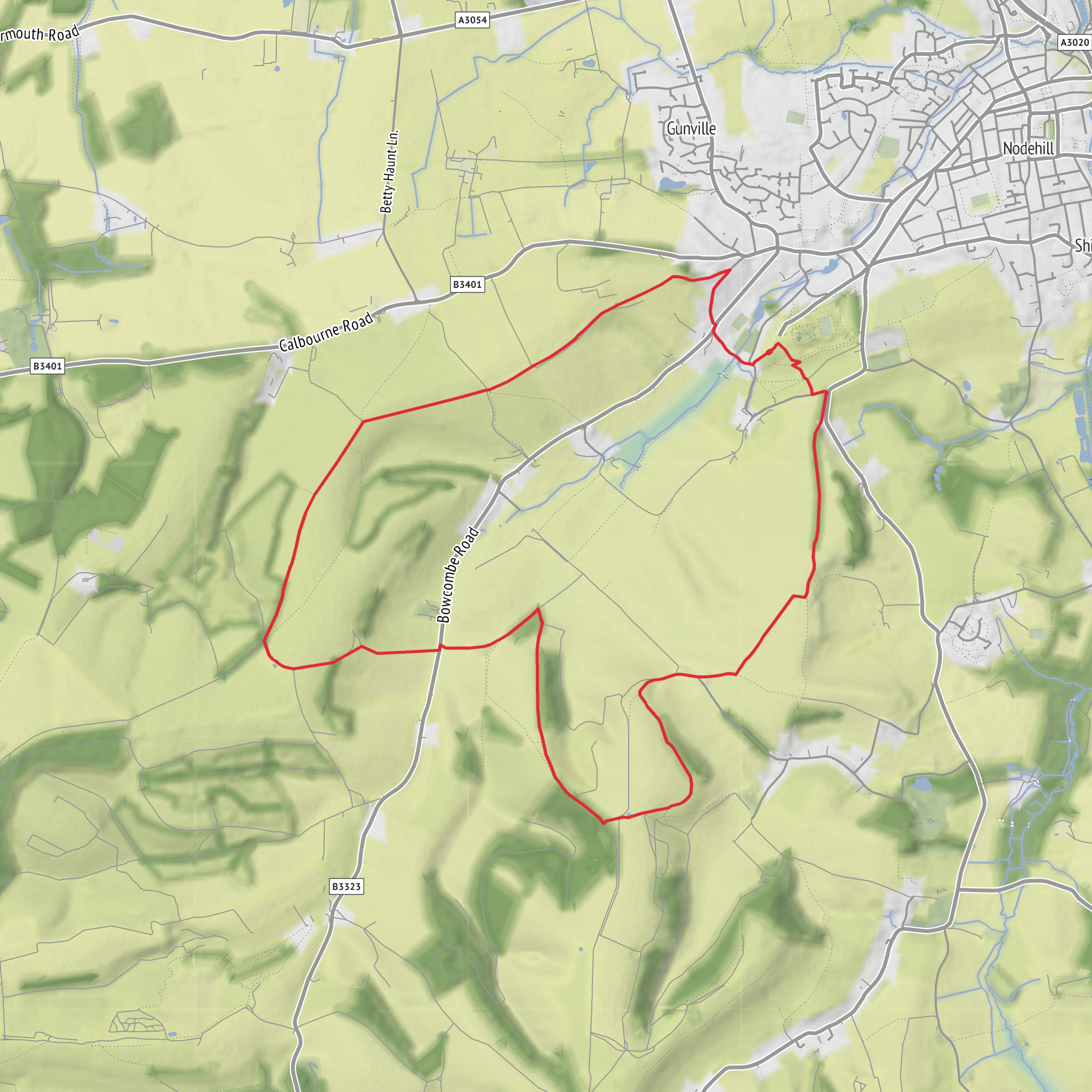
This 12 km / 7.5 mile loop combines open downland, broad island views, and a strong sense of deep history, with around 300 metres / 985 feet of climbing spread across a series of steady rises rather than one single mountain-style ascent. The route is generally best understood as a moderate half-day walk: long enough to feel substantial, but still manageable for reasonably fit walkers with decent footwear and a little route planning. Expect a mix of grassy tracks, chalky or stony paths on the downs, field-edge walking, and some short road or lane links depending on the exact line you follow. In wet weather, sections can become slippery, especially on exposed slopes and worn paths.
The walk is most closely associated with Carisbrooke Castle, Castle Hill, Carisbrooke, Newport, Isle of Wight PO30 1XY, which is the clearest significant landmark and practical start point for the loop. Carisbrooke Castle lies about 1.25 miles / 2 km south-west of Newport and has visitor parking, making it the most straightforward place to orient yourself before heading out toward the higher ground around Dukem Down. (english-heritage.org.uk)
From the start, the character of the walk builds gradually. The lower ground around Carisbrooke feels settled and historic, with village edges, old lanes, and the castle immediately setting the tone. As you climb away, the landscape opens into classic Isle of Wight downland: rounded ridges, breezier ground, and wide views that can stretch across the island interior and, on a clear day, toward the coast. The ascent toward Dukem Down is where most of the route’s effort is concentrated, and although the overall elevation gain is only about 300 metres / 985 feet, the exposed nature of the terrain can make it feel more demanding in strong wind or summer heat.
What to expect on the route
The first few kilometres are usually the easiest underfoot, giving walkers time to settle into pace before the higher ground. Once the route begins climbing onto the downs, the scenery becomes the main reward. This is the kind of walk where the horizon keeps changing: farmland and hedgerows below, open sky above, and long rolling contours that make the island’s interior feel much bigger than it looks on a map. Chalk and grass underfoot can be fast and pleasant in dry conditions, but after rain they can turn slick, especially on descents.
The middle section is likely to be the most memorable. On the ridge and upper slopes, there is a real sense of openness, with fewer visual barriers and more wind exposure. Walkers should be prepared for little shelter here. In cooler months, that means carrying an extra insulating layer and waterproof shell; in warmer months, it means sun protection and enough water, because exposed downland can feel surprisingly hot and dry. If visibility drops in mist, route-finding becomes more important, so having the route loaded in HiiKER is a sensible precaution.
The descent back toward the historic core of Carisbrooke tends to feel easier on the lungs but harder on the knees, especially if the ground is greasy. Trekking poles can be useful for anyone who prefers extra stability on downhill sections. Because this is a loop rather than an out-and-back, the return keeps changing the perspective, with the castle and surrounding landscape
Surfaces
Dirt
Grass
Gravel
Unknown
Asphalt
Cobblestone
Wood
Comments and Reviews
User comments, reviews and discussions about the Dukem Down and Roman Fort Loop, England.
average rating out of 5
0 rating(s)

