Download
Preview
Add to list
More
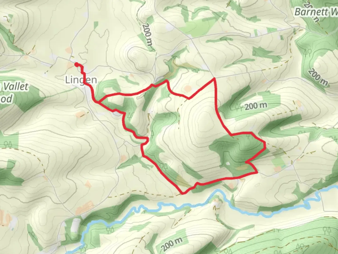
8.6 km
~2 hrs 6 min
233 m
Loop
“Embark on a scenic 9 km hike through Herefordshire's historical tapestry, with Lingen Village Hall as your charming gateway.”
Starting from the quaint Lingen Village Hall, nestled in the picturesque Herefordshire countryside, the trail offers a moderate 9 km (approximately 5.6 miles) loop that will take you through a variety of landscapes, boasting an elevation gain of around 200 metres (656 feet). This trail is perfect for those looking to immerse themselves in the English countryside without embarking on an overly strenuous hike.
Getting to the Trailhead To reach the trailhead near Lingen Village Hall, if you're driving, you can navigate to the village of Lingen, which is situated near the market town of Leominster. There is parking available at the village hall for those who arrive by car. For those opting for public transport, the nearest train stations are in Leominster and Ludlow, from which you can take a taxi to Lingen, as direct bus services may be limited.
Navigating the Trail As you embark on your hike, you can use the HiiKER app to help navigate the loop, ensuring you stay on the right path. The trail is well-marked, but having a digital tool can provide that extra layer of security, especially in areas where the trail may become less distinct.
Landmarks and Scenery The trail will lead you through lush fields, woodlands, and along serene riverbanks. Early on, you'll pass by traditional English farmland, where you might catch a glimpse of local wildlife such as deer, foxes, and various bird species. The mixed woodlands are particularly enchanting, with a canopy of oak, ash, and beech trees that provide a habitat for squirrels and woodland birds.
Historical Significance This area is steeped in history, with the trail passing close to the remains of medieval settlements and ancient earthworks. Keep an eye out for the subtle signs of these past civilizations, such as old stone walls and faint ridge-and-furrow patterns in the fields, which are remnants of the agricultural practices of our ancestors.
Elevation and Terrain The 200-metre elevation gain is spread out across the loop, meaning there are no excessively steep sections to tackle. However, there are a few gradual inclines that will get your heart pumping. The terrain is a mix of grassy paths, farm tracks, and country lanes, with some muddy sections after rain, so waterproof footwear is recommended.
Preparing for the Hike Given the English weather's propensity for change, it's wise to pack layers and waterproof gear, even if the day starts out sunny. A refillable water bottle, snacks, and a basic first-aid kit are also essential for this medium-difficulty hike. Don't forget to check the weather forecast before you set out, and plan your hike accordingly.
Wildlife and Nature Conservation As you enjoy the natural beauty of the Herefordshire countryside, remember to respect the wildlife and habitats you encounter. Stick to the marked paths, avoid disturbing animals, and take any litter back with you to preserve the area's pristine condition for future hikers and the local wildlife that calls it home.
By following these guidelines and using the HiiKER app for navigation, you're set for a delightful day of hiking through the English countryside, rich with natural beauty and historical intrigue.

What to expect?
Activity types
Comments and Reviews
User comments, reviews and discussions about the Lingen Village Hall, England.
4.33
average rating out of 5
3 rating(s)