Download
3D Preview
Add to list
More
8.2 km
~1 hrs 48 min
106 m
Point-to-Point
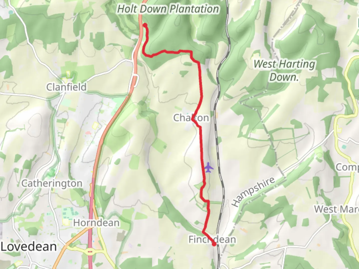
“Discover the Chalton Park and Staunton Way trail: 8 km of natural beauty and historical intrigue in Hampshire.”
Starting near Hampshire, England, this 8 km (approximately 5 miles) point-to-point trail offers a delightful mix of natural beauty and historical intrigue. With an elevation gain of around 100 meters (328 feet), the Chalton Park and Staunton Way trail is rated as medium difficulty, making it suitable for moderately experienced hikers.
Getting There
To reach the trailhead, you can either drive or use public transport. If driving, set your GPS to Chalton, Hampshire. For those using public transport, the nearest significant landmark is Petersfield Railway Station. From there, you can take a local bus or taxi to Chalton.
Trail Overview
The trail begins near Chalton, a quaint village with a rich history dating back to the Saxon era. As you start your hike, you'll notice the rolling hills and lush greenery that characterize the South Downs National Park. The initial part of the trail is relatively flat, allowing you to ease into the hike.
Key Landmarks and Points of Interest
Chalton Windmill (1 km / 0.6 miles in): One of the first landmarks you'll encounter is the Chalton Windmill. Though no longer operational, this historic structure offers a glimpse into the area's agricultural past. It's a great spot for a quick rest and some photos.
Queen Elizabeth Country Park (3 km / 1.9 miles in): As you continue, you'll enter Queen Elizabeth Country Park. This expansive park is home to a variety of wildlife, including deer and numerous bird species. The park also features several picnic areas and restrooms, making it a convenient stop.
Butser Hill (4 km / 2.5 miles in): The trail then ascends towards Butser Hill, the highest point in the South Downs. The climb is gradual but steady, offering panoramic views of the surrounding countryside. The hill is also a Site of Special Scientific Interest, known for its unique chalk grassland habitat.
Flora and Fauna
The trail is abundant with diverse flora and fauna. In spring and summer, you'll find wildflowers like orchids and cowslips. The wooded sections are home to ancient oak and beech trees. Keep an eye out for local wildlife such as red kites, buzzards, and even the occasional fox.
Historical Significance
The region is steeped in history. Chalton itself has archaeological sites dating back to the Iron Age. The trail also passes near the site of the Battle of Cheriton, a significant conflict during the English Civil War. Informational plaques along the route provide context and enrich your hiking experience.
Navigation and Safety
For navigation, it's highly recommended to use the HiiKER app, which provides detailed maps and real-time updates. The trail is well-marked, but having a reliable navigation tool ensures you stay on course. Always carry sufficient water, snacks, and a basic first aid kit. Weather can be unpredictable, so dress in layers and bring waterproof gear.
Final Stretch
The trail concludes near the village of Rowlands Castle. Here, you can find several pubs and cafes to relax and refuel. Public transport options are available from Rowlands Castle Railway Station, making it easy to return to your starting point or continue your journey.
This trail offers a perfect blend of natural beauty, historical landmarks, and moderate physical challenge, making it a rewarding experience for any hiker.

What to expect?
Activity types
Comments and Reviews
User comments, reviews and discussions about the Chalton Park and Staunton Way, England.
4.83
average rating out of 5
6 rating(s)