
Download
3D Flyover
Add to list
More
4.8 km
~1 hrs 13 min
159 m
Loop
“Explore Hampshire’s countryside on a 5 km loop blending natural beauty, history, and diverse wildlife.”
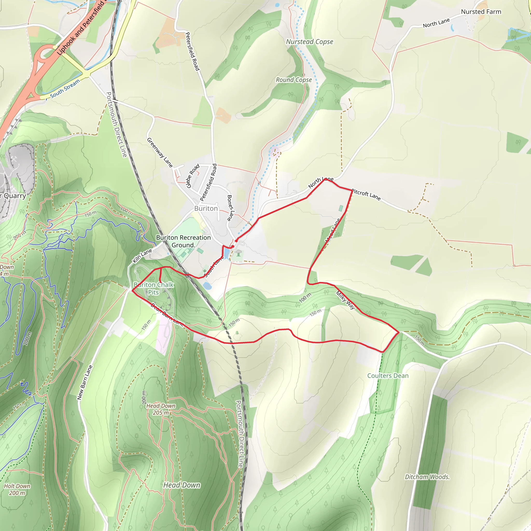
Starting near the picturesque village of Buriton in Hampshire, England, this 5 km (approximately 3.1 miles) loop trail offers a delightful mix of natural beauty and historical intrigue. The trailhead is conveniently accessible by car, with parking available near the village center. For those using public transport, the nearest train station is Petersfield, from where you can take a short taxi ride or a local bus to Buriton.
Initial Ascent and Chalk Pits
The trail begins with a gentle ascent, gaining around 100 meters (328 feet) in elevation. As you start your hike, you'll pass through the Buriton Chalk Pits, a site of significant geological interest. These pits were historically used for chalk extraction, which was a vital industry in the region. The chalk pits are now a haven for wildlife, including various bird species and small mammals. Keep an eye out for kestrels and buzzards soaring above.
Woodland and Farmland
Continuing along the trail, you'll traverse a mix of woodland and open farmland. The woodland areas are particularly enchanting, with ancient trees and a rich undergrowth of ferns and wildflowers. In spring and early summer, the woods are carpeted with bluebells, creating a stunning visual display. The farmland sections offer expansive views of the South Downs, with rolling hills and patchwork fields stretching into the distance.
Milky Way Path
Around the halfway point, you'll join the Milky Way path, a historic route that has been used for centuries. This section of the trail is relatively flat and easy-going, allowing you to catch your breath and enjoy the surroundings. The Milky Way path is lined with hedgerows that are home to a variety of bird species, including robins, blackbirds, and the occasional owl.
Historical Landmarks
As you make your way back towards Buriton, you'll pass several points of historical interest. One notable landmark is the Buriton Manor House, a grand estate with origins dating back to the medieval period. The manor house is not open to the public, but its impressive architecture can be admired from the trail. Nearby, you'll also find the remnants of an old water mill, which once played a crucial role in the local economy.
Navigation and Safety
For navigation, it's highly recommended to use the HiiKER app, which provides detailed maps and real-time updates. The trail is well-marked, but having a reliable navigation tool will ensure you stay on track. Be prepared for varying terrain, including some muddy sections after rain. Sturdy hiking boots are advisable, and carrying a waterproof jacket is always a good idea given the unpredictable British weather.
Wildlife and Flora
Throughout the hike, you'll encounter a diverse array of flora and fauna. The chalk grasslands are particularly rich in wildflowers, including orchids and cowslips. Butterflies are abundant in these areas, with species such as the chalkhill blue and marbled white frequently spotted. The woodlands provide a habitat for deer, foxes, and badgers, so keep your eyes peeled for these elusive creatures.
This trail offers a perfect blend of natural beauty, historical significance, and moderate physical challenge, making it an ideal choice for hikers looking to explore the Hampshire countryside.
What to expect?
Activity types
Comments and Reviews
User comments, reviews and discussions about the Buriton Chalk Pits and Buriton via Milky Way, England.
4.67
average rating out of 5
3 rating(s)


