Download
3D Preview
Add to list
More
8.9 km
~1 hrs 59 min
126 m
Loop
“Explore the diverse landscapes of Royden Park and Thurstaston Loop, a scenic 9 km trail in England.”
Starting near the quaint village of Frankby, England, the Royden Park and Thurstaston Loop is a delightful 9 km (approximately 5.6 miles) trail with an elevation gain of around 100 meters (328 feet). This loop trail is rated as medium difficulty, making it suitable for moderately experienced hikers.
Getting There
To reach the trailhead, you can drive to Royden Park, which is well-signposted and has ample parking facilities. For those using public transport, the nearest train station is Meols, about 3 miles (4.8 km) away. From Meols, you can take a local bus or taxi to Royden Park.
Trail Highlights
Royden Park
Starting at Royden Park, you'll find yourself surrounded by lush greenery and well-maintained paths. The park itself is a popular spot for families and dog walkers, featuring a miniature railway and a walled garden. As you begin your hike, take a moment to appreciate the historical significance of the park, which was once part of the Royden Hall estate.
Thurstaston Common
About 2 km (1.2 miles) into the hike, you'll reach Thurstaston Common. This area is a designated Site of Special Scientific Interest (SSSI) due to its unique heathland habitat. The common offers stunning views over the Dee Estuary and the Welsh hills. Keep an eye out for local wildlife, including various bird species and, if you're lucky, the occasional red squirrel.
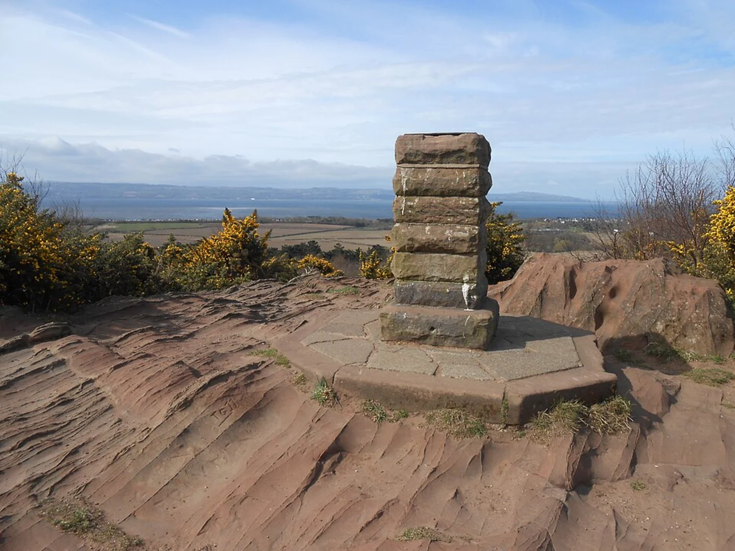
Thurstaston Hill
Continuing on, you'll ascend Thurstaston Hill, the highest point of the trail. The climb is gradual but rewarding, offering panoramic views from the summit. The elevation gain here is about 50 meters (164 feet) over a distance of 1.5 km (0.9 miles). At the top, you'll find a trig point and a bench where you can rest and take in the scenery.
Wirral Way
Descending from Thurstaston Hill, you'll join the Wirral Way, a former railway line converted into a multi-use path. This section is relatively flat and easy-going, making it a pleasant stretch to cover the next 3 km (1.9 miles). The Wirral Way is lined with trees and offers occasional glimpses of the Dee Estuary.
Thurstaston Beach
Approximately 6 km (3.7 miles) into the hike, you'll reach Thurstaston Beach. This pebble and sand beach is a great spot to take a break and enjoy the coastal views. The beach is also part of the Dee Estuary SSSI, so it's a good place to observe wading birds and other marine life.
Return to Royden Park
The final 3 km (1.9 miles) of the loop take you back through Thurstaston Common and Royden Park. This section is mostly downhill or flat, making for a comfortable end to your hike. As you re-enter Royden Park, consider exploring the walled garden or taking a ride on the miniature railway if time permits.
Navigation and Safety
For navigation, it's highly recommended to use the HiiKER app, which provides detailed maps and real-time GPS tracking. The trail is generally well-marked, but having a reliable navigation tool will ensure you stay on course.
Preparation Tips
Wear sturdy hiking boots, as some sections can be uneven or muddy, especially after rain. Bring water and snacks, as there are limited facilities along the trail. A lightweight rain jacket is advisable, given the unpredictable British weather.
This trail offers a mix of woodland, heathland, and coastal scenery, making it a diverse and enjoyable hike. Whether you're interested in local history, wildlife, or simply a good walk, the Royden Park and Thurstaston Loop has something for everyone.

What to expect?
Activity types
Comments and Reviews
User comments, reviews and discussions about the Royden Park and Thurstaston Loop, England.
4.8
average rating out of 5
5 rating(s)