
Download
3D Flyover
Add to list
More
10.8 km
~2 hrs 18 min
88 m
Loop
“A mellow wander through Essex’s patchwork fields and storybook villages, with muddy stretches possible after rain.”
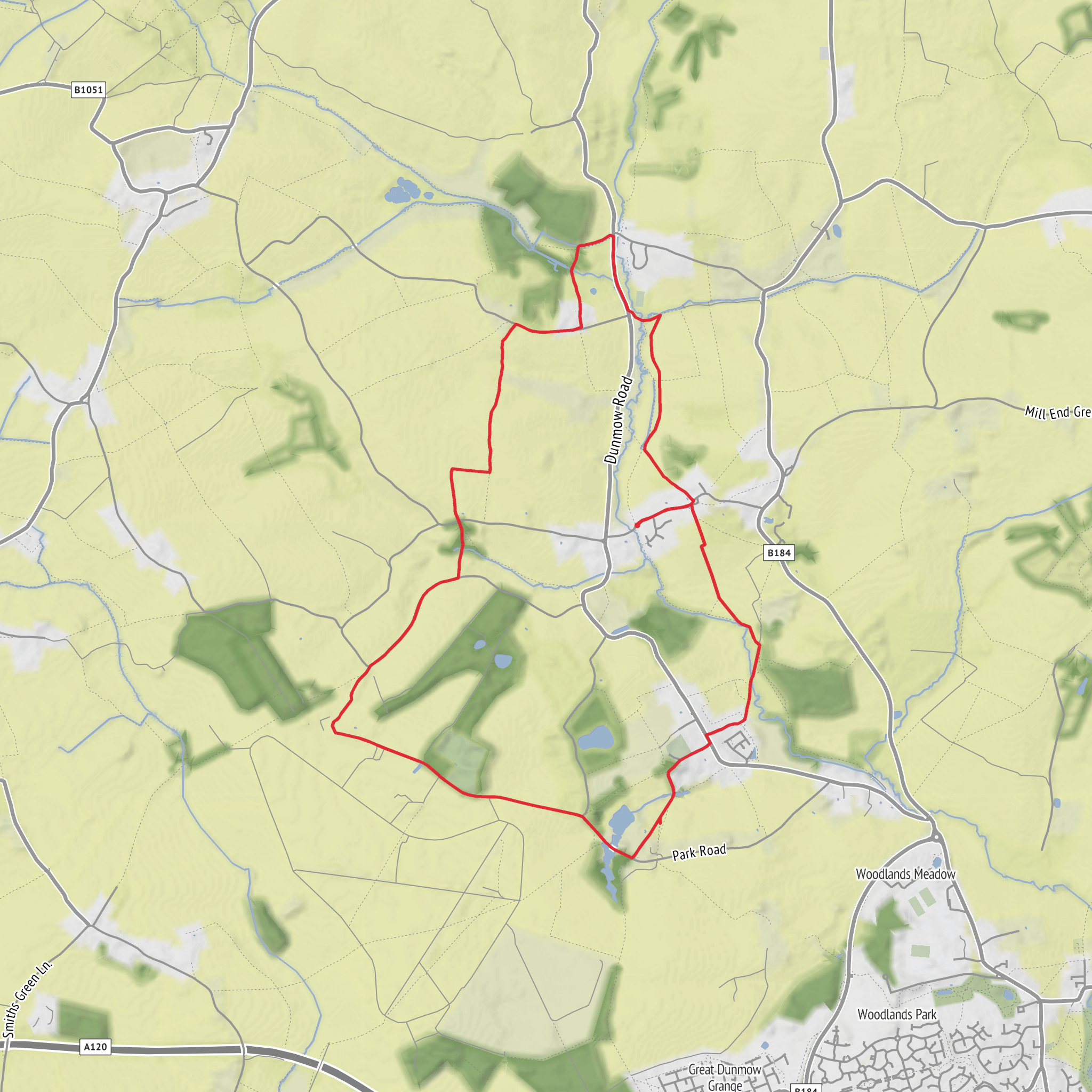
This easy loop of around 11 km / 6.8 miles with roughly 100 metres / 328 feet of ascent explores gently rolling Essex countryside between Great Easton and Broxted, following a mix of quiet lanes, field-edge paths and village footpaths through the “Hundred Parishes” landscape. The gradients are modest rather than sustained, so the route suits walkers looking for a relaxed half-day outing, but the terrain can still become muddy after rain, especially on farm tracks, field margins and lower ground near streams. The walking is more about open views, historic villages and pastoral scenery than dramatic climbing. (matfrygbr.co.uk)
The most practical place to treat as the start is the centre of Great Easton village, near the war memorial, village green and the Church of St John and St Giles, Great Easton, Dunmow, Essex CM6. That cluster of landmarks is the clearest known starting point in the village and works well for navigation and meeting up. Great Easton sits in Uttlesford, northwest Essex, in a rural area of lanes and scattered hamlets between Great Dunmow, Thaxted and Stansted. (hundredparishes.org.uk)
By car, approach via Great Dunmow or Thaxted and use considerate on-street parking only where permitted in Great Easton, taking care not to block narrow lanes, gateways or farm access. Village centres here are compact and residential, so arriving early is wise. If you are planning the route in advance, HiiKER is the best tool to check the exact line of the loop, junctions and any path changes before setting out.
By public transport, services in this area are limited and should be checked close to travel day. Travel Essex provides the main journey-planning resources for buses and demand-responsive transport in this part of Uttlesford, and Great Easton is also linked to local school and rural bus services in some timetables. Depending on where you are coming from, Great Dunmow or Stansted-area connections may be the most realistic gateway before a final bus or taxi transfer. Travel Essex also notes that DigiGo operates in parts of Essex including Great Dunmow and surrounding areas, which may help with first/last-mile planning, though coverage should be confirmed for your exact date. (travelessex.co.uk)
What the route feels like
From Great Easton, the loop typically heads out through a landscape of hedged lanes, arable fields and shallow valleys, with the climbing spread out in short rises rather than one major hill. Broxted Hill is one of the more noticeable high points, but even there the ascent is gentle by hiking standards. Expect a rhythm of open farmland, occasional tree belts, old cottages and long views across the valley sides. In clear weather, the higher sections around Broxted Hill give some of the best perspective over the surrounding patchwork of fields and historic farmsteads. (hundredparishes.org.uk)
The route passes through a countryside shaped by ancient rights of way and small-scale farming. That means surfaces can vary quite a bit over only a few kilometres: one stretch may be a firm quiet lane, the next a grassy edge path, then a potentially slick farm crossing or a narrow footbridge near a stream. Waterproof footwear is a sensible choice in any season outside prolonged dry spells. Because the route is easy rather than urban, walkers should still be prepared for limited signage in places and should keep an eye on field boundaries and path junctions. (matfrygbr.co.uk)
Landmarks and historic interest
Great Easton has more historical depth than its quiet setting first suggests. The parish church, St John and St Giles, contains fabric dating back to the 12th century, with later rebuilding and a brick bell tower added in 1928. Around the village green are several listed buildings, including the former Bell Inn, which dates from around 1500, and other timber-framed houses that give the centre much of its character. (hundredparishes.org.uk)
One of the most interesting features near the church is the surviving motte of a small medieval castle, a mound about 6 metres / 20 feet high. It is thought to date from the mid-12th century, during the civil war known as The Anarchy, when insecure local conditions encouraged the construction of small defensive sites. The mound is associated in local historical interpretation with the era of Geoffrey de Mandeville, Earl of Essex, a major figure in that conflict. Even if the earthwork is subtle, it adds a remarkable layer of Norman-period history to what otherwise feels like a peaceful village walk.
Surfaces
Unknown
Asphalt
Grass
Ground
Concrete
Comments and Reviews
User comments, reviews and discussions about the Great Easton and Broxted Hill Loop, England.
average rating out of 5
0 rating(s)
