
Download
3D Flyover
Add to list
More
8.5 km
~1 hrs 51 min
92 m
Loop
“A gentle Essex ramble through hedgerows and old hamlets, where quiet fields unfurl in soft waves.”
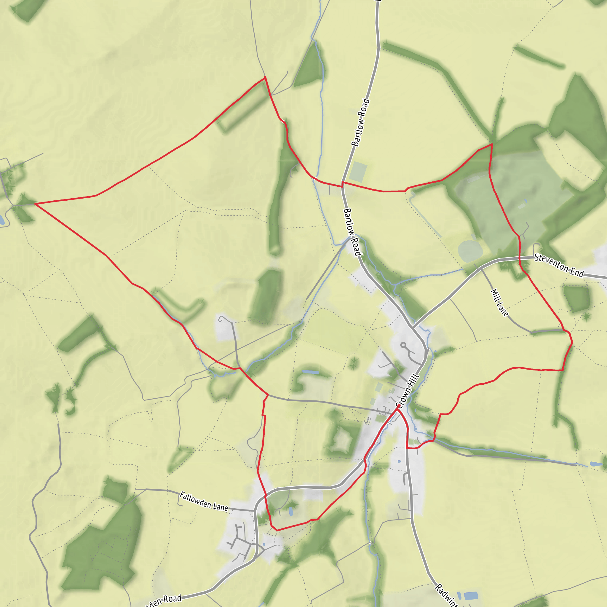
This easy countryside loop of around 9 km (5.6 miles) with roughly 100 m (330 ft) of elevation gain explores the gently rolling farmland and quiet lanes around Ashdon and Steventon End in north-west Essex, close to the Cambridgeshire border. Expect a relaxed outing rather than a strenuous one: broad views over arable fields, hedgerows, small woods, and a scattering of historic village buildings define the character of the walk. The gradients are usually mild, but the route can feel more undulating than the numbers suggest, especially after rain when field-edge paths and bridleways may become muddy.
The start is near Ashdon, a village southeast of Saffron Walden. If you are arriving by car, the most practical landmark is the area around All Saints Church, Ashdon, Radwinter Road, Ashdon, Saffron Walden CB10 2HF or the village centre nearby, where walkers typically orient themselves before joining local footpaths and lanes. Parking should be approached considerately, using any signed public parking or unobtrusive roadside spaces where permitted. If using public transport, the nearest larger access hub is usually Saffron Walden, from which local bus connections may reach Ashdon or nearby villages; otherwise, a taxi for the final stretch is often the simplest option. Rail users commonly approach via stations such as Audley End or Whittlesford Parkway, then continue by road.
The route suits walkers looking for a half-day ramble with easy navigation in fair conditions. It is well matched to families with older children, casual walkers, and anyone wanting a quieter rural circuit without steep climbs. Good waterproof footwear is still worth having, because even an easy Essex loop can become slippery where paths cross cultivated land, pass through gateways, or run along shaded edges.
What the route feels like
From the village edge, the walk typically settles quickly into open agricultural scenery. Much of the landscape here is shaped by centuries of farming, so you can expect a mix of field paths, grassy margins, farm tracks, and short road sections linking rights of way. The first few kilometres are usually the gentlest, with only slight rises and dips as the route leaves the settled village environment and opens into wider views.
As the loop works toward Steventon End, the countryside becomes more dispersed and tranquil. Small clusters of houses and farm buildings appear between stretches of open land, and the sense of space is one of the main rewards. On clear days, the higher points—modest though they are—give broad views across the surrounding Essex and Cambridgeshire border country. None of the climbs are long, but the cumulative ascent of about 100 m (330 ft) comes from repeated shallow undulations rather than one single hill.
The return leg usually feels especially peaceful, with long hedgerow corridors, occasional tree belts, and a rhythm of gates, stiles, and track junctions. Because this is a loop through working countryside, walkers should be prepared for route surfaces to vary a lot within a short distance: one section may be firm and grassy, the next rutted or muddy, and another a quiet tarmac lane.
Landmarks, landscape, and local character
Ashdon itself is one of the most notable points of interest. The village has a long history, and its church, traditional houses, and rural layout reflect the deep agricultural heritage of this part of Essex. All Saints Church is the standout historic landmark, with origins reaching back many centuries and a churchyard that adds to the sense of place at the start or end of the walk.
Steventon End is less a dramatic landmark than a classic small English hamlet setting: scattered dwellings, farmsteads, and lanes that preserve the feel of an older rural landscape. The appeal here is subtle. Rather than major monuments, the route offers historic field patterns, old boundary hedges, mature trees, and the kind of settlement geography that has changed only gradually over time.
This area sits within a landscape long influenced by medieval agriculture and later estate farming. Many of the footpaths walkers use today follow historic lines of movement between villages, fields, and farms. Even where the route crosses modern cultivated land, the broader pattern often reflects much older parish boundaries and farming systems. That historical continuity is one of the most interesting aspects of the walk: it is a route through lived-in countryside rather than wilderness.
Nature and wildlife
Wildlife is typical of lowland farmland and hedgerow habitat. Depending on season, walkers may see or hear skylarks over open fields, woodpigeons, rooks, crows, and various finches along hedge lines. Kestrels and buzzards are also possible overhead. In spring and early summer, the verges and field margins can be especially attractive, with wildflowers, grasses, and insect activity adding colour to what might otherwise seem like a simple agricultural route.
Mammal sightings are often brief but possible, especially early or late in the day. Brown hares, rabbits, and deer may be seen in or near the fields, while foxes are always a possibility in quieter stretches. The wooded edges and thicker hedgerows also support smaller birds and pollinators. Because this is active farmland, dogs should be kept under close control, particularly around livestock and during ground-nesting bird season.
Terrain, conditions, and what to look out for
Although rated easy, this is not necessarily a completely effortless stroll in all weather. The main things to watch for are mud, uneven ground, and indistinct path lines across or beside fields. After ploughing or during wetter months, some sections may be less obvious underfoot. Gates and stiles may also slow progress slightly, so allow more time than the distance alone suggests if walking with children or less experienced hikers.
Road walking is
Surfaces
Unknown
Grass
Asphalt
Paved
Dirt
Ground
Comments and Reviews
User comments, reviews and discussions about the Ashdon and Steventon End Loop, England.
average rating out of 5
0 rating(s)
