
Download
3D Flyover
Add to list
More
4.3 km
~57 min
56 m
Loop
“A bright countryside loop of rolling rises, open views, and quiet rural character rewards steady walkers.”
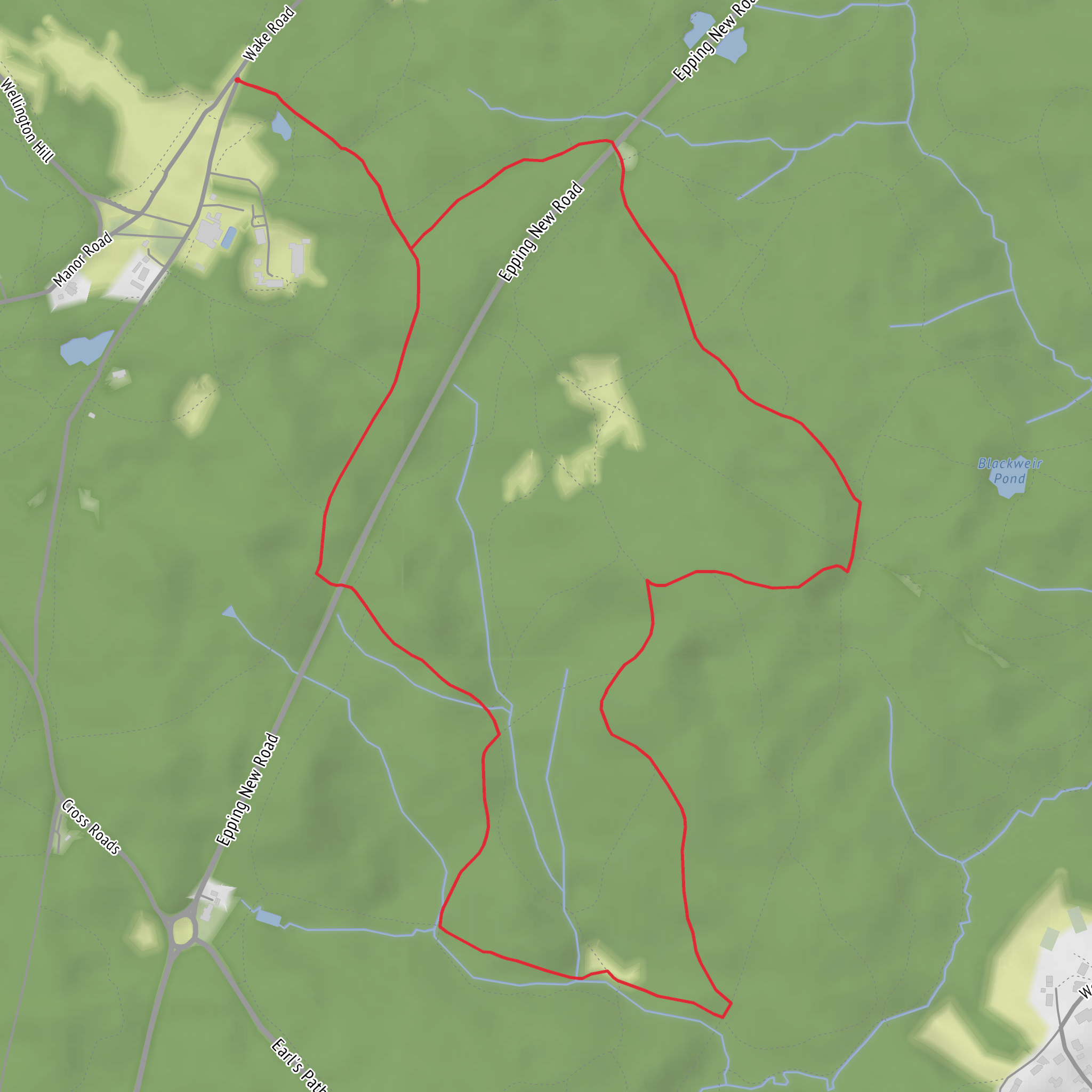
This easy loop covers about 4 km / 2.5 miles with roughly 100 m / 330 ft of ascent, making it a good short outing for walkers who want a modest climb, open views, and a route that feels varied without being demanding. Expect a mix of gently rising ground, short steeper pulls, and easier connecting sections as the loop works around Mount Pleasant and Broom Hill. With the elevation spread over a relatively short distance, the walk feels more like a steady ramble with a few uphill moments than a sustained climb.
The route is best suited to most walkers with basic fitness, including families with older children and anyone looking for a half-day walk rather than a full mountain day. Underfoot conditions are likely to change with the season: firmer paths in dry weather can become muddy or slick after rain, especially on shaded slopes, field-edge tracks, and any worn sections near gates or junctions. Footwear with decent grip is usually enough, but waterproof shoes or light boots are a sensible choice in wetter months.
What to expect on the route
From the start, the loop typically builds interest quickly rather than saving everything for the end. The first section is usually the easiest for settling into the walk, with a gradual rise that helps you gain height without much effort. As you move toward the higher ground around Mount Pleasant and Broom Hill, the landscape tends to open out, and this is where the route earns its character. Even on a short circuit, the higher points often provide the best sense of space, with views across surrounding countryside and a clearer feel for the shape of the local terrain.
The climb is modest at around 100 m / 330 ft total, but because the route is only about 4 km / 2.5 miles, some sections may feel a little sharper than the overall difficulty rating suggests. None of it should be technical, though walkers should still take care on loose gravel, wet grass, exposed roots, or uneven ruts. If visibility drops in mist or low cloud, a short route can still become confusing at path splits, so carrying the route in HiiKER is the simplest way to stay on line.
Once on or near the higher ground, look for the contrast between more exposed stretches and quieter, more sheltered sections. Short loops like this often alternate between open hillside, pasture or moor-edge terrain, and enclosed tracks bordered by hedges, scrub, or small woodland patches. That variety makes the walk feel longer and more rewarding than the distance alone suggests.
Landmarks, scenery, and wildlife
Mount Pleasant and Broom Hill suggest a route shaped by local high points rather than a single summit objective, so the main landmarks are likely to be the rises themselves, the changing views between them, and any old boundary features such as walls, hedgelines, gates, or track junctions. On a walk of this scale, the appeal often comes from subtle landscape details: the way the ground rolls, the shift from enclosed approach paths to broader outlooks, and the sense of moving through a lived-in rural landscape rather than remote backcountry.
Nature will vary by season, but walkers should watch for common upland and farmland birdlife such as skylarks, crows, finches, and raptors riding thermals over open ground. In spring and summer, hedgerows and grassy margins may support butterflies, bees, and a good range of wildflowers. In damper or quieter corners, rabbits and small mammals are often more noticeable than larger wildlife. If there are patches of gorse, broom, or rough grassland along the route, these can add color and shelter for birds and insects, especially in warmer months.
Because this is an easy countryside loop rather than a remote wilderness hike, the main things to look out for are practical rather than dramatic: livestock in fields, muddy gateways, electric fencing, and the possibility of overgrown path edges in late summer. Ticks can also be present in long grass and scrubby areas, so it is worth checking clothing and legs after the walk.
Historical background
The historical interest of a route like this usually lies in the landscape itself. Names such as Mount Pleasant and Broom Hill often preserve older local descriptions: “Mount Pleasant” commonly refers to a viewpoint or favored rise, while “Broom Hill” points to ground where broom, a shrubby yellow-flowering plant, was once prominent or remains part of the vegetation pattern. Place-names like these can reflect centuries of local land use, farming, and wayfinding.
In many parts of Britain and Ireland, short hill loops of this kind pass through countryside shaped by long agricultural history, with old field systems, boundary lines, cart tracks, and settlement patterns still visible in the modern walking landscape. Even where there are no major ruins or monuments directly on the route, the walk can still offer a strong sense of historic rural land management through its lanes, walls, hedges, and path align
What to expect?
Surfaces
Unknown
Dirt
Comments and Reviews
User comments, reviews and discussions about the Mount Pleasant and Broom Hill Loop, England.
average rating out of 5
0 rating(s)


