Download
3D Flyover
Add to list
More
14.5 km
~3 hrs 51 min
574 m
Loop
“Explore the Belle Tout and Flagstaff Point trail for stunning views, historical landmarks, and vibrant wildlife.”
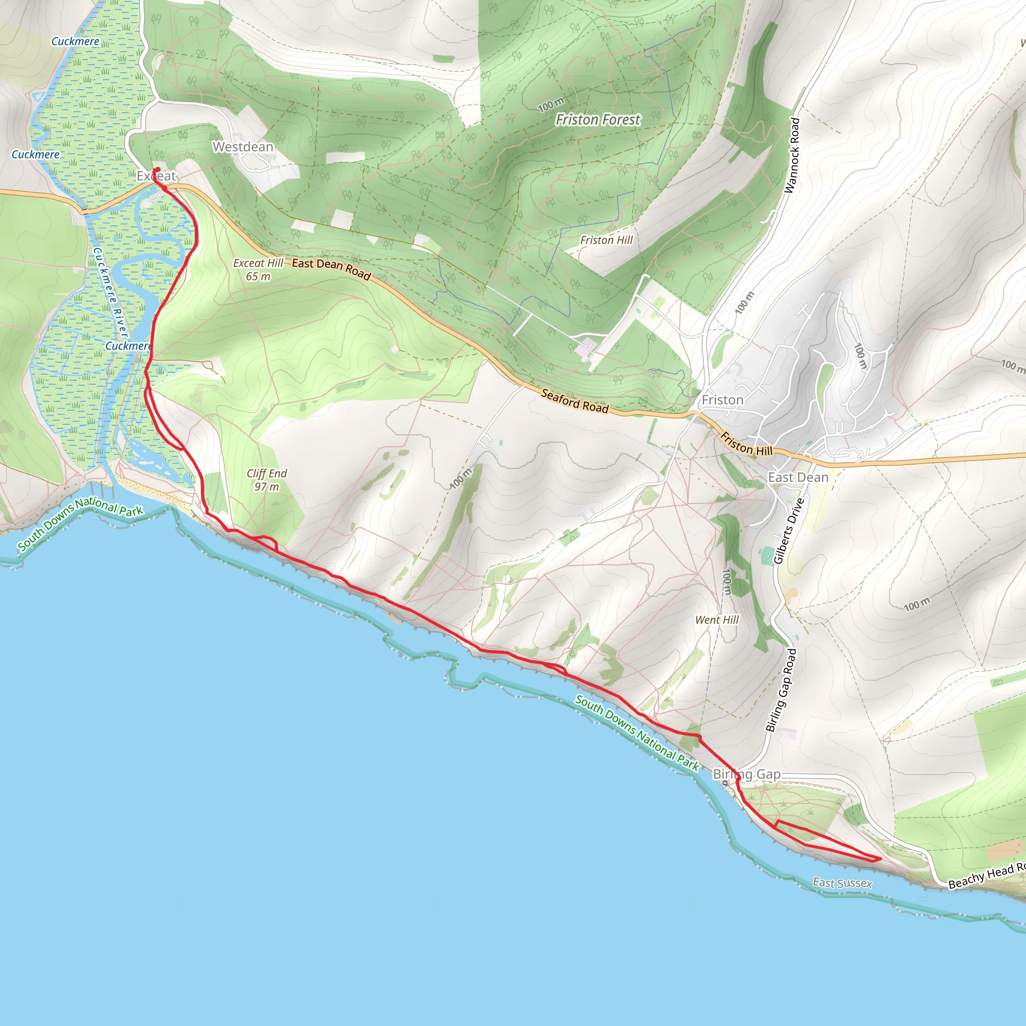
Starting near East Sussex, England, the Belle Tout and Flagstaff Point via England Coast Path is a captivating loop trail that spans approximately 15 km (around 9.3 miles) with an elevation gain of about 500 meters (1,640 feet). This medium-difficulty hike offers a blend of stunning coastal views, historical landmarks, and diverse wildlife, making it a must-visit for any hiking enthusiast.
Getting There
To reach the trailhead, you can either drive or use public transport. If driving, head towards Eastbourne in East Sussex and follow signs to Beachy Head Road. There is parking available near the Beachy Head Pub, which serves as a convenient starting point. For those using public transport, Eastbourne Railway Station is the nearest major station. From there, you can take a local bus or taxi to Beachy Head.
Trail Overview
The trail begins near the Beachy Head Pub, a well-known landmark. From here, you will head west along the England Coast Path, which offers breathtaking views of the English Channel. The path is well-marked, but it's advisable to use HiiKER for navigation to ensure you stay on track.
Belle Tout Lighthouse
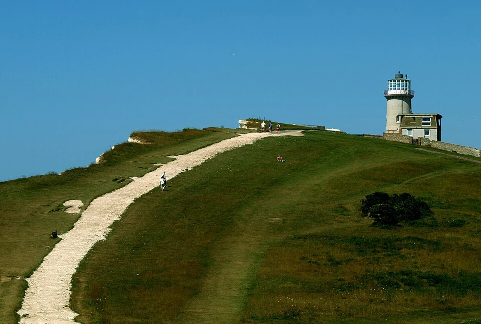
At approximately 3 km (1.9 miles) into the hike, you will encounter the Belle Tout Lighthouse. This historic lighthouse, originally built in 1832, has been decommissioned but remains a significant landmark. It was famously moved inland in 1999 to prevent it from falling into the sea due to coastal erosion. The lighthouse now serves as a unique bed and breakfast, and its location offers panoramic views of the coastline.
Flagstaff Point
Continuing along the trail, you will reach Flagstaff Point at around the 7 km (4.3 miles) mark. This area is known for its dramatic cliffs and expansive sea views. It's a great spot to take a break and enjoy the scenery. The elevation gain here is noticeable, so be prepared for some steep sections.
Wildlife and Flora
The trail is rich in wildlife and flora. Keep an eye out for seabirds such as kittiwakes and fulmars, which nest along the cliffs. The chalk grasslands are home to various wildflowers, including orchids and rare species like the Adonis blue butterfly. During the spring and summer months, the area is particularly vibrant with blooming flowers and active wildlife.
Historical Significance
The region is steeped in history. The cliffs of Beachy Head have been a significant navigational landmark for centuries. During World War II, the area was heavily fortified, and remnants of wartime bunkers and pillboxes can still be seen along the trail. These historical elements add an intriguing layer to your hike, offering a glimpse into the past.
Return Loop
As you make your way back towards the starting point, the trail loops inland, offering a different perspective of the landscape. The return path is less steep but equally scenic, passing through rolling hills and open fields. The final stretch brings you back to Beachy Head Road, completing the loop.
Preparation Tips
Given the elevation changes and coastal exposure, it's essential to wear sturdy hiking boots and bring layers to protect against wind and sudden weather changes. Carry enough water and snacks, as there are limited facilities along the trail. Using HiiKER for navigation will help you stay on course and make the most of your hike.
This trail offers a perfect blend of natural beauty, historical intrigue, and physical challenge, making it a rewarding experience for hikers of all levels.
What to expect?
Activity types
Comments and Reviews
User comments, reviews and discussions about the Belle Tout and Flagstaff Point via England Coast Path, England.
average rating out of 5
0 rating(s)
