Download
3D Flyover
Add to list
More
5.6 km
~1 hrs 11 min
44 m
Loop
“Explore serene water views and historic woodlands on the accessible Arlington Reservoir and Ludlay Coppice trail.”
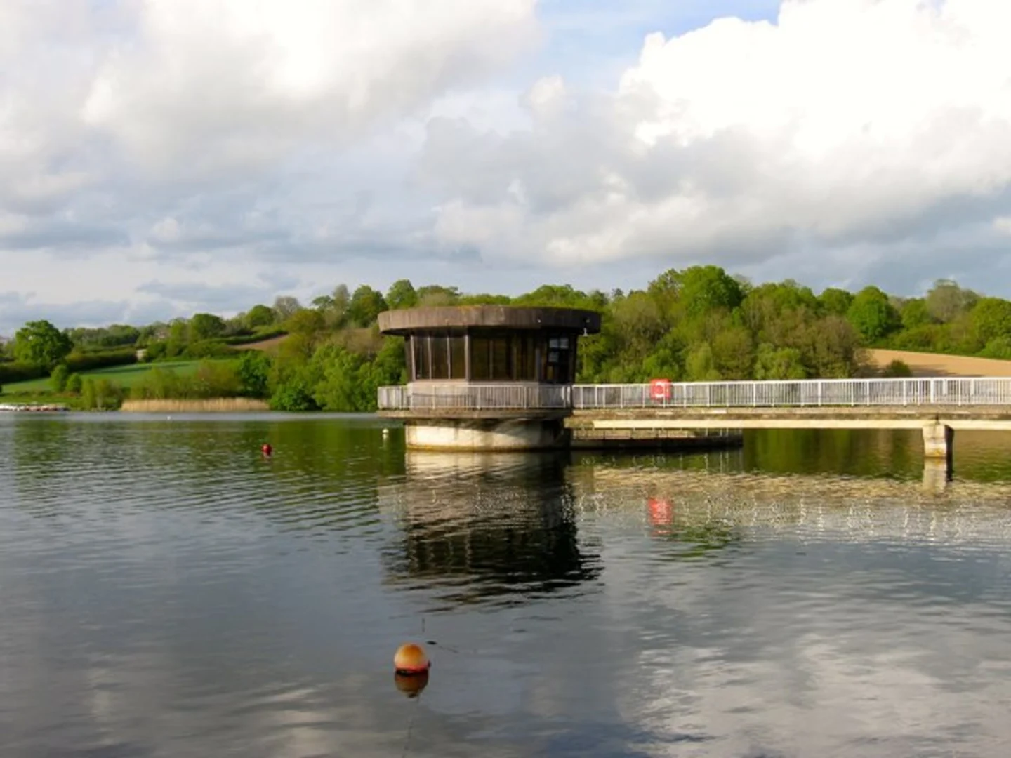
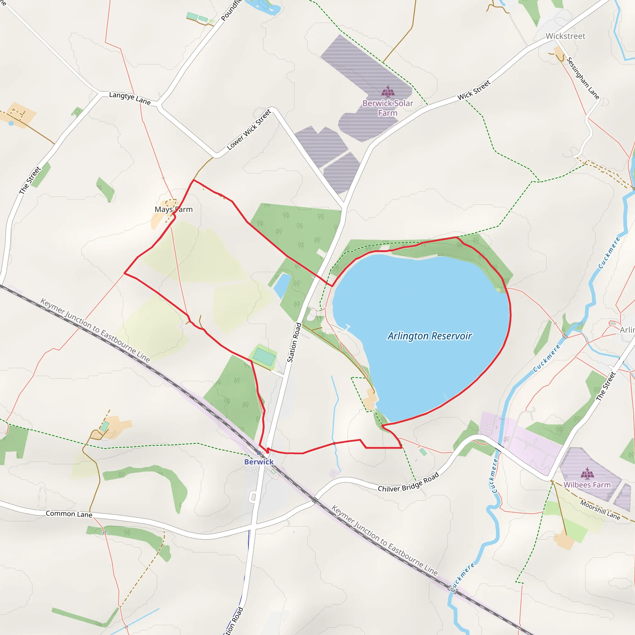
Starting your hike near East Sussex, England, the Arlington Reservoir and Ludlay Coppice trail offers a delightful 6 km (approximately 3.7 miles) loop with no significant elevation gain, making it accessible for a wide range of hikers. The trailhead is conveniently located near the Arlington Reservoir, a well-known landmark in the area.
Getting There
To reach the trailhead, you can drive and park at the Arlington Reservoir car park. If you prefer public transport, take a train to Berwick Station, which is the nearest railway station. From Berwick Station, it's a short taxi ride or a pleasant walk of about 2 km (1.2 miles) to the reservoir.
Trail Overview
The trail begins at the Arlington Reservoir, a serene spot known for its birdwatching opportunities. As you start your hike, you'll follow a well-marked path that loops around the reservoir. The first section of the trail is relatively flat and easy, making it a great warm-up. Keep an eye out for various species of waterfowl, including swans, ducks, and herons, which are commonly seen here.
Arlington Reservoir
Approximately 1 km (0.6 miles) into your hike, you'll reach the northern edge of the reservoir. This area is particularly scenic, offering panoramic views of the water and surrounding countryside. There are several benches along this stretch where you can take a break and enjoy the tranquility.
Ludlay Coppice
Continuing on, the trail leads you into Ludlay Coppice, a beautiful woodland area. The transition from open water to dense forest is quite striking. The coppice is home to a variety of wildlife, including deer, foxes, and numerous bird species. The forest floor is often carpeted with bluebells in the spring, adding a splash of color to your hike.
Historical Significance
Ludlay Coppice has historical significance dating back to medieval times when it was managed as a coppiced woodland. This traditional method of woodland management involved periodically cutting back trees to ground level to promote new growth, providing a sustainable source of timber and firewood. As you walk through the coppice, you may notice the multi-stemmed trees that are characteristic of this ancient practice.
Navigation and Safety
The trail is well-marked, but it's always a good idea to have a reliable navigation tool. HiiKER is an excellent app for this purpose, offering detailed maps and real-time tracking to ensure you stay on course. The trail is rated as medium difficulty, primarily due to its length rather than any challenging terrain.
Final Stretch
As you exit Ludlay Coppice, the trail loops back towards the reservoir. The final stretch offers more open views and a chance to spot additional wildlife. The path here is wide and well-maintained, making for an easy and enjoyable end to your hike.
Practical Tips
- Wear comfortable walking shoes, as the trail can be muddy in places, especially after rain.
- Bring water and snacks, as there are no facilities along the trail.
- Binoculars can enhance your birdwatching experience at the reservoir.
- Check the weather forecast before you go, as conditions can change rapidly.
This 6 km loop around Arlington Reservoir and through Ludlay Coppice offers a perfect blend of water views, woodland scenery, and historical interest, making it a rewarding hike for nature lovers and history enthusiasts alike.
What to expect?
Activity types
Comments and Reviews
User comments, reviews and discussions about the Arlington Reservoir and Ludlay Coppice, England.
average rating out of 5
0 rating(s)
