
Download
3D Flyover
Add to list
More
5.6 km
~1 hrs 7 min
0 m
Loop
“Big skies, shifting dunes, and quiet shores make this a gently reflective Lincolnshire coastal wander.”
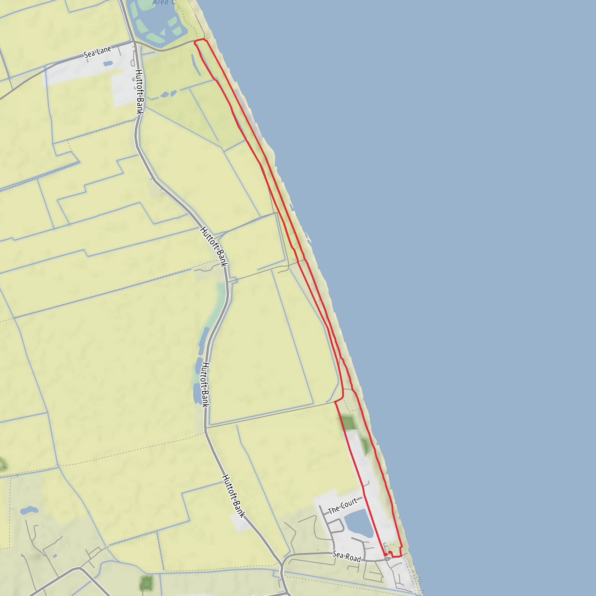
This easy coastal loop explores the quiet shoreline and dune-edge paths around Anderby Creek and Moggs Eye on the Lincolnshire coast, covering about 6 km / 3.7 miles with virtually no climbing—roughly 0 m / 0 ft of elevation gain. The route is generally flat throughout, making it suitable for families, casual walkers, and anyone looking for a relaxed outing rather than a strenuous hike. The usual start point is the Anderby Creek car park on Sea Road, Anderby Creek, Skegness PE24 5XU, which is the main access point used for walks in this part of the Lincolnshire Coastal Country Park. (visitlincolnshire.com)
From the start, the walk heads away from the car park past the seafront area and bungalows before joining tracks that run beside and behind the dunes. One of the distinctive features of this route is the transition between open beach, low dune systems, and quieter inland margins, so the scenery changes more than the modest distance might suggest. After the short built-up edge near Anderby Creek, the route reaches the dune-backed section known as Moggs Eye, where sandy tracks, marram grass, and broad coastal views become the dominant character of the walk. (visitlincolnshire.com)
What to expect on the route
Because the terrain is so level, the main challenge is usually not fitness but surface conditions. Depending on the exact line taken, walkers may encounter compact paths, sandy stretches, beach sections, and occasional uneven ground near dune margins. After wet or windy weather, sand can drift across paths and make footing slightly slower than the distance suggests. If part of the loop uses the beach, conditions are easiest on firmer sand at lower tide, while softer upper-beach sand can feel more tiring underfoot. Even on a short route, coastal wind can make the walk feel cooler and more exposed than expected. (visitlincolnshire.com)
A rough way to picture the outing is in three parts: an opening section from Anderby Creek through the seafront edge and access tracks; a middle stretch around Moggs Eye and the dunes at around 2 to 3 km / 1.2 to 1.9 miles into the walk; and a return leg that loops back toward Anderby Creek, often with wider sea views and a more open feel. With almost no ascent, most walkers can allow around 1.5 to 2 hours at an unhurried pace, longer if stopping for birdwatching, beachcombing, or photographs. This is a route where weather and tide matter more than gradient. (visitlincolnshire.com)
Landmarks, wildlife, and coastal character
The standout landmarks in this area are less about dramatic high points and more about the atmosphere of the Lincolnshire coast: long sandy beach, dune ridges, open skies, and the quiet, low-lying landscape of the Coastal Country Park. Anderby Creek itself is known for its peaceful seafront setting, while the Moggs Eye area gives the walk a wilder feel, especially where the path runs along the base of the dunes. Nearby features in the wider coastal park include visitor facilities, nature reserves, and art or interpretation points that reflect the area’s natural history. (visitlincolnshire.com)
Wildlife is one of the main reasons to slow down here. The wider Lincolnshire Coastal Country Park includes multiple wildlife-rich reserves, with habitats ranging from dunes to grazing marsh and reedbed, supporting birdlife throughout the year. On this loop, walkers should watch for seabirds and shorebirds along the beach, as well as smaller birds using the dune vegetation and scrubby edges for shelter. In quieter seasons, the sense of space is especially strong, and the area can feel notably remote despite the easy access. (visitlincolnshire.com)
The coast here is also dynamic. Wind, tides, and shifting sand continually reshape the beach margins, so the exact feel of the shoreline can vary from one visit to the next. That changing coastline is part of the appeal, but it also means walkers should be alert to soft sand, eroded dune edges, and any temporary access changes. For navigation, it is best to check the route carefully in HiiKER before setting out. (visitlincolnshire.com)
History and local significance
This stretch of coast has a layered history shaped by the sea, settlement, and land reclamation. The broader Lincolnshire coast has long been influenced by efforts to manage marshland and create usable grazing land inland from the shore, and that reclaimed coastal landscape still defines the character of the area today. Place-name evidence in nearby Huttoft points to Anglo-Norse influence, reflecting the Scandinavian connections found across parts of eastern England. (awayresorts.co.uk)
Moggs Eye also has archaeological interest. Historic England has documented timber remains found on the beach there, investigated as a putative Viking Age ship’s timber. While this is
What to expect?
Surfaces
Unknown
Sand
Grass
Concrete
Asphalt
Paved
Comments and Reviews
User comments, reviews and discussions about the Anderby Creek Loop via Moggs Eye, England.
average rating out of 5
0 rating(s)


