
Download
3D Flyover
Add to list
More
5.2 km
~1 hrs 17 min
156 m
Loop
“A punchy Downs loop with sweeping chalk ridges, airy views, and a wilder feel than expected.”
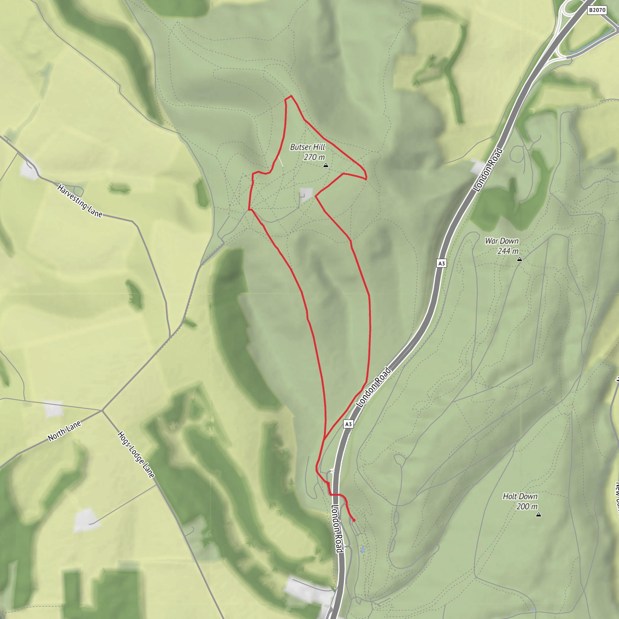
This 5 km / 3.1 mile loop on Butser Hill packs a lot into a relatively short outing: a steepish climb or two, broad chalk downland, sweeping ridge views, and a real sense of walking across one of the most important hilltops in the South Downs. With around 200 metres / 656 feet of ascent, it feels more demanding than the distance suggests, so “medium” is a fair rating, especially in wet or windy weather when the exposed slopes can make the route feel tougher. Butser Hill rises to about 270–271 metres / 886–889 feet and is the highest point in Hampshire and one of the highest points on the South Downs ridge, so even a short circuit here has a big-landscape feel. (southdowns.gov.uk)
The start is best understood as being near Butser Hill car park, Butser Hill, near Petersfield, Hampshire, or alternatively near the Queen Elizabeth Country Park Visitor Centre, Gravel Hill, Horndean, PO8 0QE, if approaching from the lower park. Official visitor information for Butser Hill points walkers either to the hilltop car park or to Queen Elizabeth Country Park at the foot of the hill just off the A3. (southdowns.gov.uk)
By car, the simplest approach is via the A3, using the signed access for Queen Elizabeth Country Park / Butser Hill. Parking is available at the top on Butser Hill and also at Queen Elizabeth Country Park; current visitor information notes that parking charges apply. If you want the shortest access to the loop itself, the hilltop parking area is usually the most convenient. (southdowns.gov.uk)
By public transport, the most practical rail hub is Petersfield railway station, which has onward road access toward Queen Elizabeth Country Park and Butser Hill. The area is also linked to wider South Downs walking routes from Queen Elizabeth Country Park, making taxi or local bus connections the usual final leg if you are not driving. For planning the exact approach to the trailhead and checking path lines on the hill, HiiKER is the best tool to use before setting out. (southdowns.gov.uk)
What the route feels like
Expect a route that alternates between open hilltop walking and descending into the folds of the downland around Hilhampton Bottom. The terrain is typically chalk and grass, with some worn paths and potentially slippery sections after rain. Chalk can be deceptively slick, especially on steeper gradients, so footwear with reliable grip matters more here than the modest distance might suggest. Because the hill is so exposed, wind can be a bigger factor than mud; even on a bright day, the summit area can feel noticeably cooler than the sheltered lower slopes. Official guidance for walks on the hill specifically warns that the top is very exposed and recommends layers and waterproofs. (hants.gov.uk)
A loop of around 5 km / 3.1 miles with 200 metres / 656 feet of climbing will usually take most walkers about 1.5 to 2 hours at a relaxed pace, longer if you stop often for views, wildlife, or photography. The climbing is concentrated enough that it can feel punchy rather than gradual. If the route begins near the top, you may first contour or descend before re-climbing; if you begin lower down from Queen Elizabeth Country Park, the ascent to the ridge is more sustained. Either way, this is not a flat stroll despite the short mileage.
Landmarks, views, and route character
Butser Hill’s main attraction is the sense of height and openness. On clear days, the summit and upper slopes give wide views across the South Downs and surrounding Hampshire countryside. The hill is also known for dark skies and panoramic horizons, which says a lot about how open the landscape is. (southdowns.gov.uk)
Hilhampton Bottom adds contrast to the route. In downland terms, a “bottom” is a dry valley, and this part of the walk gives you that classic South Downs shape: rounded ridges, steep chalk sides, and sheltered hollows that feel very different from the breezy crest above. South Downs National Park material also notes work at Hilhampton Down to create and improve routes through the hillside, including areas around yew woodland, so this section can feel more varied and enclosed than the open summit. (southdowns.gov.uk)
You may also encounter or pass near Grandfather’s Bottom, another dramatic chalk scarp feature associated with Butser Hill. Even if your exact loop does not fully enter it, the surrounding slopes help explain why this area is so visually striking: the land drops and folds sharply, creating some of the most memorable relief on this part of the Downs. (southdowns.gov.uk)
Nature and wildlife
This is an excellent walk for anyone interested in chalk grassland. Butser Hill is a biological and geological Site of Special Scientific Interest and also a **National Nature
What to expect?
Surfaces
Unknown
Grass
Unpaved
Asphalt
Comments and Reviews
User comments, reviews and discussions about the Butser Hill and Hilhampton Bottom Loop, England.
average rating out of 5
0 rating(s)

