Download
Preview
Add to list
More
7.1 km
~1 hrs 50 min
257 m
Loop
“Explore Devon's natural beauty and history on a scenic 7 km loop from Fingle Bridge.”
Starting near the charming village of Fingle Bridge in Devon, England, the River Teign and Hunter's Path trail offers a delightful 7 km (4.3 miles) loop with an elevation gain of approximately 200 meters (656 feet). This medium-difficulty hike is perfect for those looking to explore the natural beauty and historical richness of the area.
Getting There
To reach the trailhead, you can drive to Fingle Bridge, where there is a small car park available. For those using public transport, the nearest train station is in Exeter, from where you can take a bus to Moretonhampstead and then a taxi to Fingle Bridge.
Trail Overview
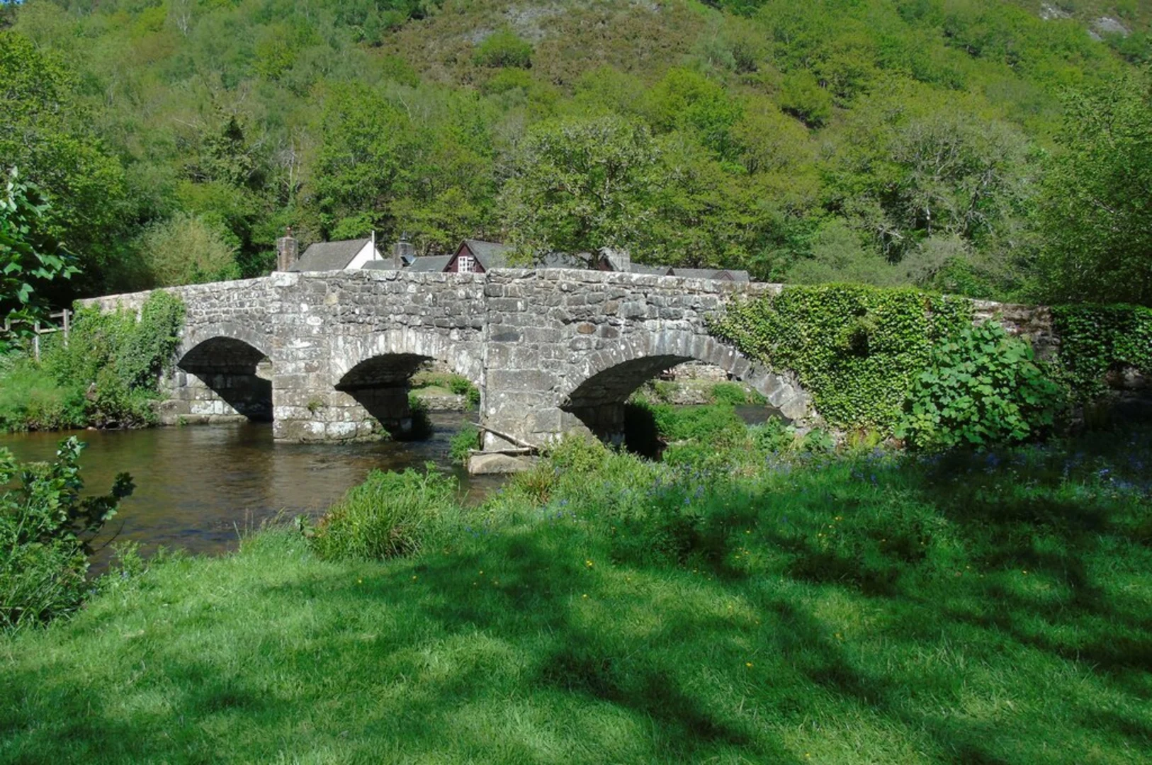
The trail begins at Fingle Bridge, a picturesque stone bridge that dates back to the 17th century. From here, you will follow the River Teign upstream, enjoying the serene sounds of flowing water and the lush greenery that lines the riverbanks. The path is well-marked and relatively flat for the first 2 km (1.2 miles), making it an easy start.
Nature and Wildlife
As you hike along the river, keep an eye out for kingfishers darting across the water and otters playing along the banks. The area is also home to a variety of bird species, including buzzards and woodpeckers. In the spring and summer months, the trail is adorned with wildflowers, adding a splash of color to your journey.
Climbing Hunter's Path
After approximately 2 km (1.2 miles), the trail begins to ascend as you approach Hunter's Path. This section is more challenging, with a steady climb that gains about 150 meters (492 feet) in elevation over the next 1.5 km (0.9 miles). The effort is well worth it, as the path offers stunning views over the Teign Gorge and the surrounding Dartmoor landscape.
Historical Significance
Hunter's Path is steeped in history, having been used by hunters and poachers for centuries. The path winds through ancient woodlands, where you can still see remnants of old hunting lodges and boundary stones. This area was once part of the extensive hunting grounds of the local gentry, and the landscape has remained largely unchanged for hundreds of years.
Returning to Fingle Bridge
After reaching the highest point of the trail, the path begins to descend back towards the river. This section is less steep but can be slippery in wet conditions, so take care as you make your way down. The descent offers more beautiful views and eventually brings you back to the riverbank.
Final Stretch
The final 2 km (1.2 miles) of the trail are relatively flat and follow the river back to Fingle Bridge. This is a great opportunity to relax and enjoy the peaceful surroundings before completing your hike. The loop ends where it began, at the historic Fingle Bridge, where you can take a moment to rest and perhaps enjoy a picnic by the river.
Navigation
For those looking to ensure they stay on track, the HiiKER app is an excellent tool for navigation. It provides detailed maps and real-time tracking to help you navigate the trail with confidence.
This hike offers a perfect blend of natural beauty, wildlife, and historical intrigue, making it a must-do for anyone visiting the Devon area.

What to expect?
Activity types
Comments and Reviews
User comments, reviews and discussions about the River Teign and Hunter's Path, England.
4.0
average rating out of 5
1 rating(s)