Download
Preview
Add to list
More
10.8 km
~2 hrs 37 min
281 m
Loop
“The Woodhead Reservoir Loop offers a moderately challenging hike through stunning moorlands, woodland, and historical sites.”
Starting near Derbyshire, England, the Woodhead Reservoir Loop is a captivating 11 km (approximately 6.8 miles) trail that offers a moderate challenge with an elevation gain of around 200 meters (656 feet). This loop trail is perfect for those looking to immerse themselves in the serene beauty of the Peak District National Park.
Getting There
To reach the trailhead, you can drive or use public transport. If driving, set your GPS to the Woodhead Reservoir car park, located near the A628 road. For those using public transport, the nearest significant landmark is the town of Glossop. From Glossop, you can take a local bus towards the Woodhead Reservoir area, with the closest bus stop being near the A628 road.
Trail Overview
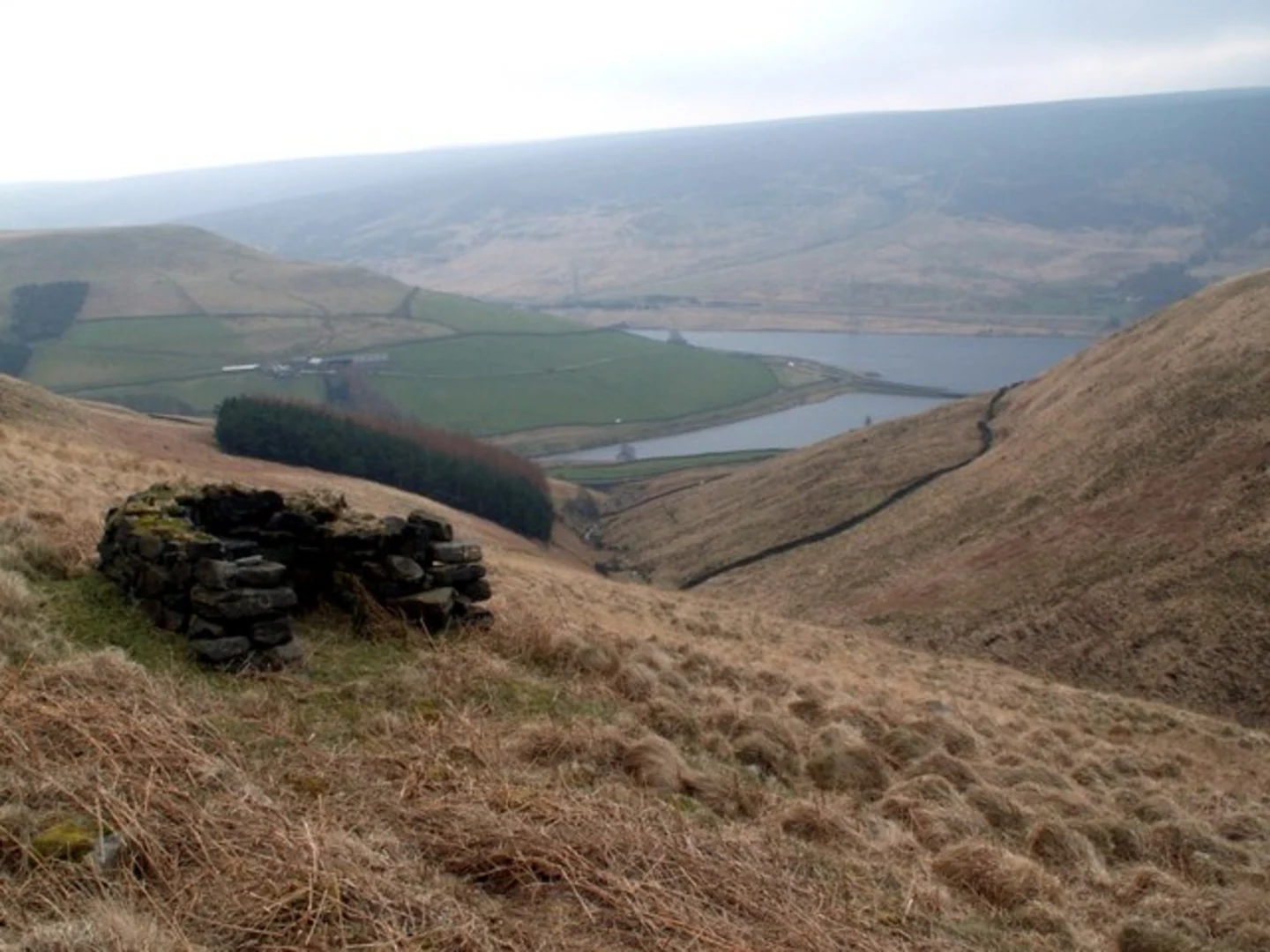
The trail begins at the car park near the Woodhead Reservoir, a significant water body that has been a crucial part of the region's water supply system since the 19th century. The reservoir itself is a sight to behold, with its calm waters reflecting the surrounding hills and sky.
Key Sections and Landmarks
- Initial Ascent: The first part of the trail involves a gentle ascent, offering panoramic views of the reservoir and the surrounding moorlands. This section is about 2 km (1.2 miles) long and gains approximately 50 meters (164 feet) in elevation.
- Moorland Path: As you continue, the trail takes you through open moorland, characterized by heather and peat bogs. This area is home to various bird species, including the red grouse and curlew. This section is relatively flat and stretches for about 3 km (1.9 miles).
- Historical Significance: Around the 5 km (3.1 miles) mark, you'll come across remnants of old stone structures, which are believed to be part of ancient settlements. This area provides a glimpse into the region's rich history, dating back to the Bronze Age.
- Woodland Stretch: The trail then descends into a wooded area, where you can enjoy the shade of oak and birch trees. This section is about 2 km (1.2 miles) long and includes a gentle descent of around 50 meters (164 feet).
- Reservoir Edge: The final part of the loop takes you along the edge of the reservoir, offering stunning views of the water and the surrounding hills. This section is approximately 4 km (2.5 miles) long and relatively flat, making for a relaxing end to your hike.
Wildlife and Flora
The Woodhead Reservoir Loop is a haven for nature enthusiasts. The moorlands are covered in heather, which blooms in late summer, painting the landscape in shades of purple. Keep an eye out for wildlife such as red deer, foxes, and a variety of bird species. The reservoir itself is a popular spot for birdwatching, with species like the great crested grebe and tufted duck often spotted.
Navigation
For navigation, it is highly recommended to use the HiiKER app, which provides detailed maps and real-time updates to ensure you stay on track. The trail is well-marked, but having a reliable navigation tool can enhance your hiking experience.
Preparation Tips
- Footwear: Given the varied terrain, sturdy hiking boots are recommended.
- Weather: The weather in the Peak District can be unpredictable, so pack layers and waterproof gear.
- Supplies: Bring enough water and snacks, as there are no facilities along the trail.
- Safety: Always inform someone of your hiking plans and estimated return time.
The Woodhead Reservoir Loop offers a perfect blend of natural beauty, historical intrigue, and moderate physical challenge, making it a must-visit for hikers exploring the Peak District.

What to expect?
Activity types
Comments and Reviews
User comments, reviews and discussions about the Woodhead Reservoir Loop, England.
4.5
average rating out of 5
4 rating(s)