Download
3D Preview
Add to list
More
24.8 km
~5 hrs 37 min
404 m
Loop
“Discover a 25 km loop trail blending natural beauty, historical landmarks, and diverse wildlife around Derbyshire.”
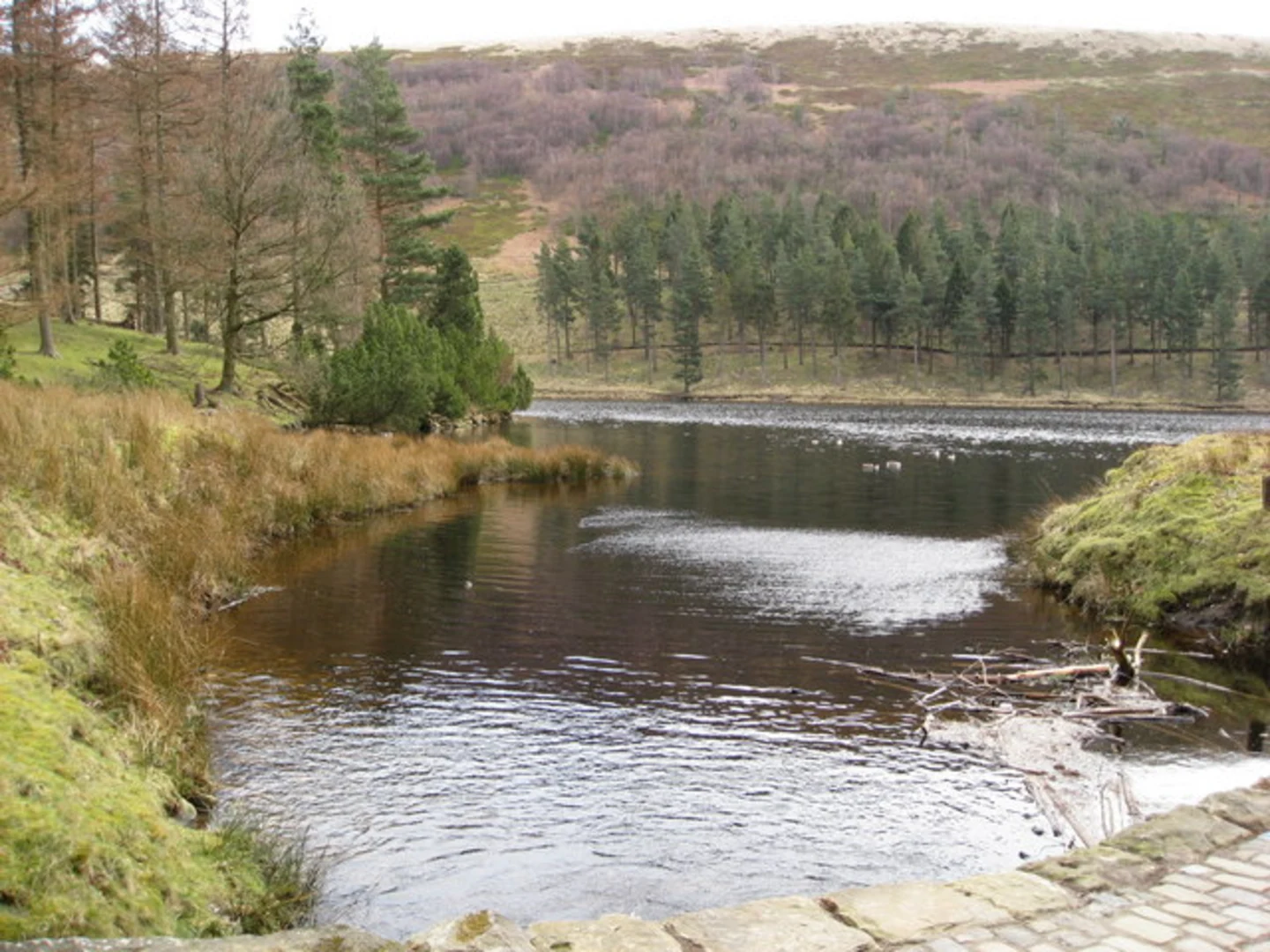
Starting near Derbyshire, England, the Ladybower and Howden Reservoir Loop is a captivating 25 km (15.5 miles) loop trail with an elevation gain of approximately 400 meters (1,312 feet). This medium-difficulty hike offers a blend of natural beauty, historical landmarks, and diverse wildlife, making it a rewarding experience for outdoor enthusiasts.
Getting There
To reach the trailhead, you can drive or use public transport. If driving, head towards the Ladybower Reservoir, which is well-signposted from the A57. There are several car parks available near the reservoir. For those using public transport, the nearest major town is Sheffield. From Sheffield, you can take a bus to Bamford or Hope, and then a taxi or local bus to the Ladybower Reservoir.
Trail Overview
The loop begins near the Ladybower Reservoir, a significant landmark in its own right. Constructed between 1935 and 1943, the reservoir is famous for its role in the Dambusters training missions during World War II. The trail initially follows the reservoir's edge, offering stunning views of the water and surrounding hills.
Key Sections and Landmarks
Ladybower Reservoir to Derwent Dam
The first section of the trail takes you along the western edge of Ladybower Reservoir. After approximately 5 km (3.1 miles), you'll reach the Derwent Dam. This dam is historically significant as it was used by the RAF's 617 Squadron for practice runs before the famous Dambusters raid. The dam's impressive architecture and the surrounding scenery make it a perfect spot for a short break.
Derwent Dam to Howden Reservoir
Continuing north, the trail leads you to the Howden Reservoir. This section is about 7 km (4.3 miles) long and involves a gradual ascent, gaining around 150 meters (492 feet) in elevation. The path here is well-maintained and offers panoramic views of the Upper Derwent Valley. Keep an eye out for local wildlife, including red deer and various bird species.
Howden Reservoir to Alport Castles
From Howden Reservoir, the trail heads west towards Alport Castles, one of the largest landslides in the UK. This geological marvel is approximately 6 km (3.7 miles) from Howden Reservoir and involves another 150 meters (492 feet) of elevation gain. The rugged terrain and unique rock formations make this a highlight of the hike.
Alport Castles to Ladybower Reservoir
The final leg of the loop takes you back towards Ladybower Reservoir, covering around 7 km (4.3 miles). This section is mostly downhill, offering a gentle descent through lush woodlands and open moorlands. As you approach the reservoir, you'll pass through picturesque villages like Ashopton, which was submerged during the reservoir's construction but still holds historical significance.
Navigation and Safety
Given the trail's length and varied terrain, it's advisable to use a reliable navigation tool like HiiKER to stay on track. The weather in this region can be unpredictable, so come prepared with appropriate clothing and gear. Ensure you have enough water and snacks, as there are limited facilities along the route.
Flora and Fauna
The Ladybower and Howden Reservoir Loop is rich in biodiversity. The woodlands are home to oak, birch, and pine trees, while the moorlands are covered in heather and bilberry. Wildlife enthusiasts can spot red deer, badgers, and a variety of bird species, including peregrine falcons and red grouse.
Historical Significance
The reservoirs themselves are steeped in history, particularly related to World War II. The Derwent Dam's role in the Dambusters training missions adds a layer of historical intrigue to the hike. Additionally, the submerged villages of Derwent and Ashopton offer a poignant reminder of the area's past.
This trail offers a perfect blend of natural beauty, historical landmarks, and diverse wildlife, making it a must-visit for hikers of all levels.

What to expect?
Activity types
Comments and Reviews
User comments, reviews and discussions about the Ladybower and Howden Reservoir Loop, England.
4.8
average rating out of 5
5 rating(s)