Kinder Reservoir, Kinder Downfall, Kinder Low and South Head Loop - Hill Houses
Download
Preview
Add to list
More
16.7 km
~4 hrs 25 min
657 m
Loop
“Explore a scenic, 17 km loop trail from Hayfield with challenging climbs, stunning views, and historical significance.”
Starting near Derbyshire, England, this 17 km (approximately 10.5 miles) loop trail offers a moderately challenging hike with an elevation gain of around 600 meters (about 1,970 feet). The trailhead is accessible by car, with parking available near the village of Hayfield. For those using public transport, buses from Manchester and Sheffield serve Hayfield, making it a convenient starting point.
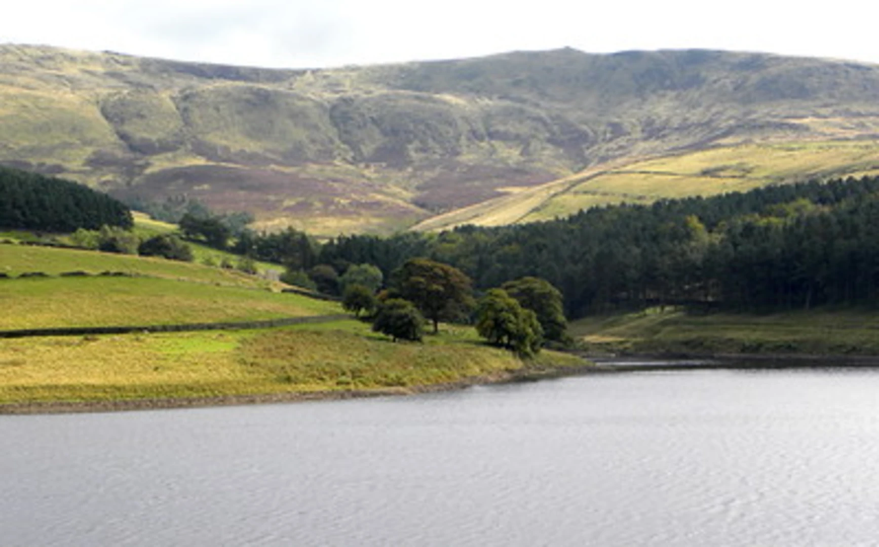
Initial Ascent and Kinder Reservoir
The hike begins with a gentle ascent towards Kinder Reservoir. This initial section is relatively easy, allowing you to warm up before the more strenuous parts of the trail. The reservoir itself is a picturesque spot, surrounded by rolling hills and offering a serene setting. It's a great place to take a short break and enjoy the views.
Kinder Downfall
Continuing from the reservoir, the trail becomes steeper as you approach Kinder Downfall, the highest waterfall in the Peak District. This section is about 4 km (2.5 miles) from the start and involves a significant elevation gain. The waterfall is particularly impressive after heavy rain, as the water cascades down the rocky cliffs. Be cautious here, as the rocks can be slippery.
Kinder Low
From Kinder Downfall, the trail leads you to Kinder Low, the highest point on the Kinder Scout plateau. This section is around 6 km (3.7 miles) into the hike and offers panoramic views of the surrounding landscape. The terrain here is rugged and can be challenging, so sturdy hiking boots are recommended. The plateau is also home to various bird species, including the red grouse and the golden plover, making it a great spot for birdwatching.
South Head
After enjoying the views from Kinder Low, the trail descends towards South Head. This section is approximately 10 km (6.2 miles) from the start and involves a mix of rocky and grassy terrain. South Head offers another excellent vantage point, with views stretching across the Peak District. The descent can be steep in places, so take your time and watch your footing.
Return to Hayfield
The final leg of the hike takes you back towards Hayfield, completing the loop. This section is about 7 km (4.3 miles) and is mostly downhill, allowing for a more relaxed pace. Along the way, you'll pass through fields and woodlands, offering a variety of landscapes to enjoy. Keep an eye out for local wildlife, including deer and various bird species.
Historical Significance
The Kinder Scout area is historically significant, as it was the site of the 1932 Mass Trespass, a pivotal event in the history of public access to the countryside in England. This act of civil disobedience led to increased public rights of way and the eventual establishment of national parks. As you hike, you'll be walking through a landscape that played a crucial role in the fight for public access to natural spaces.
Navigation
For navigation, it's highly recommended to use HiiKER, which provides detailed maps and real-time tracking to ensure you stay on the right path. The trail is well-marked, but having a reliable navigation tool can be invaluable, especially in poor weather conditions.
This loop trail offers a mix of natural beauty, challenging terrain, and historical significance, making it a rewarding hike for those prepared for a moderately strenuous adventure.

What to expect?
Activity types
Comments and Reviews
User comments, reviews and discussions about the Kinder Reservoir, Kinder Downfall, Kinder Low and South Head Loop - Hill Houses, England.
5.0
average rating out of 5
5 rating(s)