Download
3D Flyover
Add to list
More
9.9 km
~2 hrs 30 min
319 m
Loop
“Explore the enchanting Grindleford to Cuber Loop, a 10 km hike blending natural beauty, history, and moderate challenge.”
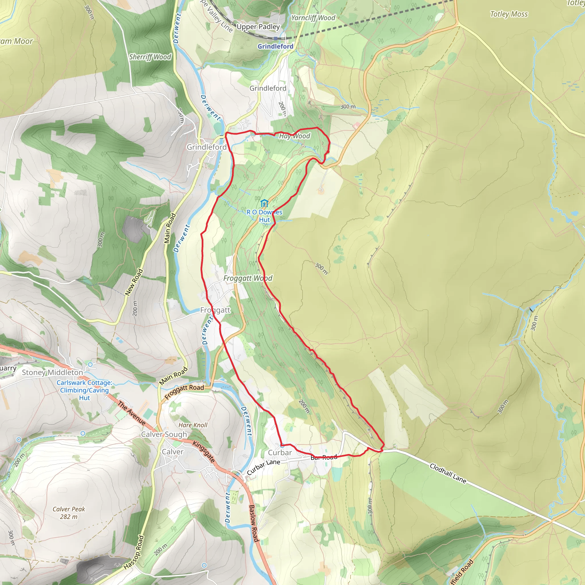
Starting near the picturesque village of Grindleford in Derbyshire, England, the Grindleford to Cuber Loop is a delightful 10 km (approximately 6.2 miles) trail with an elevation gain of around 300 meters (984 feet). This loop trail offers a medium difficulty rating, making it suitable for moderately experienced hikers.
Getting There
To reach the trailhead, you can either drive or use public transport. If driving, head towards Grindleford, which is easily accessible via the A625 road. Parking is available near the Grindleford Station, which is a convenient starting point. For those using public transport, Grindleford Station is well-served by trains from Sheffield and Manchester, making it a straightforward journey.
Trail Navigation
For navigation, it’s highly recommended to use the HiiKER app, which provides detailed maps and real-time updates to ensure you stay on track throughout your hike.
The Hike
The trail begins near Grindleford Station, where you’ll immediately be greeted by the lush greenery of the Peak District National Park. As you set off, the initial part of the trail is relatively flat, allowing you to ease into the hike. After about 1 km (0.6 miles), you’ll start to notice a gradual incline as you make your way towards Padley Gorge.
Padley Gorge
Padley Gorge is one of the first significant landmarks you’ll encounter. This enchanting area is known for its ancient woodland and babbling brook, making it a perfect spot for a short break. The gorge is also a haven for wildlife, including various bird species and small mammals. Keep an eye out for the striking dippers and grey wagtails that frequent the area.
Ascending to Cuber Edge
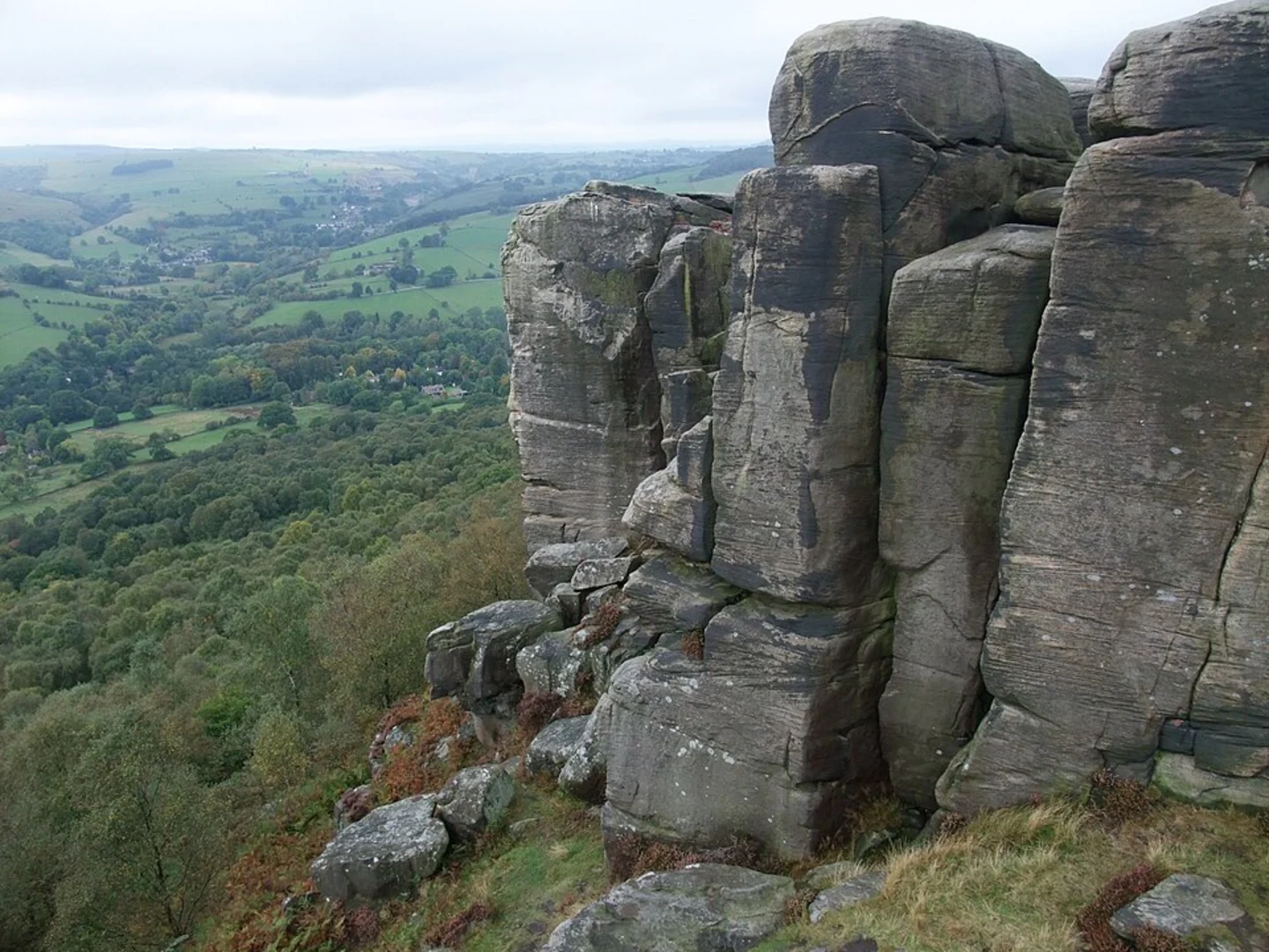
Continuing from Padley Gorge, the trail begins to ascend more steeply. Over the next 2 km (1.2 miles), you’ll gain significant elevation as you approach Cuber Edge. This section can be a bit challenging, but the effort is well worth it. Upon reaching Cuber Edge, you’ll be rewarded with panoramic views of the surrounding countryside. The edge itself is a gritstone escarpment, offering dramatic vistas that are particularly stunning at sunrise or sunset.
Historical Significance
Cuber Edge and the surrounding areas are steeped in history. The gritstone edges were once quarried for millstones, and you can still see remnants of this industrial past along the trail. Additionally, the area is dotted with ancient stone circles and burial mounds, providing a glimpse into the region’s prehistoric past.
Descending Back to Grindleford
After soaking in the views from Cuber Edge, the trail begins its descent back towards Grindleford. This section is less strenuous, allowing you to enjoy the serene landscape. As you descend, you’ll pass through open moorland and heather-clad hills, which are particularly beautiful in late summer when the heather is in full bloom.
Final Stretch
The final 2 km (1.2 miles) of the trail take you through more woodland and eventually back to the starting point near Grindleford Station. This section is relatively flat and provides a gentle end to your hike.
Flora and Fauna
Throughout the hike, you’ll encounter a diverse range of flora and fauna. The woodlands are home to oak, birch, and rowan trees, while the moorlands are dominated by heather and bilberry. Wildlife enthusiasts will appreciate the variety of birds, including kestrels, buzzards, and the occasional peregrine falcon.
Practical Tips
- Wear sturdy hiking boots, as the terrain can be uneven and rocky in places.
- Bring plenty of water and snacks, especially if you plan to take breaks and enjoy the scenery.
- Check the weather forecast before setting out, as conditions can change rapidly in the Peak District.
- Use the HiiKER app for navigation to ensure you stay on the correct path.
This trail offers a perfect blend of natural beauty, historical intrigue, and moderate physical challenge, making it a rewarding experience for any hiker.
What to expect?
Activity types
Comments and Reviews
User comments, reviews and discussions about the Grindleford to Cuber Loop, England.
4.33
average rating out of 5
3 rating(s)
