
Download
3D Flyover
Add to list
More
16.2 km
~3 hrs 44 min
302 m
Point to Point
“From Hawkshead’s hush to Windermere’s bustle, this varied Lakeland ramble feels gently wild and storied.”
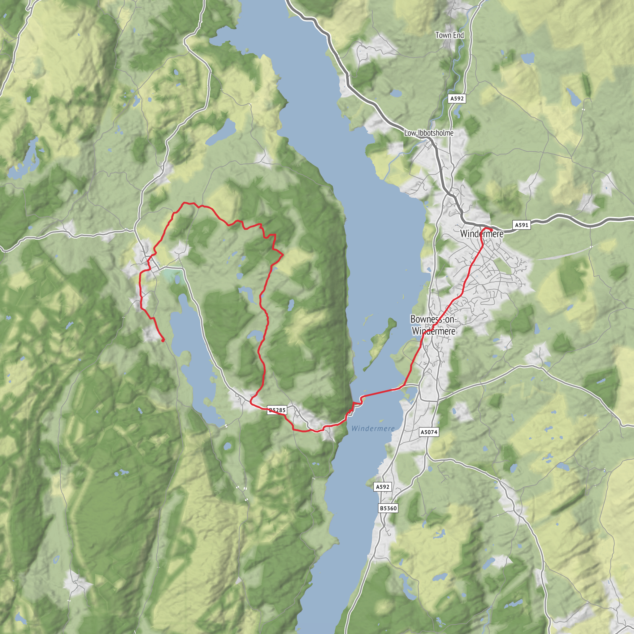
This medium-difficulty walk covers about 16 km / 10 miles with roughly 300 m / 985 ft of ascent, linking the quieter pastoral side of the Lake District with the better-known shores and transport hub around Windermere. It begins near YHA Hawkshead, Hawkshead, Ambleside LA22 0QD, just outside Hawkshead village, and threads through a landscape of field paths, low lanes, tarn-side tracks, woodland and open fell-edge ground before finishing around Windermere village and its bus/rail interchange. (maps.apple.com)
The character of the route is more varied than the modest elevation suggests. Rather than one long climb, expect a series of smaller rises and dips as you move between Hawkshead, the shores and viewpoints around Esthwaite Water, the wooded heights near Moss Eccles Tarn, and the descent toward Windermere. Underfoot, conditions can change quickly: village lanes and farm tracks may be straightforward, but woodland paths can be rooty, muddy and slick after rain, and short road sections demand care, especially where lanes narrow and traffic appears suddenly around bends. This is a route where waterproof footwear and a reliable route guide on HiiKER are especially useful. (nationaltrust.org.uk)
Setting out from Hawkshead
Starting near YHA Hawkshead places you close to one of the Lake District’s most historically rich villages. Hawkshead grew as a medieval market settlement and later became closely associated with education and literature; William Wordsworth attended Hawkshead Grammar School here, and the village still retains its compact pattern of whitewashed houses, narrow ginnels and old courtyards. The opening section is usually gentle, giving you time to settle into the walk while looking out across the pastoral basin around Esthwaite Water. (en.wikipedia.org)
Esthwaite Water is one of the quieter lakes in the national park, lying south of Hawkshead between Windermere and Coniston Water. Unlike the more dramatic high-fell settings elsewhere in Lakeland, this area feels softer and more intimate: hedged fields, mixed woodland, reed-fringed water and low undulating ground. That makes it especially rewarding in changeable weather, when cloud can obscure the bigger summits but the local scenery still feels rich and atmospheric. (en.wikipedia.org)
As you work around the Esthwaite side of the route, expect intermittent lake views rather than a continuous shoreline walk. Some sections are enclosed by walls, hedges or woodland, then suddenly open to broad views across the water toward Hawkshead, the Sawrey area and the wooded ridge of Claife Heights. Birdlife is one of the highlights here: reedbeds, wet margins and quieter water attract waterfowl and other wetland species, so binoculars are worth carrying if you enjoy wildlife watching. (thelakedistrict.org)
Esthwaite Water to Moss Eccles Tarn
The middle part of the walk is often the most memorable. As the route leaves the more open farmland around Esthwaite Water and heads toward the Sawrey side, the atmosphere shifts into classic Beatrix Potter country. Moss Eccles Tarn sits between Esthwaite Water and Windermere and is now owned by the National Trust. It is widely associated with Potter, who bought part of the tarn in 1926, planted water lilies there and stocked it with fish; the tarn and surrounding landscape are often linked with the inspiration behind The Tale of Mr. Jeremy Fisher. (nationaltrust.org.uk)
Moss Eccles Tarn itself is small, enclosed and unexpectedly tranquil, especially compared with the busier lakes nearby. The approach is usually through mixed woodland and rougher tracks, and this is where navigation deserves more attention. Junctions through the Claife Heights area can be less obvious than the map suggests, particularly in leaf fall, mist or after prolonged wet weather when side paths look similar. Keep an eye on direction changes and avoid assuming the broadest track is always the correct one. (walklakes.co.uk)
This section also carries much of the route’s cumulative ascent. None of the climbs are severe, but they can feel more tiring than expected because they come in short pulls rather than one obvious hill. Walkers should budget time for pauses here, both for navigation and for enjoying the scenery. In still conditions, the tarn can be beautifully reflective; in wet or windy weather, the woods offer some shelter, though exposed clearings can still feel cool and damp.
Toward Windermere
Beyond Moss Eccles Tarn, the route trends toward the Windermere side of the ridge. Depending on
Surfaces
Unknown
Asphalt
Gravel
Unpaved
Dirt
Grass
Ground
Cobblestone
Concrete
Comments and Reviews
User comments, reviews and discussions about the YHA Hawkshead to Windermere via Esthwaite Water and Moss Eccles Tarn, England.
average rating out of 5
0 rating(s)



