
YHA Hawkshead to Staveley via Esthwaite Water, Windermere and Dubbs Reservoir
Download
3D Flyover
Add to list
More
28.1 km
~6 hrs 40 min
633 m
Point to Point
“A varied Lakeland crossing: tranquil waters, storybook farms, and a steady final rise into Staveley.”
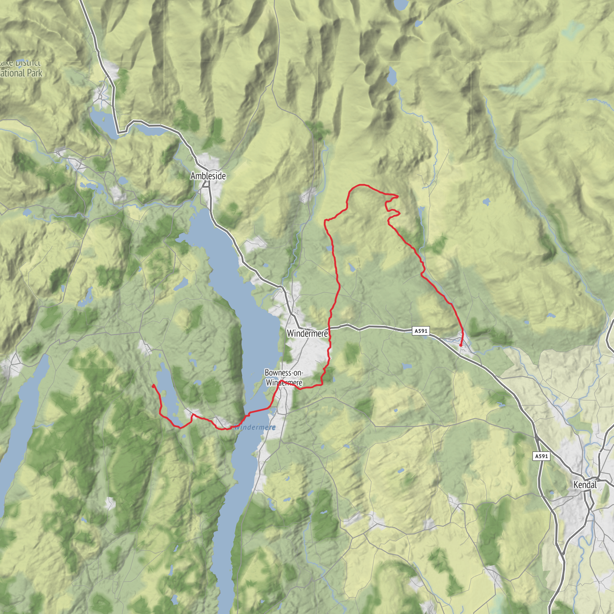
This point-to-point walk links the quieter western side of the central Lake District with the transport-friendly village of Staveley, combining lakeshore lanes, a Windermere crossing, wooded low fells, and a final climb past Dubbs Reservoir before the descent into the Kent valley. At around 28 km / 17.4 miles with roughly 600 m / 1,970 ft of ascent, it sits well in the medium category: long enough to demand stamina, but without the sustained high-mountain exposure of the bigger Lakeland passes. The start is at YHA Hawkshead, whose nearest known address is YHA Hawkshead, Hawkshead, Ambleside LA22 0QD, about 1 mile / 1.6 km south of Hawkshead village and overlooking Esthwaite Water. (maps.apple.com)
The opening miles are gentle and scenic. From the hostel, the route heads down toward the road and follows the western side of Esthwaite Water toward Esthwaite Hall Bridge, with the lake close by for much of this section. This is one of the softer, more pastoral landscapes in the national park: hedged lanes, old field walls, broad water views, and a calmer atmosphere than the busier honeypots around Ambleside and Bowness. Esthwaite Water lies between Hawkshead and Windermere and is one of the smaller lakes of the district, historically in Furness and long associated with fishing and wetland birdlife. (visorando.com)
Expect the first 5 to 7 km / 3 to 4.5 miles to feel relatively easy underfoot, mostly on lanes, tracks, and low-level paths. The climbing is modest at first, so it is worth using this section to settle into a sustainable pace rather than pushing too hard early. In wet weather, some field-edge and lakeside stretches can be greasy, and after prolonged rain the route can feel slower than the map suggests.
Esthwaite Water, Sawrey and the Windermere crossing
As the walk continues south and east, it passes through the Near Sawrey area and works toward the Windermere ferry. Near Sawrey is one of the most historically resonant parts of the route because of its close connection with Beatrix Potter and the farming landscape she helped preserve. The nearby Hill Top area is one of the best-known literary landmarks in the Lake District, and the patchwork of small fields, whitewashed farm buildings, and coppiced woodland still reflects the traditional Lakeland setting that shaped her work. A vehicle ferry operates between Ferry Nab in Bowness and Ferry House on the west shore near Far Sawrey, and this crossing is the key link that carries the route over Windermere. (nationaltrust.org.uk)
This middle section is often the most varied part of the day. You move from the intimate scale of Esthwaite’s shore and village lanes into the broader, more open setting around Windermere, where views lengthen and the sense of journey becomes stronger. Windermere itself is England’s largest natural lake, and even on a through-hike it tends to create a psychological halfway point. If conditions are clear, look for changing perspectives across the water toward wooded western shorelines, lake traffic, and the more built-up eastern side around Bowness and Windermere.
Wildlife here can be excellent, especially around the water margins and damp woodland. Depending on season and time of day, hikers may see swans, ducks, geese, herons, cormorants, and smaller woodland birds in the hedgerows and copses. Early starts improve the odds of spotting roe deer in quieter fields or woodland edges. Midges are usually less of an issue than in more boggy upland areas, but in still, humid summer weather they can be noticeable near sheltered water.
Climbing away from Windermere toward Dubbs Reservoir
After the ferry crossing, the route turns inland and gradually becomes more upland in character. The line toward Dubbs Road and Dubbs Reservoir follows Dubbs Beck for part of the way, with the reservoir appearing on the left as the route gains height. This is where the walk begins to feel more like a proper end-to-end Lakeland traverse rather than a lakeside ramble. (visorando.com)
The climb in this latter half is not especially technical, but it is where accumulated fatigue tends to show. Over the course of roughly 8 to 10 km / 5 to 6 miles after the Windermere crossing, expect the most meaningful ascent of the day, with a steady build toward the high ground above Staveley. The terrain can include rougher tracks
Surfaces
Unknown
Asphalt
Gravel
Grass
Ground
Comments and Reviews
User comments, reviews and discussions about the YHA Hawkshead to Staveley via Esthwaite Water, Windermere and Dubbs Reservoir, England.
average rating out of 5
0 rating(s)



