
Download
3D Flyover
Add to list
More
17.8 km
~5 hrs
869 m
Point to Point
“From Windermere’s bustle to Langdale’s hush, this fell walk unfurls tarns, lilies, and sweeping Lakeland drama.”
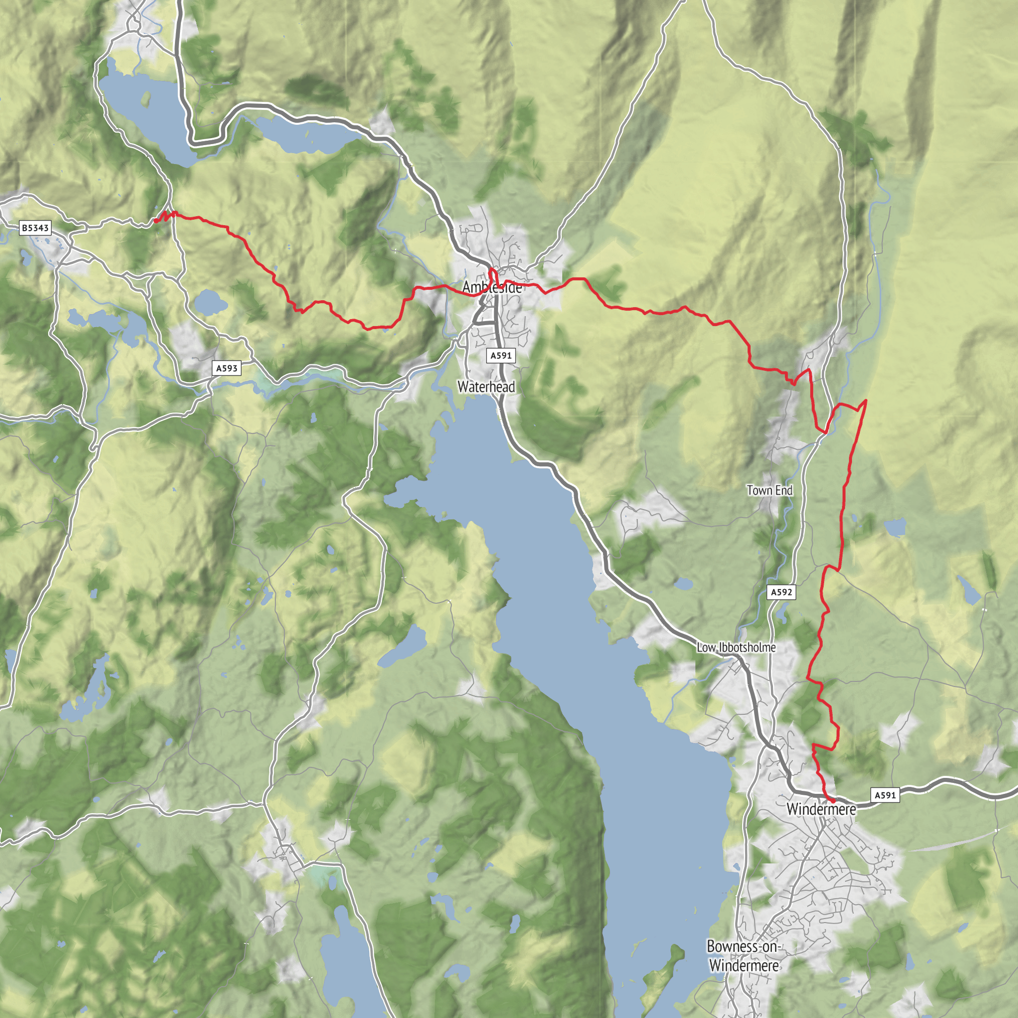
Starting near Windermere railway station, Station Precinct, Windermere, Cumbria LA23 1AH, this point-to-point walk heads west out of the busy lakeside gateway and gradually trades town streets for open fell, tarn-side paths and classic Langdale scenery before finishing at YHA Langdale, High Close, Loughrigg, Ambleside LA22 9HJ. At around 18 km / 11.2 miles with roughly 900 m / 2,950 ft of ascent, it sits well in the medium bracket, but the climbing is substantial enough that it will feel like a full mountain day for many walkers. (nationalrail.co.uk)
The opening section is usually the gentlest underfoot, leaving the station area and working through Windermere’s roads and lanes toward the higher ground above town. This early stretch is useful for settling into pace before the route begins to climb more decisively. As height is gained, views begin to open toward Windermere, England’s largest natural lake, and to the surrounding Lakeland fells. The route then trends toward the Ambleside–Loughrigg side of the district, where paths become more varied: a mix of lanes, bridleways, rougher fell tracks and steeper, sometimes rocky sections. Because this is not a circular walk, it helps to have transport plans sorted in advance rather than improvising at the finish.
Terrain and what to expect
The day’s character changes several times. Expect lower-level approach walking first, then a more sustained climb onto Loughrigg Fell, which rises to about 335 m / 1,099 ft and is well known for its wide-ranging central Lake District views. Although Loughrigg is not one of the highest fells, it is surrounded by water and valleys, so the panoramas feel much bigger than the map suggests. (lakedistrict.gov.uk)
Around the middle of the route, the ground near Lily Tarn and the approaches to Loughrigg Fell can be uneven, with short steeper pulls, exposed rock, and sections that become slick after rain. In mist, the many intersecting paths on Loughrigg can be more confusing than the modest height implies, so route-finding deserves attention. If using digital navigation, plan the track in HiiKER before setting out.
The descent and traverse toward the Langdale side often feel easier on paper than on the legs. After the main climbing, there can still be repeated ups and downs, wet patches, and rough stone underfoot. The final approach to High Close and YHA Langdale is more sheltered, with woodland and pastoral scenery replacing the more open fellside.
Landmarks, scenery and wildlife
One of the most memorable natural features on this walk is Loughrigg Tarn, tucked beneath the steep flank of Loughrigg Fell. The Lake District National Park notes that the tarn is famous for its views toward the Langdale Pikes, and in summer its surface can be carpeted with water lilies, which is especially relevant on a route passing by Lily Tarn and the wider Loughrigg area. (lakedistrict.gov.uk)
From the higher ground, expect broad views across a dense concentration of classic Lake District landmarks: Windermere, Rydal Water, the Ambleside area, and westward to the dramatic skyline of the Langdale Pikes. This is one of those walks where the scenery changes quickly with every rise and turn, moving from wooded slopes and enclosed tarns to open, rocky viewpoints.
Wildlife is typical of mixed Lakeland fell, woodland and tarn habitat. Around the tarns and wetter ground, look for waterfowl and smaller birds using reedier margins. On open fell and rough pasture, expect common upland species and, in quieter stretches, the chance of seeing birds of prey overhead. In nearby National Trust fell and woodland landscapes, sightings can include red squirrels and pine martens, a reminder of how ecologically rich these central Lake District habitats can be. (nationaltrust.org.uk)
Historical significance of the area
This route crosses a landscape shaped as much by culture as by geology. The wider Windermere–Ambleside–Langdale corridor sits in the heart of the Lake District UNESCO World Heritage cultural landscape, where farming, quarrying, transport and tourism
Surfaces
Unknown
Asphalt
Grass
Dirt
Ground
Gravel
Wood
Unpaved
Comments and Reviews
User comments, reviews and discussions about the Windermere Station to YHA Langdale via lily Tarn and Loughrigg Fell, England.
average rating out of 5
0 rating(s)



